Download
1 / 39
390 likes | 415 Vues
Explore Earth's composition, structure, and plate tectonics, from the crust to the core, including plate boundaries and geological formations like rift valleys and volcanic arcs. Discover the history of Earth's layers and the movement of continents.

E N D
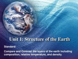
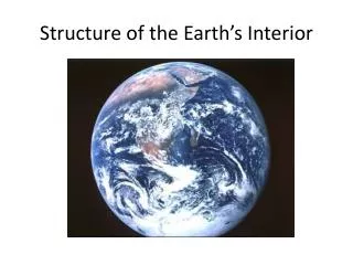
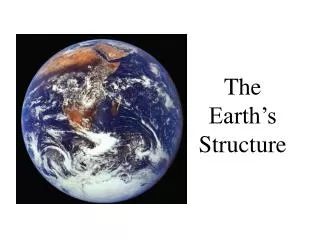
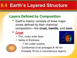
Layers Defined by Composition 8.4 Earth’s Layered Structure Earth’s interior consists of three major zones defined by their chemical composition—the crust, mantle, and core. Crust • Thin, rocky outer layer • Varies in thickness - ~7 km under oceans - Continental crust averages 8–40 km - Exceeds 70 km in mountainous regions
Continental crust Average density is about 2.7 g/cm3 Up to 4 billion years old Oceanic crust Density about 3.0 g/cm3 Younger than the continental crust (180 million years or less) **When these two collide, what do you think will happen??? Layers Defined by Composition
The Mantle 82% of Earth’s volume Melted rock, flows in convection current The Core Inner – behaves like a solid (under great pressure) Outer – liquid layer (so hot) Composition is iron and nickel Density = 11 g/cm3 - similar to metallic meteorites. Earth’s Layered Structure
Lithosphere *Crust and uppermost mantle (about 100 km) *Cool, rigid, solid Asthenosphere *Beneath the lithosphere *Upper mantle *To a depth of about 660 km *Soft, weak layer that is easily deformed Layers Defined by Physical Properties
Moho Discontinuity • Separates crust from underlying mantle Shadow Zone • Absence of P waves because of bending of waves Can be explained if Earth contains a core composed of materials unlike the overlying mantle Discovering Earth’s Layers
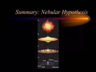
An Idea Before Its Time 9.1 Continental Drift Wegener’s continental drift hypothesis- continents had once been joined to form a single supercontinent. • Wegener proposed that the supercontinent, Pangaea, began to break apart 200 million years ago and form the present landmasses.
4 Pieces of Evidence 9.1 Continental Drift • The Continental Puzzle- pieces fit together, South America and Africa 2. Matching Fossils – same dinosaur and plant fossils found on different land masses
9.1 Continental Drift 3. Rock Types and Mountain Ranges - Several mountain belts that end at one coastline, only to reappear on a landmass across the ocean. Pangea Present Day Map
Glacier Evidence 4. Ancient Climates & Glaciers
Rejecting the Hypothesis 9.1 Continental Drift A New Theory Emerges • Wegener could not provide an explanation of exactly what made the continents move. • New technology led to findings which then led to a new theory called plate tectonics. • Wegener’s theory was ignored until the mid-1960’s, when structures on the ocean floor gave evidence of a mechanism for the movement of continents. DO NOT COPY – JUST READ!
Earth’s Major Roles 9.2 Plate Tectonics • A plateis one of numerous solid sections of the lithosphere that move as a unit over the asthenosphere – molten, melted rock in the mantle The uppermantle, along with the crust, behaves as a solid layer- known as the lithosphere.
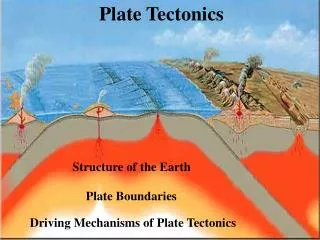
Types of Plate Boundaries 9.2 Plate Tectonics Divergent boundaries (spreading centers) where two plates move in different directions. Convergent boundaries two plates come closer Transform fault boundaries two plates travel past each other
Three Types of Plate Boundaries Coming closer Different directions Travel Past
Divergent Boundaries 9.3 Actions at Plate Boundaries Oceanic Ridges and Seafloor Spreading 1. Oceanic ridges are small mountain ranges on the ocean floor built from magma coming up in the gap of the boundary. 2. Seafloor spreading produces new oceanic lithosphere.
Divergent Boundaries 9.3 Actions at Plate Boundaries Continental Rifts 3. On land, a divergent plate boundary creates a rift valley. African RiftValley
Spreading Center Examples: Mid-Atlantic Ridge, East African Rift Valley, Rhine Valley in Northern Europe Divergent Boundaries
Convergent Boundaries 9.3 Actions at Plate Boundaries A subduction zone occurs when one oceanic plate is forced down into the mantle beneath a second plate. Oceanic-Continental • Denser oceanic slab sinks into the asthenosphere. • Pockets of magma develop and rise. • Continental volcanic arcs form • Examples: Andes, Cascades, and the Sierra Nevada's.
Oceanic-Continental Convergent Boundary Features formed: Trench, Continental Volcanic Arc Subduction Zone
Convergent Boundaries 9.3 Actions at Plate Boundaries Oceanic-Oceanic • Two oceanic slabs converge and one descends beneath the other- forming a volcano on the ocean floor . • Volcanic island arcs form as volcanoes emerge from the sea. Examples: Aleutian Islands in Alaska
Convergent Boundaries 9.3 Actions at Plate Boundaries Continental-Continental • When two continents collide forming mountain ranges(very little subduction occurs here) Examples: Himalayas, Alps, Appalachians, Ural Mts.
Transform Fault Boundaries 9.3 Actions at Plate Boundaries Plates travel past each other without destroying the lithosphere. Transform faults • Usually occur at mid-ocean ridges. • Example: San Andreas Fault Activity at boundary will result in an earthquake!
Evidence for Plate Tectonics 9.4 Testing Plate Tectonics Paleomagnetism-magnetization that can be used to determine the location of the magnetic poles at the time the rock was formed – reversed many times in history • Normal polarity—when rocks show the same magnetism as the present magnetic field • Reverse polarity—when rocks show the opposite magnetism as the present magnetic field
9.4 Evidence for Plate Tectonics 1. The discovery of strips of alternating polarity is the strongest evidence of seafloor spreading.
9.4 Evidence for Plate Tectonics 2. Earthquake Patterns • Scientists found a close link between deep-focus earthquakes and ocean trenches. (subduction zones) • The absence of deep-focus earthquakes along the oceanic ridge system (divergent boundaries) was shown to be consistent with the new theory.
9.4 Evidence for Plate Tectonics 3. Ocean Drilling • The ages of seafloor sediment confirmed the seafloor spreading hypothesis is correct • The youngest oceanic crust is at the divergent plate boundary, and the oldest crust is farthest away (on land)
9.4 Evidence for Plate Tectonics 4. Hot Spots • A hot spot is a concentration • of heat in the mantle capable of • producing magma, which rises to Earth’s surface • The Pacific plate moves over a hot spot, producing the Hawaiian Islands.
How Hawaii formed supports the evidence behind plate tectonics…
Causes of Plate Motion 9.5 Mechanisms of Plate Motion Convection occurring in the mantle is the driving force for plate movement. • Convective flowis the motion of matter resulting from changes in temperature.