Echo Sounding
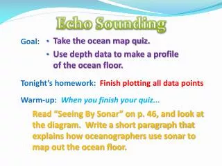
Echo Sounding. Take the ocean map quiz. Use depth data to make a profile of the ocean floor. Goal: Tonight’s homework: Finish plotting all data points Warm-up: When you finish your quiz... .

Echo Sounding
E N D
Presentation Transcript
Echo Sounding • Take the ocean map quiz. • Use depth data to make a profile of the ocean floor. Goal: Tonight’s homework: Finish plotting all data points Warm-up: When you finish your quiz... • Read “Seeing By Sonar” on p. 46, and look at the diagram. Write a short paragraph that explains how oceanographers use sonar to map out the ocean floor.
The Ocean Floor • Bathymetry– measurement of ocean depths and the charting of the shape or topography of the ocean floor • Ocean surface and sea floor are measured using two different technologies: Sonar and Satellite • Echo sounder • (uses sound waves) • Invented in the 1920s • Primary instrument for measuring depth • Reflects sound from ocean floor • Seasat, Geosat, and others • Measure ocean surface from space • Variations in ocean surface help map the ocean floor
Sonar Technology Echo Sounder Multi-beam Sonar
Satellite Technology SEASAT GEOSAT Measures direction and speed of ocean currents Measures slight variations in the ocean surface
Ocean Floor Features Goal: To compare ocean features found along the Atlantic and Pacific Ocean floor. Tonight’s homework: • “Exploring the Oceans” online activity due Fri. Warm-up: In your journal: Look at the illustration on p. 48 – 49 and then read “Regions of the Ocean Floor” on p. 49. • What are the two major regions? • List the major features found on each region.
Mapping the Ocean Floor • Two major topographic regions of the ocean floor • Continental margins • Deep-ocean basin (ocean floor) What major features can be found along the ocean floor?
The Atlantic Ocean Profile Continental Margin Continental Margin Mid-Ocean Ridge Deep ocean basin Would these continental margins be considered active or passive?
Continental Margin Continent Active or Passive? Continental shelf Continental slope Draw this diagram in your journal! Continental rise Abyssal plain (piled up sediment)
Continental Margins • Passive continental margins • Found along most coastal areas that surround the Atlantic Ocean • Not associated with plate boundaries • Experience little volcanism and • Few earthquakes
Passive Margins Features comprising a passive continental margin • Continental shelf • Flooded extension of the continent • Varies greatly in width; Almost flat (like a shelf) • Often covered by thick accumulations of shallow-water sediments • Inhabited by coral and lots of other marine life • Continental slope • Marks the seaward edge of the continental shelf • Relatively steep structure • Boundary between continental crust and oceanic crust • Continental rise • More gradual incline found in regions where trenches are absent • Sediment from the continent piles up at the bottom of the continental slope
Deep-Ocean Basin • Abyssal plain • Likely the largest, flattest surface on Earth • Sites of thick accumulations of sediment • Found in all oceans • Seamountsandguyots • Isolated volcanic peaks • Many form near oceanic ridges • May emerge as an island • May sink and form flat-topped seamounts called guyotsor tablemounts
Deep Ocean Trenches • Long, relatively narrow features • Deepest parts of ocean • Most are located in the Pacific Ocean • Found nearActive Margins (subduction zones) • Associated with volcanic activity • Volcanic islands arcs • Continental volcanic arcs
Mid-Ocean Ridge • Characterized by • An elevated position • Extensive faulting • Numerous volcanic structures that have developed on newly formed crust • Interconnected ridge system is the longest topographic feature on Earth’s surface • Over 70,000 kilometers (40,000 miles) in length • In all major oceans
Where is the continental margin? 0 km 2000 km 2400 km Distance from Beach 0 km 160 km 240 km Distance from Beach
Active vs. Passive Margins Goal: To compare ocean features found along the Atlantic and Pacific Ocean floor. Tonight’s homework: “Exploring the Oceans” online activity due tomorrow Warm-up: Please take out your lab. Then, in journal: • Describe the differences between an active and passive margin. What features would you find at each, and why? • Where in the world would you find each?
Passive Margin Continent Continental shelf Continental slope Continental rise Abyssal plain (piled up sediment)
Active Margins • Tectonic activity (subduction zone) • Very narrow continental shelf; Continental slope descends abruptly into a deep-ocean trench • Located primarily around the Pacific Ocean (convergent plate boundaries)
Where is the continental margin? Passive Margin 0 km 2000 km 2400 km Distance from Beach Active Margin 0 km 160 km 240 km Distance from Beach