Download
1 / 16
160 likes | 307 Vues
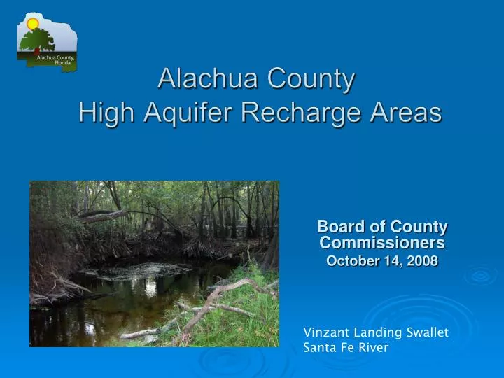
Alachua County High Aquifer Recharge Areas. Board of County Commissioners October 14, 2008. Vinzant Landing Swallet Santa Fe River. Comprehensive Plan Direction.

E N D
Alachua County High Aquifer Recharge Areas Board of County Commissioners October 14, 2008 Vinzant Landing Swallet Santa Fe River
Comprehensive Plan Direction • Comp Plan COSE 4.5.3 called for aquifer recharge/vulnerability study of Alachua County as basis for update of high aquifer recharge map. • Coordination and review with Regional Planning Council, Water Management Districts, etc.
Mapping Background Previous map used for water resources community outreach and education since 1988; Developed by the Florida Geological Survey; Depicts aquifer vulnerability based on topography and thickness of the confining unit above the Floridan aquifer; Map adopted in the 1991 Alachua County Comprehensive Plan to show high aquifer recharge areas; Alachua County code references to guide location of higher risk hazardous materials facilities handling and stormwater basin design
Mapping Revision Methods • Alachua County technical staff assisted by the Florida Geologic Survey with final map prepared by Advance GeoSpacial, Inc. • Oversight by Inter-Agency Technical Advisory Committee • Similar methodology used by Leon, Columbia, and Marion Counties • Model used “Weights of Evidence” approach • Statistical processing conducted to smooth map regions
Mapping Revision Methods • Four Data Layers were evaluated; • Overburden thickness (above the Floridan aquifer) • Karst Features (sinkholes, swallets…) • Soil Permeability • Water Level Difference (between the surficial and Floridan aquifer)
Map Differences • The unconfined area or highly vulnerable area is approximately the same. • More area included in the Alachua • Less area included east of Archer • Increase in size of vulnerable areas • North of Alachua • In proximity to Orange Lake
Mill Creek Swallet Santa Fe River Sink Alachua Lake Paynes Prairie
Map Implementation Useful educational tool to promote water resource conservation and protection Protect high quality groundwater in western Alachua County where the Floridan aquifer is most vulnerable Protect springs and groundwater that receive water recharge from the Newberry Limestone Plain in western Alachua County; the source of many Santa Fe River springs Increase groundwater protection in other vulnerable areas where the Floridan aquifer is poorly confined and karst features dominate
Map Implementation Areas within the Vulnerable and Highly Vulnerable Zones and stream-to-sink basins, will be considered high aquifer recharge areas The new protection zone map will be adopted into the Alachua County Comprehensive Plan as part of the first round of Large Scale Comprehensive Plan amendments in 2009. Text changes will be made to the Comprehensive Plan that are consistent with use of the new map County codes regulating new construction of high risk hazardous materials facilities and the design of stormwater basins will be revised to reference new map
Alachua County High Aquifer Recharge Areas • The updated protection zones redefines areas that will be considered as high aquifer recharge • Stream-to-sink watersheds were overlain on the aquifer protection zones map to provide additional protection of the Floridan aquifer in two areas; • Santa Fe River including tributaries • Smaller closed basins in the central portion of Alachua County
COSE Definition Changes High Aquifer Recharge Areas: Areas where stream-to sink surface water basins occur, and areas where the Floridan aquifer system is designated as unconfined or semi confined in Florida Geological Survey Open File report 21, “Geologic Interpretation of the Aquifer Pollution Potential in Alachua County, Florida,”vulnerable and highly vulnerable as depicted in the Alachua County Floridan Aquifer Protection Zones map (2008). Stream-to-sink Aquifer Recharge Basins: A drainage basin typified by streams discharging into sinkholes and other karst features.
Outreach Plan • Outreach to all the municipalities within Alachua County • Presentations to committees and working groups including, though not limited to; • Environmental Protection Advisory Committee • Chamber of Commerce • Rural Concerns Advisory Committee • Sierra Club and Santa Fe Springs Working Group • Builder’s Association of North Florida • Two public workshops located in the areas where map changes are most significant; • northern Alachua County, and • southern Alachua County
In Summary • Recommended action- Authorize staff to: 1) advertise County Initiated Amendments to the Conservation Open Space Element of the Alachua County Comprehensive Plan to adopt an updated map of aquifer recharge areas, with related definition, and policies as part of the next round of Large Scale Plan Amendments to be adopted in 2009. 2) initiate a public outreach and information process relating to the updated map of Alachua County aquifer recharge areas.