
SlideServe
Menu
Préférences
© SlideServe · v2026

Atmospheric Data Collection and Analysis for Forecasting at Multiple Altitudes

melora avatar
18 diapositives · 323 Views · Sep 17, 2014

This document outlines the requirements for atmospheric data including relative humidity, temperature, and geopotential height at various pressure levels. Data should have a 6-hour frequency, along with other essential variables such as sea surface temperature, surface pressure, snow water equivalent, and soil parameters. It also specifies the need for 2-meter air temperature, wind components, and mean sea level pressure, among others. Examples of data files and usage of IDL routines for data extraction are provided for clarity.
Atmospheric Data Collection and Analysis for Forecasting at Multiple Altitudes - slide 1
01 / 18Atmospheric Data Collection and Analysis for Forecasting at Multiple Altitudes
1 / 17

Télécharger la présentation

Atmospheric Data Collection and Analysis for Forecasting at Multiple Altitudes
Une image / un lien ci-dessous est fourni (tel quel) pour télécharger la présentation

Politique de téléchargement : le contenu du site vous est fourni TEL QUEL pour votre information et votre usage personnel ; il ne peut être vendu, concédé sous licence ni partagé sur d’autres sites sans l’accord de son auteur.Le contenu vous est fourni TEL QUEL, pour votre information et votre usage personnel uniquement. Téléchargez la présentation en cliquant sur ce lien. Lors du téléchargement, si vous ne parvenez pas à télécharger une présentation, l’éditeur a peut-être supprimé le fichier de son serveur.Pendant le téléchargement, si vous ne parvenez pas à obtenir une présentation, le fichier a peut-être été supprimé par l’éditeur.

F I N

Plus de contenu associé

Transcription de la présentation
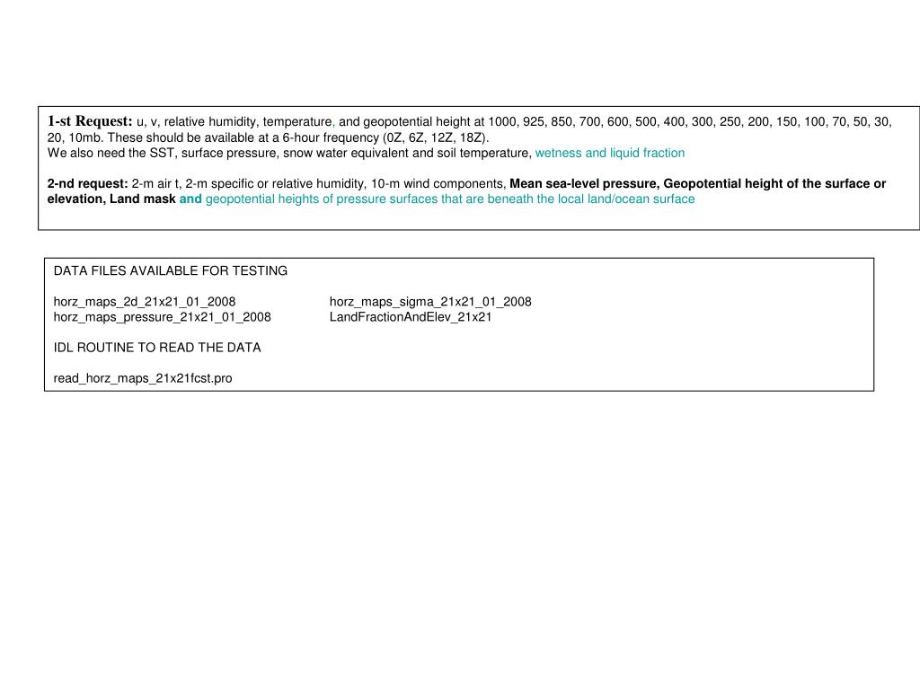
  1. 1-st Request: u, v, relative humidity, temperature, and geopotential height at 1000, 925, 850, 700, 600, 500, 400, 300, 250, 200, 150, 100, 70, 50, 30, 20, 10mb. These should be available at a 6-hour frequency (0Z, 6Z, 12Z, 18Z). We also need the SST, surface pressure, snow water equivalentand soil temperature, wetness and liquid fraction 2-nd request:2-m air t, 2-m specific or relative humidity, 10-m wind components, Mean sea-level pressure, Geopotential height of the surface or elevation, Land mask and geopotential heights of pressure surfaces that are beneath the local land/ocean surface DATA FILES AVAILABLE FOR TESTING horz_maps_2d_21x21_01_2008 horz_maps_sigma_21x21_01_2008 horz_maps_pressure_21x21_01_2008 LandFractionAndElev_21x21 IDL ROUTINE TO READ THE DATA read_horz_maps_21x21fcst.pro

  2. DATA FORMATS horz_maps_2d_21x21.ctl : UNDEF -.999000E+03 OPTIONS SEQUENTIAL OPTIONS BIG_ENDIAN OPTIONS TEMPLATE TITLE UN-NAMED * XDEF 21 LINEAR -100.0 2.5 YDEF 21 LINEAR 20.0 2.0 ZDEF 0 LINEAR 1 1 TDEF 31*4 LINEAR 1JAN2008 6H * VARS 5 HEADER 0 99 HEADER GTM 0 99 SURFACE TEMPERATURE (K) PSF 0 99 SURFACE PRESSURE (MB) SNWD 0 99 SNOW DEPTH (MM) (ZERO OVER NONLAND) TDSL 0 99 DEEP SOIL TEMPERATURE (K) (ZERO OVER NONLAND) ENDVARS horz_maps_press_21x21.ctl : UNDEF -.999000E+03 OPTIONS SEQUENTIAL OPTIONS BIG_ENDIAN OPTIONS TEMPLATE TITLE UN-NAMED * XDEF 21 LINEAR -100.0 2.5 YDEF 21 LINEAR 20.0 2.0 TDEF 31*4 LINEAR 1JAN2008 6H * VARS 7 HEADER 0 99 HEADER U 17 99 U (M/S) V 17 99 V (M/S) T 17 99 T (K) PHI 17 99 PHI (M2/S2) Q 17 99 SPECIFIC HUMIDITY (KG/KG) SLP 0 99 SEA LEVEL PRESSURE (MB) ENDVARS horz_maps_sigma_21x21.ctl : UNDEF -.999000E+03 OPTIONS SEQUENTIAL OPTIONS BIG_ENDIAN OPTIONS TEMPLATE TITLE UN-NAMED * XDEF 21 LINEAR -100.0 2.5 YDEF 21 LINEAR 20.0 2.0 ZDEF 0 LINEAR 1 1 TDEF 31*4 LINEAR 1JAN2008 6h * VARS 5 HEADER 0 99 HEADER U10M 0 99 10 M U (M/S) V10M 0 99 10 M V (M/S) T2M 0 99 2 M T (K) Q2M 0 99 2 M Q (KG/KG) ENDVARS LandFractionAndElevation_21x21.ctl : UNDEF -.999000E+03 OPTIONS SEQUENTIAL OPTIONS BIG_ENDIAN OPTIONS TEMPLATE TITLE UN-NAMED * XDEF 21 LINEAR -100.0 2.5 YDEF 21 LINEAR 20.0 2.0 * VARS 3 HEADER 0 99 HEADER U 0 99 LAND FRACTION V 0 99 GEOPOTENTIAL HEIGHT (M2/S2) ENDVARS

  3. ADDITIONAL DATA INFORMATION The ’read_horz_maps_21x21.pro' IDL routine can be used to read the forecast horz_maps_*21x21* data files. EXAMPLE 1 reading 5.56 a.m. 2M specific humidity field of file horz_maps_sigma_21x21_01_2008: IDL> im=21 & jm=21 & km=1 & nvars=5 & igrp_plot=3 IDL> ilvl=0 & itime=0 & iday=0 & smon=1 & syear=2008 IDL> histdir='/coupled/jmarshak/exp001CBay/24084/ens0/horz_maps_sigma_21x21_' IDL> tag='' & suppress=1 IDL> field_sub=fltarr(21,21) & header=fltarr(21,21) IDL> READ_HORZ_MAPS_21x21,im,jm,km,nvars,igrp_plot,ilvl, $ IDL> itime,iday,smon,syear,$ IDL> histdir,tag,field_sub,suppress=suppress,header=header IDL> print,'NEW HEADER ',header(0:20,0) NEW HEADER 2008.00 1.00000 1.00000 5.00000 56.0000 40.0000 18.0000 1.00000 21.0000 21.0000 0.00000 -100.000 20.0000 2.50000 2.00000 1.00000 2.00000 0.00000 -999.000 1.00000 0.00000 IDL> print,'MAX,MIN',igrp_plot,max(field_sub(where(field_sub gt -999.000))), $ IDL> min(field_sub(where(field_sub gt -999.000))) MAX,MIN 3 0.0177466 0.000160506 IDL> EXAMPLE 2 reading the land fraction and elevation data file ‘LandFractionAndElev_21x21’ using IDL: IDL> IDL> print,im,jm 21 21 IDL> header_s=fltarr(im ,jm ) & land_s=fltarr(im ,jm ) & elev_s=fltarr(im ,jm ) IDL> openr,2,'/coupled/jmarshak/exp001CBay/LandFractionAndElev_21x21',/swap_endian IDL> readu,2,d, header_s ,d IDL> print,'Header 21x21 :', header_s(0:14,0) Header 21x21 : 0.00000 0.00000 0.00000 0.00000 0.00000 0.00000 0.00000 0.00000 21.0000 21.0000 0.00000 -100.000 20.0000 2.50000 2.00000 IDL> readu,2,d, land_s,d IDL> readu,2,d, elev_s,d IDL> close,2 IDL>

  4. LandFractionAndElev_21x21

  5. horz_maps_2d_21x21_01_2008: psf

  6. horz_maps_2d_21x21_01_2008: gtm

  7. horz_maps_2d_21x21_01_2008: snwd

  8. horz_maps_2d_21x21_01_2008: tdsl

  9. horz_maps_pressure_21x21_01_2008: v

  10. horz_maps_pressure_21x21_01_2008: u

  11. horz_maps_pressure_21x21_01_2008: t

  12. horz_maps_pressure_21x21_01_2008: phi

  13. horz_maps_pressure_21x21_01_2008: q

  14. horz_maps_pressure_21x21_01_2008: slp

  15. horz_maps_sigma_21x21_01_2008: u10m

  16. horz_maps_sigma_21x21_01_2008: v10m

  17. horz_maps_sigma_21x21_01_2008: q2m

  18. horz_maps_sigma_21x21_01_2008: t2m