Download
1 / 15
150 likes | 236 Vues
Learn about wave erosion, deposition features, and various coastal formations like sea stacks, caves, arches, and spits. Understand the impact of longshore drift and human interventions on coastal landscapes around the world. Dive into a case study of the Curonian Spit and explore the natural and human factors shaping its history. Engaging sample questions provide opportunities for further exploration and understanding.

E N D
Wave Erosion • Hydraulic pressure = The pounding force of water/waves. • Corrosion = Minerals such as calcium carbonate & limestone dissolve in the water. • Abrasion = rock & sand particles suspended in the water bump, grind, scrape & gouge surfaces the water hits.
Depositional Features Terminology • Headlands = the points of land that extend the farthest out into wave action. • Longshore drift = a current caused by the dominant waves that have enough energy to carry silt/sand from headlands along the shore where it is later deposited. • Wave Refraction = waves bending around headlands as they hit the shallow water by shore.
Spit = A ridge of sand running away from the coast, usually with a curved seaward end. Spit grows in the prevailing direction of longshore drift. Ends are curved by the action of waves in different directions. • Bay Bar = A ridge of mud sand or silt extending across a bay.Formed when spits stretch across the mouth of the bay. • Bay Beach = An accumulation of sediment deposited by waves and longshore drift along the shore of a bay.
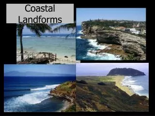
More Erosional FeaturesChanges In An Emergent Coast • Sea stacks common in eastern Canada. • Columns of land standing in the ocean just offshore. • First sea caves are formed in a headland. • More erosion turns sea caves in to the second land feature, sea arches. • Very common/popular in Newfoundland. • Excellent sketches on p.48, fig. 3.11.
Sea Stack Formation Sea Cave Formation • Waves strike the headland first. • Waves refract around the headland. • Hydraulic pressure on both sides of the headland. • Erosion of the weak portions create caves & blow holes in the sides of the headland.
Sea Arch Formation • Eventually sea caves, on alternate sides of the headland get deeper until they connect inside the headland forming a tunnel or “arch” through the head land.
Sea Stack Formation • Continuous erosion, of sea arches, causes the ground over the arch to collapse. • This leaves a pillar or column or “STACK” of land standing alone where the headland was.
Erosional Features • Straightening of an Irregular Submerging Coastline • Irregular submerging coastlines have headlands that jut out from the shore line. • The erosion of the headland can deposit silt in the bay which forms a bay beach as it tends to straighten the coastline. The headland wears away due to erosion and the bay is being in filled with eroded material.
Longshore drift results in some sand being deposited parallel to the shore but still connected to the headland. These silt deposits are known as spits. • Longshore drift and deposition can continue until the spit closes off the mouth of the bay. This massive, elongated deposit is known as a bay bar. • This continual process of erosion and deposition can erase the protruding points from the coastline over time and serves to straighten the coastline out.
Case Study: Curonian Spit • 50 km long • 400m – 4km wide • 13, 000 years old • Off the coast from Lithuania and Russia border • Faces the Baltic Sea • Lagoon shoreward • Formed as several mounds of glacial moraine were deposited and then linked by longshore current deposition.
At one point was in danger from excessive erosion (due to deforestation/devegetation) • Since early 1800’s long term efforts to protect it. • Portion preserved as parkland. Tourism encouraged but human habitation is strictly controlled.
Sample Questions • How did the spit form? • What were the human uses? • What are some preservation efforts? • What are some current uses?