Download
1 / 24
250 likes | 413 Vues
Urban 3D Models: What‘s underneath?. graz university of technology & grintec gmbh. Handheld Augmented Reality for Underground Infrastructure Visualization. austria. UbiComp 2007, Innsbruck, 16 - 19 September 2007. Geospatial Data + Augmented Reality (AR) =

E N D
Urban 3D Models: What‘s underneath? graz university of technology & grintec gmbh Handheld Augmented Reality forUnderground Infrastructure Visualization austria UbiComp 2007, Innsbruck, 16 - 19 September 2007
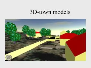
Geospatial Data + Augmented Reality (AR) = 3D real time visualization of underground infrastructure on handheld devices VIDENTE – RESEARCH PROJECT
Academic Partner VIDENTE – PROJECT PARTNERS Joint Research Project Commercial Partner • Funded by the Austrian Research Promotion Agency (FFG) • BRIDGE scheme, 2nd call • Project duration of 2 years time • Project kick-off in April 2006
AUGMENTED REALITY • Real-time integration of 3D computer graphics into a real world environment (vgl. Azuma 1997) • Computer graphics overlays enhance the real world view visualization of hidden and abstract information • Also known as „Mixed Reality“
Real world view Geodata Camera Tracking Geodatabases Position Orientation HANDHELD AR – HOW DOES IT WORK ?
Real time integration of 3D computer graphics with real world view Highly precise wide-area tracking (position, orientation) Performance ofGraphics Processing Unit Sensor shielding Availability, Run-time Integration with existing systems, SW/HW interfaces Robustness & Outdoor use: Sun light, Temperature, Dust, Wetness, Shock Ergonomics, Weight, Screen size, System interaction HANDHELD AR – REQUIREMENTS WHAT HAS TO BE CONSIDERED? HANDHELD AR SYSTEM
VIDENTE – HANDHELD AR SETUP (2) SETUP IN ACTION AT INNSBRUCK CONVENTION CENTER
VIDENTE – DATA PROVISION (1) DATA FLOW
VIDENTE – DATA PROVISION (2) MODELING PIPELINE
Data courtesy of VIDENTE – VISUALIZATION (1) – CONSTRUCTION SITE
VIDENTE – VISUALIZATION (2) – CONVENTION CENTER Data courtesy of
Data courtesy of VIDENTE – VISUALIZATION (3) – JAKOMINIPLATZ, GRAZ
VIDENTE – VISUALIZATION (4) – MAGIC LENS CONTEXT SENSITIVE MAGIC LENS Conceptual Presentation
VIDENTE – VISUALIZATION (5) – MAGIC LENS INFORMATION ENHANCEMENT / HIDING
VIDENTE – VISUALIZATION (6) – MAGIC LENS INFORMATION ENHANCEMENT / HIDING
Quick and easy locating and self-positioning Interfacing with other systems Spatially intuitive overview of the on-site underground situation Query and presentation of asset related non-geometric information VIDENTE Easy perception of complex underground infrastructure layouts (in particular in urban areas) Quick identification of particular underground infrastructure assets Essential contribution to business process optimization with utilities (intermediate term) Supplement to well established utility network management solutions Maintenance Outage Management Network Information System Mobile Mapping Network Documentation Network Planning Workforce Management Location Based Services POTENTIALS FOR PRACTICAL USE (2)
FIELDS OF APPLICATION WHERE MAY HANDHELD AR COME IN HANDY ? • Visual guidance for digging activities • Utility network planning • Locating hidden utility assets • Locating hidden spots of cable damage • Gas leak detection • On site instruction of technical staff • Visual guidance for technical facilities
Sebastian Junghanns GRINTEC GmbHAnzengrubergasse 6, A-8010 Graz sebastian.junghanns@grintec.comhttp://www.grintec.com Erick Mendez & Gerhard Schall Institut of Computer Graphics & VisionTU Graz, Inffeldgasse 16a/II, A-8010 Graz { mendez | schall }@icg.tugraz.athttp://www.icg.tugraz.at FURTHER INFORMATION http://www.vidente.at
RELATED WORK (1) Azuma, R. T.:A Survey of Augmented Reality. In: Presence: Teleoperators and Virtual Environments 6, 4 (August 1997), S. 355 - 385.URL: http://www.cs.unc.edu/~azuma/ARpresence.pdf [Stand 2007-03-15]. Höllerer T., Feiner, S., Terauchi, T., Rashid, G. & Hallaway, D. (1999): Exploring mars: Developing indoor and outdoor user interfaces to a mobile augmented reality system. Computers & Graphics, 23(6):779–785. Mendez, E., Kalkofen, D. & Schmalstieg, D. (2006): Interactive Context-Driven Visualization Tools for Augmented Reality. Proceedings of International Symposium on Mixed and Augmented Re-ality 2006 (ISMAR 06). 22.-25. Oktober 2006, Santa Barbara, California, USA. 209-216.
RELATED WORK (2) Piekarski, W. & Thomas, B. (2001): Tinmith-Metro: New Outdoor Techniques for Creating City Models with an Augmented Reality Wearable Computer. Proceedings of ISCW’01, 31-38. Reitmayr, G. & Schmalstieg, D. (2004): Flexible Parameterization of Scene Graphs. In: Proceedings IEEE Virtual Reality Conference 2005 (VR‘05), pp. 51-58. Schmalstieg, D., Fuhrmann, A., Hesina, G., Szalavári, Zs., Encarnação, L. M., Gervautz, M. & Purgathofer, W. (2002): The Studierstube Augmented Reality Project. PRESENCE - Teleoperators and Virtual Environments, 11(1): 32-54. Wagner, D. & Schmalstieg, D. (2006): Handheld Augmented Reality Displays. Proceedings of IEEE Virtual Reality 2006 (VR 2006), March 2006.
LINKS • Vidente: http://www.vidente.at • Coin: http://www.coin3d.org • GML: http://www.opengeospatial.org/standards/gml • OpenTracker: http://studierstube.icg.tu-graz.ac.at/opentracker/ • OpenVideo: http://studierstube.icg.tu-graz.ac.at/openvideo/ • Smallworld: http://www.gepower.com/prod_serv/products/ gis_software/en/smallworld4.htm • Studierstube: http://www.studierstube.org