East Asia
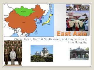
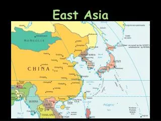
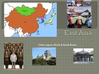
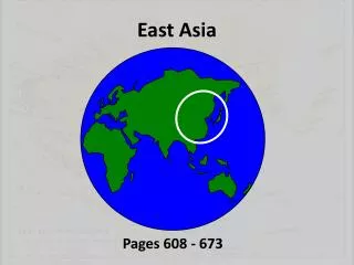
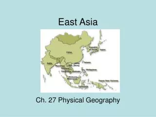
East Asia. Unit 9. Physical Geography. East Asia. Land and Sea. China covers about 80% of East Asia’s land area and has the world’s largest population. The rest of East Asia is shared by Japan, Taiwan, North and South Korea, and Mongolia. http://www.mappery.com/maps/East-Asia-Map.jpg.

East Asia
E N D
Presentation Transcript
East Asia Unit 9
Physical Geography East Asia
Land and Sea • China covers about 80% of East Asia’s land area and has the world’s largest population. • The rest of East Asia is shared by Japan, Taiwan, North and South Korea, and Mongolia. • http://www.mappery.com/maps/East-Asia-Map.jpg
Land and Sea Peninsulas, Islands, and Seas The Ring of Fire The islands of Japan and Taiwan are part of the Ring of Fire, a circle of volcanoes bordering the Pacific Ocean. Plate movements cause frequent, violent earthquakes and volcanic eruptions. Japan is vulnerable to tsunamis generated by underwater earthquakes. • Along the coast of East Asia, many peninsulas and islands dot the westernmost Pacific Ocean. The South China Sea, stretching from Taiwan to the Philippines and the peninsula of Southeast Asia, carries 1/3 of the world’s shipping traffic.
Land and Sea http://app.discoveryeducation.com/player/view/assetGuid/E6BAAD51-EFC6-436F-8C6C-7D165DD51CA0
Mountains, Highlands and Lowlands • Mountain ranges and highlands mark inland regions of East Asia. Lowlands stretch through eastern and coastal areas. • East Asian Mountains – from the area of high peaks known as the Pamirs, the Kunlun Shan and Tian Shan ranges extend across western China. The Himalaya, the world’s highest mountains, separate China from South Asia.
Mountains, Highlands, and Lowlands • Japan and Taiwan have mountainous interiors surrounded by coastal plains. Mount Fuji is a dramatic peak rising above the central plains of Honshu, Japan’s biggest island.
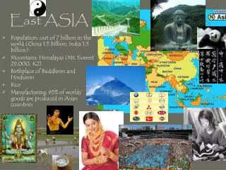
Mountains, Highlands, and Lowlands China’s Plateaus, Basins, and Deserts • The Plateau of Tibet in southwest China is East Asia’s highest plateau region with an elevation of about 15,000 feet. • The Mongolian Plateau consists mainly of grassy pastures ideal for grazing. • Broad, flat highlands include the Tarim Basin between China’s far inland mountain ranges; the Takimakan Desert to its west; and the Gobi, a desert area located in the north. • The Sichuan Basin, a huge, fertile area between the Plateau of Tibet and the North China Plain, is one of China’s most important agricultural areas. It has a mild climate and a long growing season.
River Systems • China’s major rivers originate high in the Plateau of Tibet and flow eastward to the Pacific Ocean. The Yellow River, or Huang He, get its name from the tons of yellowish topsoil blown by winds from the western deserts. • Carried eastward and deposited by the river, this rich soil makes the North China Plain an agriculturally productive area. Throughout history, flood waters have also killed hundreds of thousands of people.
River Systems • Central China’s Yangtze, or Chang Jiang, is Asia’s longest river at 3,965 miles. It flows through gorges and plains and empties into the ocean at Shanghai. • The Xi, or West, River is southern China’s most important river. It flows into the South China Swa, where it has created a huge, fertile delta. The Grand Canal – the world’s longest artificial waterway – connects Hangzhou in the south to Beijing in the north.
River Systems Rivers in Japan and Korea The Power of Wind and Water The Chinese concept of fengshui guides architects, contractors, and decorators to design and build structures that harmonize with surrounding landforms. • Japan and Korea have short, swiftly flowing rivers with spectacular waterfalls. These rivers provide hydroelectric power. North Korea’s Amnok, or Yalu, River forms its border with China.
Natural Resources • China’s large land area contains the greatest share and widest range of mineral resources, including iron ore, tungsten, tin, and gold. • The Taklimakan Desert has large oil deposits. • Northeastern China and the Korean peninsula have an abundance of coal.
Natural Resources • Only 10% of China’s land is suitable for farming, but China is nonetheless the world’s leading producer of rice. • South Korea’s prime farmland produces two crops a year of rice and barley. • Mongolia and Japan have very limited farmland and poor soil. • In Taiwan, about ¼ of the land is farmable. Taiwan’s most important resources are its hardwood forests.
Natural Resources • Japan, South Korea, Taiwan, and coastal China support the world’s busiest deep-sea fishing industries. Seafood farming also has become a major industry in East Asia.
Monsoons • Monsoon winds bring seasonal weather patterns to East Asia. • Summer monsoons blow from southeast to northwest, causing soaking rains from April to October. • Winter monsoons blow in the opposite direction, bringing icy winds from November to March. • Farmers depend on the summer monsoon rains for their crops.
Ocean Currents • The warm Japan Current flows northward toward southern Japan, bringing moisture and warm temperatures. • The cold Kuril current flows southwest from the Bering Sea, brining cold winds and lower temperatures to Japan’s northern islands. • The interaction of ocean currents and monsoon winds can give rise to violent typhoons. • Typhoons form in the Pacific Ocean and blow across coastal East Asia. They tend to be most severe between late August and Octover.