Download
1 / 27
270 likes | 452 Vues
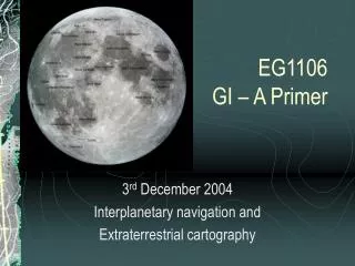
EG1106 GI – A Primer. 3 rd December 2004 Interplanetary navigation and Extraterrestrial cartography. TOPICS. Types of spacecraft Spacecraft navigation The Deep Space Network (DSN) The mapping of the Moon Mapping Mars Practical today. Types of spacecraft. Satellites Polar orbiters

E N D
EG1106GI – A Primer 3rd December 2004 Interplanetary navigation and Extraterrestrial cartography
TOPICS • Types of spacecraft • Spacecraft navigation • The Deep Space Network (DSN) • The mapping of the Moon • Mapping Mars • Practical today
Types of spacecraft • Satellites • Polar orbiters • Geostationary and sun-synchronous • Space probes • Voyager, Viking, Clementine, Ulysses • Manned craft • Lunar Apollo missions of the 1960s and 70s • Space shuttle
Types of spacecraft Meteosat NOAA Polar Orbiter
Types of spacecraft - Voyager Launched in 1977 - Voyager 1 is still operational
Types of spacecraft - Magellan Launched in 1989
Types of spacecraft - Galileo Launched in 1989
Types of spacecraft - Viking Orbiter Launched in 1976
Spacecraft Navigation • Just like ships, people and aircraft on Earth a spacecraft must be capable of spatial navigation • All spacecraft that navigate throughout the solar system is still in orbit around the Sun and so the path to be navigated is known as a trajectory • Every trajectory can be described by orbital elements (mathematical descriptions of distance, velocity, arc and gravitational influence)
Spacecraft Navigation • Spacecraft velocity measurement • Doppler shift • Spacecraft distance measurement • Ranging pulse • Spacecraft angular measurement • Very Long Baseline Interferometry (VLBI) • Optical navigation • Compares background of stars against planet body
Spacecraft Navigation - VLBI A VLBI observation of a spacecraft begins when two DSN stations on different continents track a single spacecraft simultaneously. High-rate recordings are made of the downlink's wave fronts by each station, together with precise timing data. After a few minutes, and while still recording, both DSN antennas slew directly to the position of a quasar, which is an extragalactic object whose position is known to a high precision. Then they both slew back to the spacecraft, and end recording a few minutes later. Correlation and analysis of the recorded wavefronts yields a very precise triangulation from which both angular position and radial distance may be determined. This process requires knowledge of each station's location with respect to the location of Earth's axis with very high precision. Currently, these locations are known to within 3 cm.
Deep Space Network The NASA Deep Space Network - or DSN - is an international network of antennas that supports interplanetary spacecraft missions and radio and radar astronomy observations for the exploration of the solar system and the universe. The network also supports selected Earth-orbiting missions.
Deep Space Network • Acquire telemetry data from spacecraft • Transmit commands to spacecraft. • Track spacecraft position and velocity. • Perform very-long-baseline interferometry observations. • The network is a facility of NASA, and is managed and operated for NASA by the Jet Propulsion Laboratory.
Deep Space Network Each DSS comprises a high-gain, parabolic reflector antenna dish steerable in azimuth and elevation, and its associated front-end equipment such as low-noise amplifiers and transmitters.
The mapping of the Moon • Our Moon has been observed by civilisations and scientists for centuries • Until the 1960s all observations were from astronomical observations using telescopes • After the Apollo missions of the late 1960s. Primary survey data became available. The Lunar surveyor craft produced detailed maps • Detailed observations used for determining where the Apollo landing site would be came from Patrick Moore
Hevelius, 1647: was the first to put names to Lunar features
Wilkins Map 1946
Lunar dust: orange glass (0.03mm) over three thousand million years old.
Mapping Mars • Like the Moon, Mars has been observed for many years since the creation of telescopes • Mars appears red due to the red dust and so became known as the “red planet” • Space probes have been used to accurately photograph the surface and produce a cartographically accurate set of maps • Mariner 4 (1965), Mariner 9 (1971), Viking Orbiters (1975), Viking Landers (1976). More recently the Mars Pathfinder, Nozomi and Mars Global Surveyor.
Mapping Mars • More detailed cartography has been undertaken on Mars than the Moon • The Viking lander missions used a broad array of spectrographic, photographic and seismological instruments to map, characterise and analyse the Martian surface • Today, the USGS provides detailed maps accurate to 500 metres - using a Latitude/Longitude Cartesian grid similar to Earth maps
Beagle 2 Mars Mission R.I.P!
Practical Today • D1, D2, E1 and E2 • 2pm – 3pm (1 hour ONLY) • NO more practicals until next year!!