AMERICAN GEOGRAPHY
130 likes | 248 Vues
Explore the diverse geography of the United States, a nation located in Central and Northwest North America. Bordered by the Atlantic and Pacific Oceans, it includes Alaska, Hawaii, and territories in the Caribbean and Pacific. Learn about its colonization by European powers, the Declaration of Independence in 1776, westward expansion, and key historical events like the Civil War and World War II. Discover the importance of its landmarks, weather, climate variations, and the cultural significance of its renowned sites like the Statue of Liberty and Grand Canyon.

AMERICAN GEOGRAPHY
E N D
Presentation Transcript
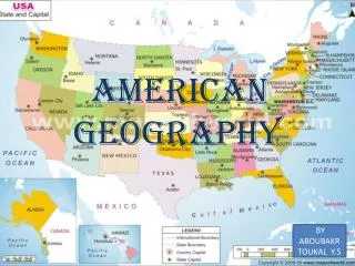
AMERICAN GEOGRAPHY BY ABOUBAKR TOUKAL Y.5
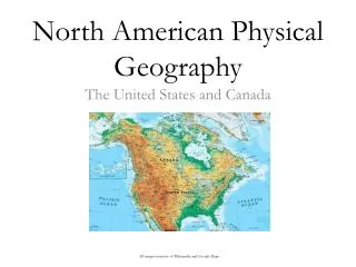
ABOUT AMERICAN GEOGRAPHY A country of central and northwest North America with coastlines on the Atlantic and Pacific oceans. It includes the noncontiguous states of Alaska and Hawaii and various island territories in the Caribbean Sea and Pacific Ocean. The area now occupied by the contiguous 48 states was originally inhabited by numerous Native American peoples and was colonized beginning in the 16th century by Spain, France, the Netherlands, and England. Great Britain eventually controlled most of the Atlantic coast and, after the French and Indian Wars (1754–1763), the Northwest Territory and Canada. The original Thirteen Colonies declared their independence from Great Britain in 1776 and formed a government under the Articles of Confederation in 1781, adopting (1787) a new constitution that went into effect after 1789. The nation soon began to expand westward. Growing tensions over the issue of Black slavery divided the country along geographic lines, sparking the secession of the South and the Civil War (1861–1865). The remainder of the 19th century was marked by increased westward expansion, industrialization, and the influx of millions of immigrants. The United States entered World War II after the Japanese attack (1941) on Pearl Harbor and emerged after the war as a world power. Washington, D.C., is the capital and New York the largest city. Population: 302,000,000.
FAMOUS PLACES IN U.S.A EMPIRE STATE BUILDING LIBERTY OF STATUE THE WHITE HOUSE GRAND CANYON GOLDEN GATE BRIDGE MT. RUSHMORE
IMPORTANTS FACTS ABOUT AMERICA … Location: North America, bordering both the North Atlantic Ocean and the North Pacific Ocean, between Canada and Mexico Land Size of America : 9,631,418 sq km Climate / Weather of America: mostly temperate, but tropical in Hawaii and Florida, arctic in Alaska, semiarid in the great plains west of the Mississippi River, and arid in the Great Basin of the southwest; low winter temperatures in the northwest are ameliorated occasionally in January and February by warm chinook winds from the eastern slopes of the Rocky Mountains Population of America : 293,500,000 Capital City of America : Washington, DC American GDP: $10.98 trillion (2003 est.)Main Industries : petroleum, steel, motor vehicles, aerospace, telecommunications, chemicals, electronics, food processing, consumer goods, lumber, mining American Currency: US dollar (USD) Agricultural products: wheat, corn, other grains, fruits, vegetables, cotton; beef, pork, poultry, dairy products, forest products, fish .Main Colors of American Flag : Red, white and blue. I HINT THE AMERICAN FLAG HAS 50 STARS AND 7 STRIPES.
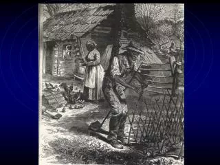
BUT WHO FIRST DISCOVERED AMERICA??? The question is flawed in premise. The United States was not a country until 1776. So if the question is then who discovered what is now known as North America then the question needs clarification. Do you consider the first people to settle the land as those who discovered it? If so than most scholars believe that the Americas were first settled by people of Asian desent between 4000 and 6000 years ago. These are the original desendants of the Native Americans including Noth and South American indeginous tribes. If you are asking about the first Europeans to set foot in the area then the answer is traditionally accepted as Leif Erickson. I believe he landed in what is now known as Newfoundland at the begining of the 11th Century. Erickson's travels did not lead to any permenat colonization. If your question is whose exploration voyages led to European colonization then the answer would be Columbus. But being your question was who first discovered the United States, awarding Columbus with the answer would not be 100% accurate because Columbus never set foot on any land that would now be part of the United States. While debated it is generally accepted that Columbus explored areas that are now the Bahamas, Cuba and Haiti. John and Sebastian Cabot both led expiditions that explored the northeastern section of what is now North America, but neither entered what is today U.S. territory. The first peron to sail to what is now the U.S. would be Spanish explorer Ponce de'Leon. He explored what is now S.E. Georgia and Florida. Hope that helps with your assignment. ANSWER FROM YAHOO ANSWERS (LUMPKIN).
HINT THE LONGEST RIVER IS CALLED RIVERS White River meanders and badlands southwest of Weta, SD. Horse Tooth Reservoir west of Fort Collins, CO. Snake River and Tertiary lava at Thousand Springs area 20 miles northwest of Twin Falls, ID. East end of the Buffalo Bill Reservoir looking downstream toward Cody, WY.
PICTURES OF EXTREME WEATHER HURRICANE LIGHTNING Frequent lightning strikes surround a tornado near Mulvane, Kansas on June 12, 2004. The Sears Tower and John Hancock Center in Chicago, Illinois on July 20, 2006 FLOODS NORTHEN LIGHTS A flooded causeway on Mobile Bay, Alabama after Hurricane Ivan's landfall in September of 2004 Brilliant display of Aurora Borealis is visible from Hurricane, West Virginia on November 10, 2004.
Interesting United States Weather Facts and Extremes Top 10 cities with most weather variety Top 10 cities with least weather variety Based on temperature variation, precipitation, wind, severe weather 1. San Francisco, California 2. San Diego, California 3. Los Angeles, California 4. Santa Barbara, California 5. Eureka, California 6. Long Beach, California 7. Honolulu, Hawaii 8. Santa Maria, California 9. San Luis Obispo, California 10.Kahului, Hawaii Based on temperature variation, precipitation, wind, severe weather • 1. Springfield, Missouri 2. Topeka, Kansas 3. Rochester, Minnesota 4. Wichita, Kansas 5. Columbia, Missouri 6. Des Moines, Iowa 7. Lincoln, Nebraska 8. Madison, Wisconsin 9. Concordia, Kansas 10. Sioux City, Iowa
SOME DEFINITIONS … GEOGRAPHY Geography (from Greek- geografia) is the study of the Earth and its lands, features, inhabitants, and phenomena. A literal translation would be "to describe or write about the Earth". The first person to use the word "geography" was Eratosthenes (276-194 B.C.). ...en.wikipedia.org/wiki/Geography U.S.A S: (n) United States, United States of America, America, the States, US, U.S., USA, U.S.A. North American republic containing 50 states - 48 conterminous states in North America plus Alaska in northwest North America and the Hawaiian Islands in the Pacific Ocean; achieved independence in 1776 .