Download
1 / 41
410 likes | 737 Vues
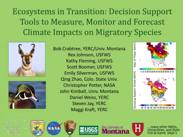
Ecosystems in Transition: Decision Support Tools to Measure, Monitor and Forecast Climate Impacts on Migratory Species. Bob Crabtree, YERC/Univ. Montana Rex Johnson, USFWS Kathy Fleming, USFWS Scott Boomer, USFWS Emily Silverman, USFWS Qing Zhao, Colo. State Univ. Christopher Potter, NASA

E N D
Ecosystems in Transition: Decision Support Tools to Measure, Monitor and Forecast Climate Impacts on Migratory Species Bob Crabtree, YERC/Univ. Montana Rex Johnson, USFWS Kathy Fleming, USFWS Scott Boomer, USFWS Emily Silverman, USFWS Qing Zhao, Colo. State Univ. Christopher Potter, NASA John Kimball, Univ. Montana Daniel Weiss, YERC Steven Jay, YERC Maggi Kraft, YERC … many other NGOs, Universities, and State Fish & Game Dept.’s
Background on science-based, empirically-driven Adaptive Harvest Models • Continental working group formed in 1992 to review the scientific basis for managing waterfowl harvest in NA • Uses annual field data (1955 to present) to inform population models on an annual cycle to set harvest • Information-theoretic criteria (model weights) reflect the relative confidence in alternative hypotheses—e.g., D-D reproduction and/or additive mortality • The AHM is not currently constrained by environmental variables (extreme weather, persistent drought, forage) • Major challenges to modification are continuity, continuance, data access and processing, and validation
. . . build the framework to ingest and process the datasets for diagnostic analysis and modeling to propose candidate constraints to AHMs RESPONSE DATA: aerial surveys of waterfowl breeding pair density (1955 to 2011 ) brood production, harvest and non-harvest mortality, and age ratios; possibly the best long-term demographic data set in the world. Higher spatial resolution starting 2000
A.30 BioClim: Mid-Continent Study Region combined Central and Mississippi flyways MODIS tile coverage of the study area. MODIS data was used to generate many explanatory variables used in analysis & modeling efforts
Goals/Hypothesis End-user applications science goal(s): • Provide neededtools and techniques for ecosystem assessments and to quantify environmental impacts (e.g., climate, land use, harvest, invasives) on species populations • Create and increase access to those environmental datasets needed (e.g., NASA data) to understand cause & consequence; avoid DEFICIENT MODELS and errors of attribution leading to… Science question(s): — with hypotheses regarding mistiming strategies (3) Can we predict [migratory] species movements in response to climate disruptions and other related disturbance impacts? (4) What are the past, present, and future demographic consequences of these combined impacts and movements?
Goals/Hypothesis End-user applications science goal(s): • Provide neededtools and techniques for ecosystem assessments and to quantify environmental impacts (e.g., climate, land use, harvest, invasives) on species populations • Create and increase access to those environmental datasets needed (e.g., NASA data) to understand cause & consequence; avoid DEFICIENT MODELS and errors of attribution leading to… Science question(s): — with hypotheses regarding mistiming strategies (3) Can we predict [migratory] species movements in response to climate disruptions and other related disturbance impacts? (4) What are the past, present, and future demographic consequences of these combined impacts and movements?
Overview of Species Decisions Tools(called EAGLES: Ecosystem Assessment, Geospatial Analysis, and Landscape Evaluation System) EAGLES Tools Management Decision-Question Interpretation & Decision Making Geospatial Data WIKI COASTER (web & ArcGIS) Covariate Data Integration Exploratory Data Analysis RRSC or ‘Risk’ models What-if-Scenarios (EF) free use/download at www.yellowstoneresearch.org
Three new EAGLES toolsets • Temporal Regression Tools – for analysis of time-series datasets to detect and map trends, goodness-of-fit for size effects. • CASA_Wetlands_Mountains* – modified CASA to use Landsat and MODIS data in highly variable landscapes using a sub-gridded approach. • ATV (Access To Validation) – initial design to create an agency crowdsourcing site for model validation and monitoring datasets. *this new version of the CASA model is proprietary but its products are free
Visual MDA and Model Output Example: Resource Selection Analysis (RSF tool) Merged Data Array 1 2 3 4 = Model prediction Single point ‘drilling down through’ data layers is basis for all modeling approaches
Goals/Hypothesis End-user applications science goal(s): • Provide neededtools and techniques for ecosystem assessments and to quantify environmental impacts (e.g., climate, land use, harvest, invasives) on populations • Create and increase access to those environmental datasets needed (e.g., NASA data) to understand cause & consequence; avoid DEFICIENT MODELS and errors of attribution leading to… Science question(s): — with hypotheses regarding mistiming strategies (3) Can we predict [migratory] species movements in response to climate disruptions and other related disturbance impacts? (4) What are the past, present, and future demographic consequences of these combined impacts and movements?
Temporally Dynamic Variables (n=77) • Climate: TOPOMET (daily, 1 km, 1950-2009); t-min, t-max, precipitation, solar radiation, VPD; other NCEP datasets • MODIS data products: existing + Percent Surface Water (PSW)—fraction of H20 w/in 500m every 8 days • Freeze-thaw (AM, PM, and transition); NTSG datasets • Ecosystem modeled (CASA): NPP, litter biomass, ET/PET, soil moisture (4 levels), water stress, SWE, snowmelt • Annual Disturbance (250m binary); forest/non-forest fire, wetland gain/loss, etc. . . . providing direct, easy access to standardized datasets to avoid deficient and biased models for terrestrial species
CASA for Wetlands and Mountains validation using Amerifluxeddy flux tower measurements.
Ecosystem Assessments in COASTER(Customized On-line Aggregation and Summarization Tool for Environmental Rasters) • Analysis of drought impacts in the Northern Rockies using NPP responding to temp/precip. • Changing Onset of Green-up (a predictive model) • Changing Snow-Rain Transition Zone • Early trend detection in Alaska Your own analysis on-line . . . . the first analysis took 37 model runs with ingestion into ArcGIS—a total of 6 hours from start to finished product/report for end-users & agency partners see www.coasterdata.net Weiss et al. 2013
Goals/Hypothesis End-user applications science goal(s): • Provide neededtools and techniques for ecosystem assessments and to quantify environmental impacts (e.g., climate, land use, harvest, invasives) on species populations • Create and increase access to those environmental datasets needed (e.g., NASA data) to understand cause & consequence; avoid DEFICIENT MODELS and errors of attribution leading to… Science question(s): — with hypotheses regarding mistiming strategies (3) Can we predict [migratory] species movements in response to climate disruptions and other related disturbance impacts? (4) What are the past, present, and future demographic consequences of these combined impacts and movements?
Example 2: Lesser Scaup Response to Climate Aerial observations from 2001 to 2009 • First built a traditional habitat model using static covariates: • - Preferred emergent wetlands and bigger, more round ponds • - Preferred still water over turbid water; avoid wooded wetlands * Then added minimum temperature anomaly
A Multivariate Auto-Regressive State-Space (MARSS) model to understand factors driving the spatio-temporal variation of waterfowl populations, takes the form: x(t) = B x(t−1) + u + C c(t) + w(t) , where w(t) ~ MVN(0, Q) (1.1a) y(t) = x(t) + v(t) , where v(t) ~ MVN(0, R) (1.1b) x(0) ~ MVN(pi, L) (1.1c) in which x is the latent population status, c is the time varying covariates(pond, Percent Surface Water, precipitation, and temperature), and y is the observed population density (at log scale). B, u, C, Q, R, and pi are the parameters to estimate. Note that in the formulas lower case letters are vectors and upper case letters are matrix. Spatial auto-correlations are considered in Q and R (but not in B, C). B, C, and L are diagonal matrices, and the diagonal entries of L are set to 1 (thus x(0) is considered as fixed and unknown elements). The model thus is a AR(1) model which allows the parameters to vary between areas. EM algorithm is applied to calculate maximum-likelihood estimates of the parameters of interest.
Left to do… • Preliminary modeling nearly completed • Conduct ecosystem assessment of mid-continent region for consideration of further covariates in a modified model structure • Conduct final analysis of 2000-2011 datasets to create predictive model for forecasting future climate scenarios and impacts.
General EAGLES Workflow Architecture Adaptation Strategies: Landscape and Management Plans • Modeling Options • Ecosystem Assessments • Focal Species (RRSC) • Future Forecasts Track 1 Environmental Geospatial Data (explanatory) How can we develop rational, evidence-based decisions for adaptation strategies to environmental change?
General EAGLES Workflow Architecture Track 2 – Modeling species populations Species legacy datasets (response) Adaptation Strategies: Landscape and Management Plans • Modeling Options • Ecosystem Assessments • Focal Species (RRSC) • Future Forecasts Environmental Geospatial Data (explanatory) How can we develop rational, evidence-based decisions for adaptation strategies to environmental change?
Bottom line: Identification of, and Access to (probably have to create them) the needed covariates • Lessons from working groups, experts, and literature • Lessons from analysis of 17 time series species datasets • Thinking like the species you’re modeling, the right: • Spatial scales (maybe many) • Temporal window(s) and resolution • A full or complete model? • Avoid deficient models at all costs (errors of attribution)
Example 1: Getting started with migratory species: Yellowstone Bison What are the determinants (predictors) of when bison leave the park during winter? And can we use them to predict movements to engage in management actions?
Example 3: 30-year spatio-temporal I-Bat analysis 30-yr anomaly trend against year 2000 via COASTER
12 years of data layers for Sage Grouse analysis, Wyoming Roads & Drill Pads 30 meter resolution Forage Biomass (gC/m2)
General EAGLES Workflow Architecture for species population decision-making Species legacy datasets (response) Adaptation Strategies: Landscape and Management Plans • Modeling Options • Ecosystem Assessments • Focal Species (RRSC) • Future Forecasts NASA and RS Geospatial Data (explanatory) ? EAGLES Tools & Work Flow “Within year (annual) adaptive decision cycle” Potential Outcomes — ‘beyond the honest broker’: Modification of the aerial survey methodologies Constraining the Adaptive Harvest Model Prioritize existing wetland management activities
Ecosystem Metrics for modeling species: Combining 2 NASA Projects with LCC funding added DECISIONS: Development of Risk-Reward Spatial Capacity Models for use with the USFWS Strategic Habitat Conservation Framework (SHC) LCCs A.30 BioClim: Ecosystems in Transition: Decision Support Tools to Measure, Monitor and Forecast Climate Impacts on Migratory Species (e.g., waterfowl)
Days yr-1 1Transitional Period Trend (1979-2008) Mean Northern Hemisphere trend Mean Latitudinal Trends 1Transitional days: AM frozen and PM non-frozen
Legacy Data: continuous quasi-experiments • How do we explain this variation in time & space? • What is this variation attributable to? • And what actions should we take?
Legacy Data: continuous quasi-experiments Models: a common language for scientists and practitioners Yij= X1ij+ X2ij + X3ij + X4ij .... Explanatory variables…COVARIATES Response or dependent variable
Recent Advances in Remote Sensing Not just satellites . . . but remote sensing of all kinds…. Now add IP DSNs (distributed sensor networks) • DATA INTEGRATION (spatial & temporal) • Direct • Indirect • Relative • Fusion • Assimilation Models
Focal Species (Legacy) Data Sets Analyzed • Bison – migration and habitat • Lesser Scaup– demography w/ climate/water • Indiana Bat – demography w/ climate change • Coyote – habitat and demography • Small Mammals (5 species) – habitat • Red Fox – winter habitat w/ snow dynamics • Elk – habitat with path & memory functions • Sage Grouse – habitat and demography • Pronghorn – demography, recruitment • Pronghorn habitat w/ scenarios • Caribou – habitat and path movements • Evening Primrose – habitat w/ climate scenarios • Swift Fox – habitat with variable availability • Grasshopper Sparrow – habitat • Moose – habitat and path movements Many factors at many scales . . .


