Physical Geography of China and Mongolia
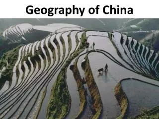
Physical Geography of China and Mongolia. Ch. 28.1. This unique landform of Southeast China is called danxia . The United Nations designated a series of these formations in 2010 as a World Heritage Site.

Physical Geography of China and Mongolia
E N D
Presentation Transcript
This unique landform of Southeast China is called danxia. The United Nations designated a series of these formations in 2010 as a World Heritage Site. • Which physical process is MOST likely responsible for this landform? • uplift • erosion • debris flow • tectonic divergence
How do summer monsoon winds affect the climate of southeastern China? • The winds cause violent storms similar to hurricanes. • The winds are dry and have contributed to the area being a desert. • The winds are cold and have contributed to the area being covered in tundra and permafrost. • The winds are full of moisture and have contributed to the area being forested and flooding often.
Three Gorges Dam video • 1. How much power will the Three Gorges Dam generate? • 2. What was the biggest consequence of the construction of the Three Gorges Dam? • 3. How does silt pose a threat to the dams?
Answers to video • The hydroelectric dam will generate as much power as ten nuclear power plants. • To build the dam, the government had to flood a huge area. More than a million people in the area lost their homes. • Silt washing down the hillsides will be trapped behind the dams and will eventually fill up the reservoirs.
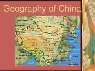
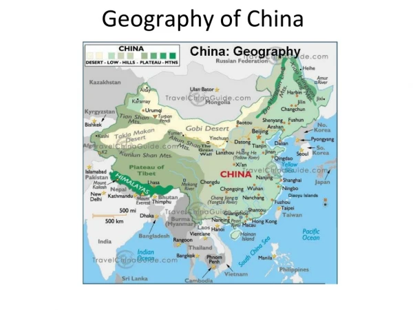
China can be divided into two parts: the mountains and plateaus of the west, and the plains and hills of the east.
The east contains the majority of the population, as the land is conducive to farming.
The mountainous barriers of the west kept China isolated for millennia.
The Gobi desert, in north-central China, is the source of frequent dust storms in the region.
The Plateau of Tibet is the source of China’s major rivers that flow eastward toward the Pacific Ocean.
The Huang He (Yellow River) is filled with loess, a fine, nutrient-rich topsoil that makes the North China Plain ideal for farming.
The Chang Jiang (Yangtze River) is a major transportation route and home to the Three Gorges Dam.
The dam produces hydroelectric power to supply eco-friendly energy to various cities in China (including Shanghai)
The Xi (Pearl River) serves rapidly developing areas in China, like the port of Guangzhou.
Climates are extremely diverse, ranging from tropical in the south to subarctic in the north.
The monsoons, or seasonal winds, direct the weather patterns of China.
Typhoons, large violent storms, threaten the region between August and late October.
China has a wealth of mineral resources and vast petroleum reserves.
Not only the world’s top producer of rice, China leads in farm output of many crops.