Download
1 / 27
280 likes | 559 Vues
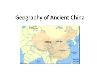
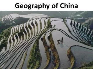
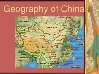
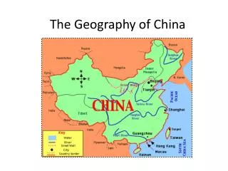
Geography of China. China From Above. Geography of China. Earliest Civilizations Developed over 4,000 years ago Centered around Huang River. Geography of China. Major river valleys still heart of agricultural economy 1. Huang River 2. Yangtze River 3. Xi River. Geography of China.

E N D
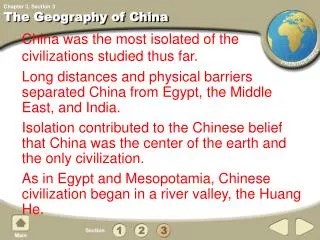
Geography of China • Earliest Civilizations • Developed over 4,000 years ago • Centered around Huang River
Geography of China Major river valleys still heart of agricultural economy • 1. Huang River2. Yangtze River3. Xi River
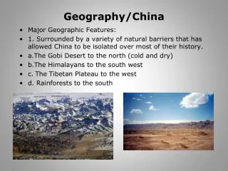
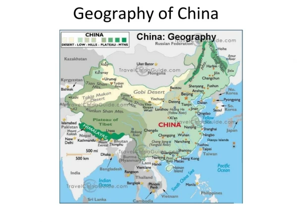
Geography of China • II. Geographic Isolation • A. Landforms and location are isolating factors • B. Mountains cover 1/3 of China • 1. Himalayas on border -Tibet & Nepal2. Mt. Everest called “Qomolangma”
Deserts of China • Deserts in northwest • Taklimakan Desert: raindrops evaporate before reaching the ground • Sandstorms last for days
Gobi Desert • One of world’s largest deserts • Extreme temperatures from a high of 113° F in the Summer to a low of minus 104 ° F in the winter. • Made up mostly of rock and gravel
Coastal Area Extend along coast of the South and East China Seas Just above Sea Level
Coastal Area Coastal Plains Fertile land; Warm, wet climate 90 % of China’s people live here
China’s Rivers • Huang River (Yellow River) • Over 3,395 miles long. • Flows from high western mountains to eastern lowlands.
China’s Rivers • Carries fertile silt, which combines with fine, wind blown dust from Gobi Desert. • Has flooded more than 1500 times with much damage.
Yangtze River • 3,900 miles long • Flows from high western mountains to eastern lowlands
Yangtze River • Nearly ½ of China’s people live in its basin. • Also a rich agricultural region
Yangtze River • The Yangtze River stretches through nine provinces • Serves as a drain for 695,000 square miles of land.
Yangtze River • Over the centuries the Yangtze has served as a transportation and commercial highway .
Yangtze River • Every year the Yangtze deposits massive amounts of silt. • More than 6 billion cubic feet annually. • That helps make the area a large plain used to grow rice.
Xi River • The Xi River is a river located in the southeast of China. • The Xi River flows generally eastward for 1,216 miles.
Xi River From the highlands to the South China Sea. Shorter than other important Chinese rivers But its volume of flow is second only to that of the the Yangtze River
Amur River • The Amur is the sixth-longest river in the world. • Flowing 2,744 miles across the Far East regions of Russia
Amur River • For 1,000 miles, the river forms a natural boundary between Russia and China. • It is the largest undammed river in the world.
Amur River It is the longest river of the Russian Far East. • It ranks behind only the Yangtze and Yellow Rivers among China’s longest rivers.
Brahmaputra River • It rises on the northern slopes of the Himalaya in Tibet. • Flowing 1,680 miles through India and Bangladesh
It joins the Ganges River, with which it shares the Ganges Delta. • The river is an important source for irrigation and transportation.