
Monitoring and Evaluation of Emergency Berms on Coastal Islands – April 2012 Overview
This report, prepared by Gordon Thomson, Director at Coastal Planning & Engineering, provides an in-depth analysis of the monitoring and performance evaluation of emergency berms constructed on various coastal islands including Shell, Pelican, Scofield, and Chandeleur Islands. Key aspects of the report detail berm design specifications, volume change mechanisms, and the monitoring process over specific timelines. The findings highlight the remaining volumes of sand in each berm project indicating effective performance. This information is crucial for future coastal management and emergency response strategies.

Monitoring and Evaluation of Emergency Berms on Coastal Islands – April 2012 Overview
E N D
Presentation Transcript
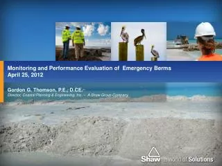
Gordon G. Thomson, P.E., D.CE. Director, Coastal Planning & Engineering, Inc. – A Shaw Group Company Monitoring and Performance Evaluation of Emergency Berms April 25, 2012
Emergency Berm Monitoring and Performance • Reach locations and design • Shell Island • Pelican Island • Scofield Island • Chandeleur Island • Volume Change Mechanisms • Summary • Sample Text Box Sample Photo Frame Emergency Berm Monitoring & Performance
Project Location Map Emergency Berm Monitoring & Performance
Emergency Berm Design • Crest elevation = +6 ft, NAVD • Crest width = 20 ft • Side slopes • 1V:25H above -2 ft, NAVD • 1V:50H below -2ft, NAVD Emergency Berm Monitoring & Performance
Shell Island (W-8) • Start = Oct. 3, 2010 • End = Nov. 23, 2010 • As-built length = 8,400 ft • Pre-construction condition had no continuous shoreline • As-built volume = 780,000 cubic yards (cy) • 360-day volume = 640,000 cy • 82% of volume remains Emergency Berm Monitoring & Performance
Shell Island (W-8) Emergency Berm Monitoring & Performance
Pelican Island (W-9) • Start = July 18, 2010 • End = Oct. 2, 2010 • As-built Length = 12,400 ft • Advanced shoreline an average of 260 ft • As-built volume = 1,240,000 cy • 360-day volume = 980,000 cy • 79% of volume remaining Photo courtesy of Great Lakes Dredge & Dock Oct 4, 2011 Emergency Berm Monitoring & Performance
Pelican Island (W-9) Emergency Berm Monitoring & Performance
Scofield Island (W-10) • Start = Sept. 13, 2010 • End = Nov. 24, 2010 • As-built length = 14,000 ft • Advanced shoreline an average of 310 ft • As-built volume = 960,000 cy • 360-day volume = 880,000 cy • 92% of volume remaining Emergency Berm Monitoring & Performance
Scofield Island (W-10) Emergency Berm Monitoring & Performance
Chandeleur Island (E-4) • Start = June 20, 2010 • End = March 21, 2011 • As-built length = 48,000 ft • Advanced shoreline an average of 410 ft • As-built volume = 3,170,000 cy • 180-day volume = 3,490,000 cy Emergency Berm Monitoring & Performance
Chandeleur Island (E-4) Emergency Berm Monitoring & Performance
Volumetric Change Mechanisms • Frequency of the monitoring surveys allowed for differentiation between the various coastal processes • Settlement: Compaction of underlying soils • Overwash: Volume change landward of as-built crest (no net loss of sediment) • Longshore transport: Sediment movement along Gulf shoreline • Offshore loss: Loss of fine grained sediment in an offshore direction Emergency Berm Monitoring & Performance
Profile Comparison: Pelican Island Emergency Berm Monitoring & Performance
Summary Emergency Berm Monitoring & Performance
Gordon Thomson Director, CPE – A Shaw Group Company gordon.thomson@shawgrp.com CONTACT