Exploring the World Around Us
Exploring the World Around Us. I. What is GEOGRAPHY?. The study of how the natural environment influences people, how people’s activities affect Earth, and how the world is changing, both physically and culturally. Two types of Geography?. A. The Five Themes of Geography. Location.
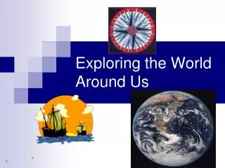

Exploring the World Around Us
E N D
Presentation Transcript
I. What is GEOGRAPHY? • The study of how the natural environment influences people, how people’s activities affect Earth, and how the world is changing, both physically and culturally. • Two types of Geography?
Location • --Every place on Earth has a location. • --Location is defined in terms of ABSOLUTE and RELATIVE location.
a. Absolute Location • --DEFINITION: the EXACT spot on Earth where something is found. A precise place.
Absolute location uses a grid system to accurately locate places. --Example: the latitude-longitude system
Latitude/Longitude System • Lines of LATITUDEare drawn in an east-west direction • These lines measure distance north and south of the EQUATOR • The EQUATOR is an imaginary line that circles the globe half-way between the North Pole and South Pole.
--Lines of LATITUDE are called PARALLELS. --they are always parallel to the EQUATOR.
PARALLELS north of the EQUATOR are labeled with an N • PARALLELS south of the EQUATOR are labeled with an S
…Longitude • Lines of LONGITUDE are drawn in a north-south direction
Longitudinal lines measure distance east and west of the PRIME MERIDIAN • The PRIME MERIDIAN is an imaginary line that runs thru Greenwich, England from the North Pole to the South Pole.
b. Relative Location • --DEFINITION: the position of a place in relation to other places • Example: St. Louis is in extreme eastern Missouri on the west bank of the Mississippi River.
Drawbacks of Relative Location • Relative location is very imprecise and only gives a general idea about location. • It relies on prior knowledge. • The relative location given for St. Louis is ONLY useful if the person told knows the location of Missouri and the Mississippi River.
Place • Every place on Earth has unique characteristics that make it different from every other place.
Types of places • 1. Every place can be described in terms of its PHYSICAL CHARACTERISTICS. • These include mountains, rivers, soil, beaches, and wildlife.
Place described by Physical Characteristics… • Example: the Sahel: a hot and dry place along the southern edge of the Sahara Desert in Africa.
2. Every place can be described in terms of its HUMAN CHARACTERISTICS. • These are derived from the ideas and actions of people that result in changes to the environment, such as buildings, roads, clothing, and food habits. Also, people’s way of life, activities, religion, and language.
3. Human-Environment Interaction • How people relate to their environment & how they are affected by it.
Types of Human-Environment Interaction • 1. People ADAPT to their environment. • 2. People DEPEND on their environment. • 3. People CHANGE their environment.
4. Movement • Transportation of people, goods, and ideas. WHY & HOW? EXAMPLES? • Migration. What & Why? • Trade---Movement of goods betw. areas. • EXPORTS? • IMPORTS? • Interdependence: dependence of countries for goods, resources, and knowledge from other countries. (Trade partners? Examples?) (Tariffs?)
1.TRANSPORTATION of people, goods, and ideas. • Information/ideas (music) • Fashion • Goods (food, material objects) • People (travel, move to another location) • Others?
5. Region • Geographic area displaying some type of unity: landforms, govt., language, religion, industry, vegetation, climate, etc. (Physical or Cultural features)
Regions can be defined by more than one characteristic… • Physical characteristics • Language • Religion • Others?
NOTES ARE FINISHED FOR THE DAY… • 20 August 2010
MAP ELEMENTS • All maps should contain the four basic elements.
Direction • Direction is indicated on a map in one of three manners… • Direction Indicator • Compass Rose • Use of Latitude and Longitude Lines
A. Direction Indicator • A DIRECTION INDICATOR is simply an arrow that describes location. • Usually the DIRECTION INDICATOR will point north.
B. Compass Rose • A COMPASS ROSE should display the 4 CARDINAL DIRECTIONS (North, East, South, and West) • “Never Eat Soggy Waffles” • “Never Eat Shredded Wheat”
--A compass rose may have 4, 8, 16, 32, or 64 points. --8 point compass rose has the four basic intermediate directions.
Intermediate directions are located halfway between the cardinal directions • Simply combine the 2 cardinal directions starting with North or South first
Ex: halfway between North and East is Northeast.Not Eastnorth!!!!
16-point compass rose shows directions that are halfway between cardinal and intermediate directions.
Halfway between North and Northeast is determined by combining the cardinal direction (North) and the intermediate direction (Northeast).
-Stating the cardinal direction first, we have North Northeast. --this can be written Nne.
This direction is also considered an intermediate direction… • …some call it an inter-intermediate direction.
32 and 64-point compass roses continue combining directions, but are seldom used in class.
23 August 2010 • Notes are finished for today. • Please work on homework assignment.
2. Scale • Scale helps the map-reader determine distance. There are 3 types: • Written Scale • Graphic Scale • Fractional Scale
WRITTEN SCALE • Ex: 1 inch equals 5 miles • 1 inch on the map represents 5 miles in the REAL world.
The Graphic Scale is important when enlarging or reducing maps by photocopy techniques because it changes with the map.
C. FRACTIONAL SCALE • This uses a Ratio in determining distance. • Ex: 1:316,800 (This is the same as 1/316,800) • 316,800 is the number of inches in 5 miles. • Note: 1 mile = 5280 feet 1 mile = 63,360 inches
Once the scale is expressed as a ratio, any unit of distance can be used… • OTHER EXAMPLES: • 1 INCH ON THE MAP = 316,800 INCHES IN THE REAL WORLD. • 1 FOOT ON THE MAP = 316,800 FEET IN THE REAL WORLD. • 1 METER ON THE MAP = 316,800 METERS IN REAL WORLD. • 1 PENCIL LENGTH ON THE MAP = 316,800 PENCIL LENGTHS IN THE REAL WORLD.
EXAMPLES OF FRACTIONAL SCALE… • 1. “One inch equals one mile” • We have inches on one side so we must have inches on the other: • One mile is 63,360 inches so the ratio is 1:63,360
2. “One foot equals one mile” • We have feet on one side so we must have feet on the other: • There are 5,280 feet in a mile so the ratio is 1:5,280
That’s all folks. 24 August 2010 • Homework.
3. Key/Legend • The key/legend helps the reader interpret a map by using symbols/colors to represent actual objects on the earth’s surface.
These symbols may change from map to map, so it is important for the reader to acquaint himself/herself with the legend/key.