ESA Contribution to Validation Supersites
260 likes | 434 Vues
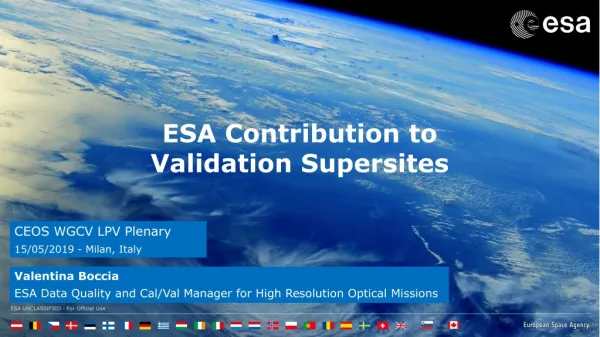
ESA Contribution to Validation Supersites. CEOS WGCV LPV Plenary 15/05/2019 - Milan, Italy. Valentina Boccia ESA Data Quality and Cal/Val Manager for High Resolution Optical Missions. At ESA we see the establishment and operational exploitation of a

ESA Contribution to Validation Supersites
E N D
Presentation Transcript
ESA Contribution to Validation Supersites • CEOS WGCV LPV Plenary • 15/05/2019 - Milan, Italy • Valentina Boccia • ESA Data Quality and Cal/Val Manager for High Resolution Optical Missions
At ESA we see the establishment and operational exploitation of a network of Supersites as key element of Land Product Validation.
We wish for the establishment of a Supersite network that: • is spread worldwide • is representative of several biomes • adopts the same validation protocols and procedures for each site • can be used to operationally validate data generated by multiple EO satellite missions (and from multiple Space Agencies) • is the result of a global effort at international level, for the benefit of the EO international users community. Sentinel-2 - Lake Mackay, western Australia
ESA is contributing to the establishment of such Supersite network through: • FRM4VEG project (Fiducial Reference Measurements for Vegetation) • Preparation activities for the BIOMASS mission Sentinel-2 - Lake Mackay, western Australia
FRM4VEG (Fiducial Reference Measurements for Vegetation) The FRM4VEG project is conceived as the first step of ESA contribution to the development of a Supersites network for Land Product Validation. • FRM4VEG is currently focusing on: • Europe; • the EO data acquired by ESA optical satellites.
FRM4VEG (Fiducial Reference Measurements for Vegetation) The project aims at: • Include estimation of uncertainties in the validation measurements and overall EO data validation process, so to ensure full traceabilityto EO data users. • Identify one or two European sites (goal: 1 forest and 1 agricultural) to be the first European Supersites for Land Product Validation, building on already existing capabilities. • Generation of fully documented Protocols and Procedures to be implemented in order to proper validate the considered EO data and ensure full traceability trough the validation process. • Identify what has to be done in order to make them actual Supersites (e.g. which instrumentation has to be permanently installed, how measurements have to be taken, how characterization of the sites has to be performed, etc.) • Bring together the international community through a dedicated Workshop in order to have a fruitful discussion on protocols, sites characterization, etc. so to achieve a common understanding and agreement. • Bring together the international community through an inter-comparison (round-robin) validation exercise performed simultaneously over the same site. Sentinel-2, Augustus Island, Australia
FRM4VEG (Fiducial Reference Measurements for Vegetation) The project aims at: • Include estimation of uncertainties in the validation measurements and overall EO data validation process, so to ensure full traceabilityto EO data users. • Identify one or two European sites (goal: 1 forest and 1 agricultural) to be the first European Supersites for Land Product Validation, building on already existing capabilities. • Generation of fully documented Protocols and Procedures to be implemented in order to proper validate the considered EO data and ensure full traceability trough the validation process. • Identify what has to be done in order to make them actual Supersites (e.g. which instrumentation has to be permanently installed, how measurements have to be taken, how characterization of the sites has to be performed, etc.) • Bring together the international community through a dedicated Workshop in order to have a fruitful discussion on protocols, sites characterization, etc. so to achieve a common understanding and agreement. • Bring together the international community through an inter-comparison (round-robin) validation exercise performed simultaneously over the same site. Sentinel-2, Augustus Island, Australia
Fiducial Reference Measurements MUST… Have documented evidence of metrological traceability to SI (or appropriate international community standard) including full uncertainty budget (instrumentation and usage); Consider all spatial/temporal/scaling issues; FRM4VEG for Land products Be independent of any satellite geophysical retrieval process; Provide long-term sustainable mission validation information; Be carried out following community agreed good practice protocols (some of which still need to be written…!) Be a direct translation of QA4EO to in-situ data; Facilitate interoperability between sensors; Building on the existing capabilities.
FRM4VEG (Fiducial Reference Measurements for Vegetation) We are currently focusing on the EO data acquired by ESA optical satellites. • S1 TOC 100m • Many more coming soon... Sentinel-2, Ganges Delta, India
FRM4VEG – What has been done so far? END of Phase 1 KO of Phase 1 2 FIELD CAMPAIGNS March 2019 March 2018 Summer 2018 Wytham Woods (UK) Barrax (Spain)
FRM4VEG – What has been done so far? END of Phase 1 KO of Phase 1 2 FIELD CAMPAIGNS March 2019 March 2018 Summer 2018 Wytham Woods (UK) - Experimental farm. - Flat terrain. - Generally clear skies. - 2 hours driving from Valencia Barrax (Spain)
FRM4VEG – What has been done so far? END of Phase 1 KO of Phase 1 2 FIELD CAMPAIGNS March 2019 March 2018 Summer 2018 • Semi-natural woodland (Oak, Ash, Beech, Hazel, Sycamore); • Managed research forest with ∼ 75 years of ecological monitoring; • Canopy walkway, Flux tower Wytham Woods (UK) Barrax (Spain)
FRM4VEG – What has been done so far? Instrument Calibration history and certificates DRAFT DRAFT FRM Protocols and Procedures Validation Methodology + Instruments Technical Handbooks
FRM4VEG – What’s next? END of Phase 2 KO of Phase 2 2 FIELD CAMPAIGNS End 2021 / Beg. 2022 End 2019 / Beg. 2020 • Selection of one or two European sites (goal: 1 forest and 1 agricultural) to be the first European Supersites for Land Product Validation. • Identification of what has to be done in order to make them actual Supersites (e.g. which instrumentation has to be permanently installed, how measurements have to be taken, how characterization of the sites has to be performed, etc.)
FRM4VEG – What’s next? END of Phase 2 KO of Phase 2 2 FIELD CAMPAIGNS 1 Inter-comparison exercise End 2021 / Beg. 2022 End 2019 / Beg. 2020 1 Workshop • to bring together the international community. • to have a fruitful discussion on protocols, sites characterization, etc. so to achieve a common understanding and agreement
FRM4VEG – What’s next? END of Phase 2 KO of Phase 2 2 FIELD CAMPAIGNS End 2021 / Beg. 2022 End 2019 / Beg. 2020 FRM Protocols and Procedures Validation Methodology Generation of fully documented Protocols and Procedures to be implemented in order to proper validate the considered EO data and ensure full traceability trough the validation process.
A few remarks • We are currently in the process of identifying and selecting the first European sites to become part of the Supersites Network for Land Products Validation. They are meant to be operationally used for validation and to give ”the good example” to the other validation sites that wish to become part of the Supersites Network. In order to do that, we need feedback from CEOS LPV. Those sites need to be in the CEOS list of Supersites. Sentinel-2, Lake Natron, Africa Sentinel-2, The Great Blue hole: Lighthouse Reef – Belize Barrier reef
A few remarks • We are currently in the process of identifying and selecting the first European sites to become part of the Supersites Network for Land Products Validation. They are meant to be operationally used for validation and to give ”the good example” to the other validation sites that wish to become part of the Supersites Network. In order to do that, we need feedback from CEOS LPV. Those sites need to be in the CEOS list of Supersites. • By the end of FRM4VEG Phase 2, we will ask CEOS LPV for feedback on the FRM Protocols and Procedures documents we are writing. We hope for CEOS LPV endorsement and the creation of a related CEOS document(s). Those Protocols and Procedures are meant to be adopted and implemented operationally throughout the Supersites Network for Land Validation Products at international level.
A few remarks • We are open for collaborations with other Entities/Institutes that have similar activities and are interested in setting up the first two European sites of the Supersites Network for Land Product Validation. • We see some potential opportunities also from the Hypernet project. We are currently investigating on it and suggestions are welcomed.
ESA is contributing to the establishment of such Supersite network through: • FRM4VEG project (Fiducial Reference Measurements for Vegetation) • Preparation activities for the BIOMASS mission Sentinel-2 - Lake Mackay, western Australia
ESA support to LPV subgroup on biomass: potential supersites • Airbornecampaign support • In-situ campaign support • Potential future support Work in progress
Airborne campaign support • French Guiana (Neotropicalforest) • Supersitesimaged: • Paracou • Nouragues • Arbocel • TropiSAR 2009 airbornecampaign • Neotropicalforest • Field campaign (782 Forest plots caracterised) • P-band SAR, L-band SAR • LIDAR • Potential future supersites: • BAFOG • Montagne tortue • Organabo • Gabon (Afrotropicalforest) • AfriSAR 2015-2016 airbornecampaign • Afrotropicalforest • Field campaign (363 Forest plots caracterised, TLS) • P-band SAR, L-band SAR • LIDAR • 2 Airborne Instruments: DLR F-SAR (P- and L-band SAR), ONERA Sethi (P-band SAR) • Collaboration with NASA: JPL UAVSAR (L-band SAR), GSFC LVIS (canopy lidar) • Joint operationscollocated in time and space • Supersitesimaged: • Lopé • Mabounie • Mondah • Rabi
In-situ campaign support • French Guiana (Neotropicalforest) • TropiScat 2011-2014 in-situ campaign • P-band and L-band SAR • Full polarimetric and tomographic • Measurementsevery 15 minutes • Supersitesimaged: • Paracou • Ghana (Afrotropicalforest) • AfriScat 2015-2016 in-situ campaign • P-band and L-band SAR • Full polarimetric and tomographic • Measurementsevery 10 minutes • Supersitesimaged: • Ankasa
Other potential future support • To bedefined and agreedfollowing the work of the CEOS LPV focus on Biomass. • (more info in the presentation of Laura Ducanson at 11:00) Work in progress
Thank you for your kind attention! • Valentina Boccia – valentina.boccia@esa.int Sentinel-2, Namibia