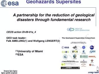
Integrated Monitoring of Earthquake-Induced Landslides at the Sea of Marmara Supersite
This project develops an innovative ground and space-based monitoring experiment to address earthquake-induced landslide geohazards in the Sea of Marmara region of Turkey. With a focus on integrating multi-parameter monitoring techniques, the initiative aims to enhance our understanding of landslide triggers such as heavy rainfall and seismic activity. The study includes the analysis of geological data, in-situ investigations, and the development of an early warning system. Ultimately, it seeks to improve risk assessment and urban planning for areas susceptible to these natural hazards.

Integrated Monitoring of Earthquake-Induced Landslides at the Sea of Marmara Supersite
E N D
Presentation Transcript
The earthquake induced landslide geohazard: development of a ground and space integrated monitoring experiment at Sea of Marmara SupersitePascal Bigarre(Ineris),Semih Ergintav(Tubitak) Supersites Coordination Workshop “Key technologies for the monitoring of geologically active regions prone to natural hazards” session
The earthquake induced landslide geohazard Earthquake induced landslides directly caused fatalities. produced extensive damage to housing, buildings, infrastructures and lifelines. They may isolate entire zones, perturbing rescue and relief efforts.
The Sea of Marmara • In Turkey total loss caused by landslides in terms of affected buildings constitutes 27% of the entire loss from all natural hazards (Duman, 2005), especially in the seismically active NAF Zone (Gokceoglu, 2005) • The 17 August 1999 Mw 7.4 Kocaeli earthquake caused extensive landslides, subsidences and liquefaction-induced ground deformations along the coast of IzmitBay (Cetin, 2004) • Numerous tsunami occurrences are historically related to the earthquakes in the segments of the WNAF (Altinok, 2000) • Major submarine mass wasting - landslides have been observed and mappedfromhighresolutionsurveys (Gazioglu, 2005) • Tsunami effects were observed and measured during the 1999 post-event surveys in several places along both the northern and the southern coasts of the Izmit bay (Tinti & al, 2006)
Marsite - WP6 • 8 Partners involved: IU, TUBITAK, ITU, INERIS, IFSTTAR-La Sapienza, U.PAVIA, INGV, CNR-ISMAR • Among objectives : • Investigate further an already constrained regional landslide – on shore & off shore - and seismic prone area including in situ and space monitoring • Improve our scientific understanding in landslide triggers : heavy rainfalls and strong shaking • Prototype an EWS for those geohazards
The AvcilarPeninsula : a well-constrained area Numerous previous studies and relevant bibliography. Pre-existent landslide data for this area of interest include : • Geologic and geomorphologic data :Landslide GIS (hr dem, shape files) • In situ geophysical investigations : Amplification map, seismic profiles • Small earthquakes from weak motion stations, PGA data and waveformsrelated to 1999earthquakes, regional GPS data • Impact of Structural framework • Landslide recent activity (-> 2000 – 2012) • Morpho-Bathymetry , seismic profiles • &c
TBB IMT-Tubitakproject • landslide hazard includes more than 4000 m of drilling through 69 subsurface and deep boreholes • Coupling the Marsite WP6 – TBB projects • Selection of pilot site candidate(s) for evaluation of multi-parameter monitoring techniques • Drill cores - Labtests • Natural Water Content • Particle Size Analysis • AtterbergLimits • Specific Weight • Consolidate Test • Shear Test (CU or CD) • TriaxialTest (CU oe CD) • Instrumentation • Inclinometry • Water table
Scenario (INERIS, IU, TUBITAK): Surface : METEORIC, GPS-DISPLACEMENT, WATER CONTENT, &c Borehole WATER TABLE, ACCELERATIONS, INCLINOMETRY Collecting – sharing data to studydisplacements and deformations versus rainfall, watertable, seismicgroundaccelerations
e.cenarisinfrastructure : easy open access to multi-parameterground monitoring dataset to the partners • seamlesscatalogues and time series, sesimogams, pre-processeddata, maps, etc • metadatarelated to the instrumentation and Technical and field documentation – photos - reports - hazardmapping
Risk periodic Modelling Low Modelling Permanent Medium Early Warning High Presentactivity
Expected Outputs In straight collaboration withotherMarsiteWPs (5, 9, &c), otherSupersitesprojects :and EPOS project , itisexpected to provide for : • Betterknowledge of earthquakeinducedlandslidemechanisms and enhancedhazardassessementtools, includinginteractions between faults and observed landslides. • Access to a coherentmultidisciplinarydatasetrelated to landslidegeohazard, includingdynamic GIS database for susceptibilitymapping of seismictriggerredlandslide • An integrated solution combininggroundand space monitoring technologies applied to the landslidegeohazard and based on a pre-existing infrastructure • Useful contribution to prevention, preparedness and risk management, especially urban planning – realization and transformations Synergy with TBB project and other close implemented Stackholders : T.R. Ministry of Environmentand Urbanism, Metropolitan Municipalities, Disaster Affairs General Directorate, &c