Download
1 / 33
330 likes | 450 Vues
Explore the changes in Kyungpook National University's land usage from 2006 to 2010 using remote sensing tools. Discover key transformations and their impacts on the campus environment.

E N D
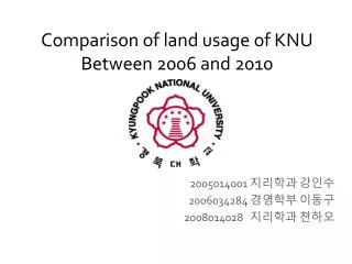
Comparison of land usage of KNUBetween 2006and 2010 2005014001 지리학과 강인수 2006034284 경영학부 이동구 2008014028 지리학과쳔하오
Contents • Introduction • Reason why chose the Subject • Introduce about KNU • Main Subject • Comparison 2006 & 2010 KNU • Automatic analysis + Individual analysis • Field Survey • Result analysis • Conclusion • How to use the result • Power of Remote Sensing
INTRO • There are many small and big changes in KNU • Entrance of Global Plaza, BTL Dorm, Techno building, East gate – Law school, extension of College of social science and so on • By using the remote sensing tool, we will figure out how many changes are done
About KNU • Kyungpook National University Slogan : Truth · Pride · Service Establishment : 1946. 5.28 Type : National President : Ham, In suk Nation : Republic of Korea Location : Gyeongbuk National Univ., Sangyeok 3-dong, Buk-gu, Daegu, Korea(Main campus)The number of student : undergraduate -28,170(2010)graduate school : 6,640(2010) Teaching staff : 1,118(2010) Symbol : Cheomseongdae
Main Subject • Comparison of land usage of KNU between 2006 and 2010
BIG 5 Changes 1. Entrance of Techno Building and BTL dormitory
BIG 5 Changes 2. Global Plza (GP)
BIG 5 Changes 3. East Gate + extension of College of social science + Entrance of Law school
BIG 5 Changes 4. Entrance of parking lot at college of IT Engineering 2
BIG 5 Changes 5. Faculty Apartment
Comparison 2006 & 2010 KNU Raster Attribute Editor 2006 & 2010 KNU
Comparison 2006 & 2010 KNU 2006 2010 forest : 38.93 % road : 27.48 % water : 0.45 % open : 8.40 % building : 24.74 % Total : 100 % • forest : 43.12 % • road : 25.18 % • water : 0.46 % • open : 8.65 % • building : 22.59% • Total : 100 % * Round off at three decimal places
Conclusion • Thanks to the Remote Sensing tool, We can display very objective figures how changed the usage of land by entrance of buildings in KNU • Compared to the field survey, • It is convenient to access the spot. If field survey can’t approach the spot, but remote sensing can
Conclusion • Fast, objective, save money & time. • Very useful to keep the information • Remote Sensing is very powerful tool • It can be used many kinds of information