Download
1 / 7
70 likes | 235 Vues
SCCOOS Goals and Efforts. Within COCMP, SCCOOS aims to develop products and procedures— based on observational data —that effectively evaluate and improve ocean management: Step 1: Determine pertinent ocean parameters for data supported region

E N D
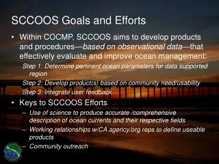
SCCOOS Goals and Efforts • Within COCMP, SCCOOS aims to develop products and procedures—based on observational data—that effectively evaluate and improve ocean management: Step 1: Determine pertinent ocean parameters for data supported region Step 2: Develop product(s) based on community need/usability Step 3: Integrate user feedback • Keys to SCCOOS Efforts • Use of science to produce accurate /comprehensive description of ocean currents and their respective fields • Working relationships w/CA agency/org reps to define useable products • Community outreach
Basic Physical Fields • Surface Currents • Data gathering velocity maps initially based on hi-rez (1km) and long-range (6-10 km) HF radar observations. Evolution to ROMS assimilated models anticipated • Trajectory analyses based on the spatial surface current information will describe motion of water parcels as a function of time from particular origins. • Subsurface Currents • Data gathered from COCMP and NOAA gliders; moorings near LJ and SB and in SMB; as well as OC Water District current profilers will be used to constrain ROMS model • Surfzone and Nearshore Currents • Interactive websites will provide “nowcasts” of IB & SMB regions • Southern CA wave momentum stress prediction - as an extension of CDIP • Month-long observations to provide comprehensive velocity products (vertical, horizontal, temporal variation) • Products designed for model calibration/validation • 3D maps of nearshore flow
Basic Physical Fields • Subsurface Water Properties • Density stratification from SCCOOS gliders, moorings and Underway CTD • ROMS to provide 3D fields: temp, salinity, currents, biogeochemical data • Sea Level • ROMS sea level “nowcasts” and forecasts as per: baroclinic and barotropic tides, local winds and remote forcing • Satellite Observations • Current maps overlays will be produced from observations of sea surface temperature and ocean color products • Surface Meteorology • Meteorological property (wind, air temp, humidity) maps to be available daily @ 3km resolution • Daily report to include 3-days worth of hourly predictions for So CA Bight
Potential COCMP Product Applications • Water Quality • Aid in identification of coastal pollution sources • Statistical descriptors, time histories, and trajectory maps used to gauge transport of bacteria, provide early warning tools, and sampling guidelines • NPDES discharge plume prediction by coupling EPA PLUMES model to observations and subsurface stratification modeling • Plume prediction and elimination of known stormwater discharges • Data gathering from stormwater discharges to determine regional management protocols for fecal bacterial and/or other materials • So CA water quality agencies - Integration of currently gathered data into the SCCOOS data system • Southern California Coastal Water Research Project (SCCWRP) Commissioner’s Technical Advisory Group (CTAG)
Potential COCMP Product Applications • Oil Spill Response as well as Search and Rescue • Meteorological and surface current data gathered and forecasted by COCMP will aid in spill response as well as search & rescue procedures • Surface currents data and trajectory key to tracking spill region • Wind and wave data helps determine effective deployment of “operational assets” (booms, spill response vessels, etc.) • Environmental/Meteorological statistics used for spill site risk assessment • Efficient/Effective determination of spill regions and recovery assets. SCCOOS products will support federal, state, and local agencies • Marine Resources & Protected Areas • Statistical descriptions help define egg and larval pathways connecting coastal marine communities • Tracking and determining likely climate & flow patterns & variations key to assessing environmental impact on fishery production
Potential COCMP Product Applications • Coastal Erosion • Data products to aid coastal erosion management depend on COCMP measurements and predictions of the alongshore wave climate and nearshore currents • Predictive tool to assess storm surge and storm driven erosion rates • Surf zone current prediction and alongshore sediment transport forecasts can define accretion and erosion regions • Vessel Traffic Aids • ROMS to provide vessel traffic w/hourly sea level predictions in sensitive regions • Driven by tides, local winds, and remote forcing • Real-time observations and predictions of waves, winds, and currents are of practical use to mariners for safe and efficient at-sea operations