WP1
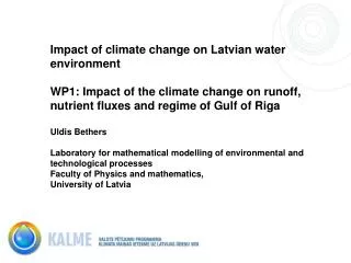
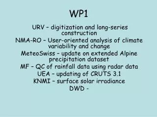
WP1. URV – digitization and long-series construction NMA-RO – User-oriented analysis of climate variability and change MeteoSwiss – update on extended Alpine precipitation dataset MF – QC of rainfall data using radar data UEA – updating of CRUTS 3.1 KNMI – surface solar irradiance DWD -.

WP1
E N D
Presentation Transcript
WP1 URV – digitization and long-series construction NMA-RO – User-oriented analysis of climate variability and change MeteoSwiss – update on extended Alpine precipitation dataset MF – QC of rainfall data using radar data UEA – updating of CRUTS 3.1 KNMI – surface solar irradiance DWD -
URV-Digitisation: status and prospects.51 Tx/Tn daily records & approximate length
A more complete view of the whole effort: temperature records 2012 2011
ORAN data sources European Climate Assessment & Dataset (1965-2012)
ORAN data sources Temporal span: 1852-2012 (with major gaps in 1870s & 1940s)
ORAN stations Cap Falcon, City, Es Senia, Tafaroui
Summary • Data rescue activities. NMA-RO has used sources which were prior identified (listed in deliverable D.1.14) to rescue data at Romanian stations covering time intervals prior to 1960. Monthly bulletins issued by the Romanian Meteorological Service were used and snow data and catchment average precipitation for 17 river basins have been digitized for the interval 1921-1940 (e.g. figure 1). In addition, daily bulletins issued by the Romanian Meteorological Service (from year 1925) have been used as alternative sources to fill some gaps of digitized air pressure data for 2 stations from Northern and Eastern Mediterranean areas (Tripoli and Tanger).
Siret basin – newly rescued and digitized data for 1921-40 Figure 1. Evolution of monthly sum of precipitation (in mm) over Siret Basin recovered for the interval 1921-1940.
The precipitation climate of the Alps, as seen from an extended rain-gauge dataset F. A. Isotta, D. Masson and C. Frei 3rd April 2012
Data contributions • Domain: Lon. 2-17.5E, lat. 43-49N (including flatland & adjacent hill ranges) • Typical inter-station distance: 10 – 15 km • Daily sums (ca. 06:00-06:00), (1961-) 1971-recent Mean # stations (instantaneous)
Spatial control of rain gauge precipitations using radar data(Contribution to WP1) F Mounier, P Lassègues, A-L Gibelin, J-P Céron, J-M Veysseire Meteo-France DCLIM / CNRM-GAME
Construct a 2007-2010 reference estimate of spatialized precipitation for rain gauges control and validation at fine scale. PROPOSED SOLUTION Use radar network in the spatialization process of the precipitation estimate Radar data need also to be qualified • MAIN PROBLEMS of rain gauges: density, quality, instrument types • Real-time Meteo-France (~1500-1800) • volunteers (~2800)
UEA • Updating of CRU TS 3.1 • Paper about to be submitted • Includes Potential Evapotranspiration using Penman-Monteith formula (FAO) • Ge Verver will talk about comparisons with ECA&D