Download
1 / 33
330 likes | 541 Vues
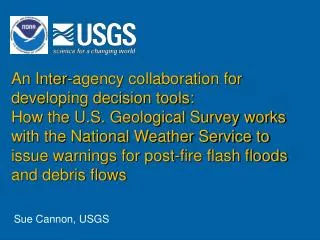
An Inter-agency collaboration for developing decision tools: How the U.S. Geological Survey works with the National Weather Service to issue warnings for post-fire flash floods and debris flows. Sue Cannon, USGS. Wildfire:. Missionary Ridge Fire, Durango CO. Cedar Fire, San Diego, CA.

E N D
An Inter-agency collaboration for developing decision tools: How the U.S. Geological Survey works with the National Weather Service to issue warnings for post-fire flash floods and debris flows Sue Cannon, USGS
Missionary Ridge Fire, Durango CO Cedar Fire, San Diego, CA Wildfire: potentially disastrous consequences It’s not over once the smoke clears………..
Wildfire effects on watersheds: • Consumption of rainfall-intercepting canopy and of soil-mantling litter and duff • Intensive drying of the soil • Generation of wood ash and water-repellent soils • Removal of obstructions to flow Results in dramatic changes in erodibility, infiltration, and runoff
Southern California Wildfires: Oct 21, 2003 >700,000 acres Simi, Piru, Verdale Grand Prix, Old Paradise, Cedar NASA Image
Old Fire Greenwood Cyn, Southern CA 12/25/03 Debris flows:
Old Fire Waterman Cyn Southern CA 12/25/03 Debris Flow: Hazards to Life and Property Camp St Sophia, Dec 25, 2003 Cable Canyon, Dec 25, 2003
Report of the Joint NOAA-USGS Debris Flow Warning System Task Force
Landslide overview map, conterminous U.S. Task Force Assignment: • Establish a prototype flash flood and debris flow warning system for burned areas in Southern California • Identify • scientific opportunities, • necessary advancements, and • costs San Bernardino Mountains, Dec. 2003 • Expand system to • other burned areas, • unburned areas, and • to a national scope
Prototype Warning System: • Save lives and protect property • Provide timely information to emergency response personnel and the public • Demonstrate merging of NOAA and USGS state-of-the-art forecast and prediction tools Missionary Ridge Fire, Durango CO Wind profiling radar
danger safety Threshold rainfall conditions for flash flood and debris flow from recently burned basins in the San Bernardino Mountains Prototype Warning System: Links NWS and USGS expertise and NWS 24x7 operational capabilities Southern California radar coverage (blue regions), and real-time rain gage locations (red dots).
Rainfallthresholds Santa Lucia Range, Sierra Madre, and Santa Ynez, Topatopa, Santa Susana and Santa Monica Mtns San Gabriel, San Bernardino and San Jacinto Mtns Peninsular Ranges
1-2 years of recovery Fresh Fires Rainfallthresholds
Flash Flood Monitoring and Prediction (FFMP) • Continuous monitoring of rainfall rates and accumulations in comparison to threshold conditions for individual stream basins • Automatically alerts forecasters when a dangerous flash flood or debris flow situation may be developing Map of Storm Precipitation Basin conditions relative to rainfall thresholds
Immediately post-fire Here comes a storm USGS develops Outlook that specifies areas that could be impacted NWS precipitation observations and forecasts USGS rainfall thresholds for burned areas in So Cal NWS compares forecasts and precip measurements with rainfall thresholds, and makes decision for Watch or Warning Outlooks, Watches and Warnings issued through NWS channels to County OES, Public Works Depts and Flood Control Districts, and to the Public, and posted on the USGS NHSS web site Prototype System Operation: Wildfire in southern CA steeplands
Palmdale Tovey Tovey Fire Pioneer Paradise Yorba Linda Soboba Outlooks:Natural Hazards Support System web site: Southern CA Fire Perimeters: August 25, 2005 The watersheds burned this summer by the Tovey Fire in Los Angeles County near the town of Palmdale are particularly susceptible to flash floods and debris flows during rainstorms….. http://nhss.cr.usgs.gov/
Watches: • Risk of hazardous weather or hydrologic event has increased significantly, but its occurrence, location, and/or timing are still uncertain • 3 days to a few hours lead time
Warnings: • Issued when hazardous weather or hydrologic event is occurring, is imminent, or has a very high probability of occurring • - 1 day to 30 minute lead times
Floods and debris flows down County Club Drive and in Wildwood Canyon at 2:00 and 3:00 pm 2:00 pm event: 0.28 inches of rain in 29 minutes 3:00 pm event: 0.19 inches of rain in 7 minutes A test of the System: October 19, 2005 Harvard Fire: Burbank
Immediate System Expansion • Refine existing rainfall thresholds and develop new ones Santa Lucia Range, Sierra Madre, and Santa Ynez, Topatopa, Santa Susana and Santa Monica Mtns San Gabriel, San Bernardino and San Jacinto Mtns Peninsular Ranges
Burned area Burned area 1.2 inches of rainfall in 60 minutes 1.5 inches of rainfall in 1.5 hour Potential System Expansion • Provide spatially specific information as storms develop Burned area 0.6 inches of rainfall in 30 minutes 0-25% 26-50% 51-75% 76-100% Probability of debris flow from drainages burned by the Missionary Ridge Fire near Durango, Colorado
Probability of debris flow occurrence ex = 1 + ex x = -7.6 + 0.6 (Ab)- 1.1(R) + 0.1(C) – 1.4(O) + 1.1(I) Ab =% of basin burned at high and moderate severities R = Basin ruggedness (Melton’s number = ΔH/A-0.5) C = % clay in soil O = % organic matter (by wt) in soil I = Average storm rainfall intensity Model A: Example:
Model Implementation 1. Delineate basins of interest
Burn Severity- High and moderate Model Implementation 2. Extract data necessary for model input for each basin
Model Implementation 2. Extract data necessary for model input for each basin Ruggedness Burn Severity
Model Implementation 2. Extract data necessary for model input for each basin %Organics and Clay Ruggedness Burn Severity
Model Implementation 2. Extract data necessary for model input for each basin Storm Rainfall Soil O and C Ruggedness Burn Severity 3. Calculate Probability for each basin, and parse into classes
Probability of debris-flow occurrence – Missionary Ridge Fire, Colorado Probability of Debris- Flow Occurrence 1-25% 25-50% 50-75% 75-100% Burn Perimeter In response to 0.5 inches of rainfall 30 minutes
Repeat Ground-Based LiDAR surveys Real-time stream gage network with video cameras SMART-R radar Intensive Research Area: Harvard Fire
Potential Future Development • Expansion to unburned areas throughout the US Seattle, WA