Download
1 / 26
260 likes | 471 Vues
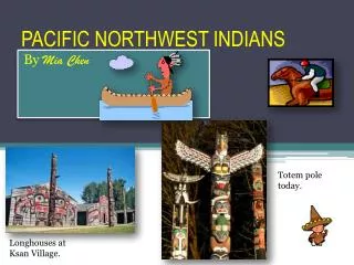
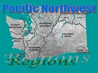
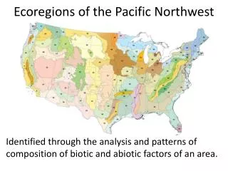
Ecoregions of the Pacific Northwest. Identified through the analysis and patterns of composition of biotic and abiotic factors of an area. Sketch this map of the PNW:. Add these lines to your drawing:. #1 Coast Range Highest Peak, 4000 feet Mary’s Peak Average Height 1,500 feet

E N D
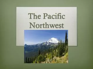
Ecoregions of the Pacific Northwest Identified through the analysis and patterns of composition of biotic and abiotic factors of an area.
#1 Coast Range • Highest Peak, 4000 feet Mary’s Peak • Average Height 1,500 feet • Highly productive coniferous forest • Sitka Spruce (historically dominated), Coastal Redwood • Most common trees are the big three: Western Redcedar, Western Hemlock, Douglas-Fir (planted) 1
2 • #2 Puget Lowlands • Seattle - Puget Sound Estuary • Formed from a glacial trough • Glaciation occurred as recently as 15,000 years ago • Ice sheet up to 3,000 feet thick near Seattle
#3 Willamette Valley • Rolling prairies • Mixed forests: coniferous and broadleaves • Oregon White Oak • Great topsoil as a result of historic ice-age floods • Temperate • Highly productive soils, Fluvial Terraces, Floodplains 3
#4 Cascades • Volcanic • Average height: 5,000 feet • Highest Peak: Mt. Rainier 14,411 feet • Rivers flow west • Coniferous • Steep ridges due to glaciers 4
5 • #5 Eastern Cascades Slope • Rainshadow (leeward) • Open Forest • Ponderosa, Lodgepole, Aspen
#6 Columbia Plateau • Wheat land • Arid Grassland • Result of volcanism 6
#7 Blue Mountains • Wallowa Mountains • Not as high as the Rockies of Cascades • Average height: 4,000 feet • Volcanic in origin • Cattle grazing • Sagebrush, Pine, Aspen 7
#8 North Basin and Range • Steens Mountains –Uplift • Cattle and sheep grazing • Arid • Sagebrush 8
9 • #9 Snake River Plain • Agricultural Land • River used for irrigation • Sagebrush in areas not irrigated
10 • #10 Rocky Mountains • 14,400 highest peak • Average height: 7,000 • Uplift • Span from Canada to Mexico
11 • #11 Klamath Mountains • Uplift • Siskiyou Mountains • Runs into California