
Understanding Supertyphoon Haitang's Track Deflection Prior to Landfall in Taiwan
This numerical study explores the factors influencing Supertyphoon Haitang's track deflection before its landfall in Taiwan in 2005. The research investigates the role of dynamical processes, Taiwan's terrain, and the vortex structure's impact on the storm's path. Using high-resolution simulations, the study sheds light on how Taiwan's landscape influences tropical cyclone trajectories.

Understanding Supertyphoon Haitang's Track Deflection Prior to Landfall in Taiwan
E N D
Presentation Transcript
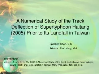
A Numerical Study of the Track Deflection of Supertyphoon Haitang (2005) Prior to Its Landfall in Taiwan REFERENCE: Jian, G.-J., and C.-C. Wu, 2008: A Numerical Study of the Track Deflection of Supertyphoon Haitang (2005) prior to its landfall in Taiwan. Mon. Wea. Rev., 136, 598-615. Speaker: Chen, D-S Advisor : Prof. Yang, M-J
Outline • Introduction • Brief overview • Model setup and experiment design • Numerical results • Discussion and conclusions
Introduction • The prior from1958 to 2005,161 Typhoons, 86 of them making landfall in Taiwan. • 70% of total land area consists of mountain • In 2005 ,3 supertyphoon landfall in Taiwan, supertyphoon Haitang have the track deflection.
Introduction (cont.) The three question: 1)What dynamical processes are responsible for Haitang’s track deflection before landfall in Taiwan? 2)What is the role played by Taiwan’s terrain? 3)What is the impact of the vortex structure ,that is, with different values of structure parameter in the initial vortex?
Brief Overview TD 230 N TS 17 m/s 00Z 12 July 2005 TS 33 m/s 18Z 13 July 2005 Guam NNE 900 Km ST 51 m/s 06Z 16 July 2005 # Max. intensity Wind speed 55 m/s 15Z 16 July MSLP 912 h Pa # Landfall About 30 km north of Hua-Lien at 0650 UTC 18 July radar
Brief Overview (cont.) • Caused 12 deaths and the property damage of at least $150 million • Moving across the CMR , further weakened to a tropical storm at 06Z 19 July • Finally , second landfall over the Fulian and then became a TD at 12Z 20 July • Radar Wu-Fen-Shan (WSR-88D) Hua-Lien (METEOR 1000S) 18Z 17 July ~ 05Z 18 July
Experiment Design • The NCAR–AFWA bogusing scheme (Davis and Low-Nam 2001) to implant an initial Rankine vortex into the operational CWB NFS analysis. The Rankine vortex is
Numerical Results CTRL CTRL NT NT
Numerical Results dBz 17/18Z ~ 18/05Z CTRL 27h ~ 42h
Numerical Results Max. Wind Speed (m/s) 28h 29h 30h 31h 32h 33h W 45.8 47.9 50.7 52.2 53.9 55.3 E 51.3 54.1 55.2 51.7 50.3 50.4 W-E -5.5 -6.3 -4.50.5 2.6 4.9
Numerical Results 33h 3.3 m/s Average asymmetric flow Storm motion vector
N R=100km W E Max. tangential wind inside the radius S Numerical Results The higher Vmax before about 31h is on the northeastern , between 31 and 35 h, the max. shifts to the western side of the storm.
Numerical Results The advection wind vectors ( red arrow) of H70 and H40 experiment are also pointing to the southwest. 2.5 m/s 2.4 m/s The storm motion vector (yellow arrow) parallel with 700 hPa. The region of stronger wind in H10 and FLAT simula-tions generally appears in the NNE. 1.5 m/s 2.3 m/s Moving westward with translation speed of 1.5 m/s and 2.3 m/s, which agree well with the adv-ection wind vectors
A35 A47 CTRL MMTW (m/s) 52.3 47.4 42.1 MSLP (hPa) 941 952 960 RMWs (km) 70 65 60 MMTW : max. mean tangential wind MSLP : mean sea level pressure RMW : the radius of max. wind Numerical Results
Discussion and Conclusions • All experiments are performed with highest horizontal resolution of 4 km using the WRF-ARW modeling system, v. 2.0.3, all the 72-h model simulations begin at 00Z 17 July 2005. • Sensitivity experiments of the Taiwan terrain, for experiments with the terrain height decreased to 70% or 40% of that in CTRL, the simulated storm still exhibits a looping path before landfall. • The Taiwan terrain plays a significant role in the track deflection. When Haitang was about 60km east of Taiwan, the low-level flow on the western side of storm center accelerated because the air parcels originate from a relatively wider area.
Discussion and Conclusions (cont.) • The high terrain in Taiwan plays a critical role in inducing the strong low-level northerly jet to the west of the center of Haitang, and thus a southward advection flow that leads to the southward drift. • The storm in A35 is larger, more intense , and more rapidly moving vortex and therefore would be more likely to move across the Taiwan terrain with less track deflection. • Although a low-level northerly jet is also predicted in the western portion of the A35 storm, the strongest winds associated with the storm are on the eastern side of the storm.