Download
1 / 42
420 likes | 428 Vues
This report assesses the current state of hurricane intensity and structure forecasting and provides recommendations for research and development activities to improve forecasting accuracy. The report highlights the need for improved understanding of the processes determining hurricane intensity and structure and the timely transfer of that understanding to operations. The report includes both a majority and a minority report, as well as public comments on the preliminary report.

E N D
Near-Final ReportNOAA Science Advisory BoardHurricane Intensity Research Working Group John T. Snow University of Oklahoma Tuesday, 25 July 2006
Outline • Motivation • Charge • Working Group Membership • Process • Public Comments on Preliminary Report • Hurricane Intensity and Structure • Near-Final Report • Majority Report • Minority Report • Closing Comments • Recommended SAB Actions
Motivation Key forecast item is hurricane “landfall”; includes both point of landfallandimpact on natural and built environment • Continual improvement over last two decades in skill of forecasting hurricane track major success • Simultaneously, only modest improvement in skill of forecasting intensity and structure– why? • Recent “surprises”: rapid changes in hurricane intensity and structure, especially just before landfall
Charge • Independently assess current “state-of-science” and R&D activities in NOAA and elsewhere with respect to hurricane intensity and structure, and then • Recommend an agenda of R&D activities that will lead to an improved understanding of the processes determining hurricane intensity and structure, and the timely transfer of that understanding to operations.
Dr. John SnowUniversity of Oklahoma Dr. Howard BaumNational Institute of Standards and Technology Dr. Shu-Hua Chen University of California, Davis Dr. Russell L. Elsberry Naval Postgraduate School Dr. Francis Edward FendellNorthrop Grumman Space Technology Dr. Greg HollandNational Center for Atmospheric Research Dr. Tiruvalam N. Krishnamurti Florida State University Dr. Michael T. MontgomeryNaval Postgraduate School Dr. Richard RotunnoNational Center for Atmospheric Research Dr. Peter WebsterGeorgia Institute of Technology Working Group Membership
Process • Meetings • Teleconferences • ftp site for presentations and reference materials • Preliminary Report to SAB – 9 March 2006 • Monterey Meeting – national and international contacts • Presentation: 60th Interdepartmental Hurricane Conference • Presentation: BASC • Public Comment – May-June • Final Report – submitted 5 July 2006 ----------- Coordination with parallel NSB study
Public Comments on Preliminary Report • HIRWG sought public comment on its initial findings and recommendations • Comments received: 11 + one additional received one week after close of comment period = 12 total • All 12 comments were examined in detail by the HIRWG • With few exceptions, the HIRWG found the comments to be insightful and helpful in preparing its Near-Final Report
Hurricane Intensity and Structure • National Hurricane Center: Intensity = peak sustained (1 min average) surface (10 m) winds anywhere in the storm • Hurricane Research Division: Structure – no standard definition = radius of maximum winds; spatial distribution of specified 10 m wind speed values; isotach fields • Occur through a set of poorly understood, complex processes involving both external environmental influences and internal vortex dynamics • Wide range of time and space scales involved
From NHC “best track”; provided by Frank Mark, 2006 Wiind Speed (knots)
Near Final Report Contains • Majority report = Executive Summary + Main body text • Minority report = Appendix 1 (self-contained) • Appendices 2 to 7 • Appendix 5: Meeting agenda = from whom the WG heard
-- Majority Report • 29 recommendations • cover a wide range of activities to improve skill in forecasting hurricane intensity and utilize that ability for societal benefits. • 10 high priority recommendations • Highlighted in executive summary and throughout the report • Assigned short or medium timeframes for accomplishment of the recommended actions
Organization of the Majority Report • Executive Summary • Introduction • Statement of the Problem – The Challenge of Forecasting Tropical Storm and Hurricane Intensity and Structure • Application of Advanced Numerical Weather Prediction Systems • Novel Methods for Data Assimilation • Improved Observations of the Hurricane and its Environment • Focused Applied Research and Development • Attaining Critical Mass • Accelerate Transfer from Research to Operations • Additional Items from Our Discovery Process
Overarching Goal (From 2. Introduction) The HIRWG is enthusiastic about possibilities for improving the forecast skill for hurricane intensity and structure, especially for major hurricanes. It accordingly recommends that NOAA adopt the following overarching goal for its research efforts in this area: To reduce the error in 48-hour intensity forecasts for hurricane-strength storms by at least 10 kt (approximately one half of a Saffir-Simpson category) within the next five years, with an emphasis on improved forecasting of rapid intensification and decay, and decay and re-intensification cycles The HIRWG recognizes that this is an ambitious goal, but considers it attainable if resources are made available and properly allocated, and the full hurricane research community – universities, private sector, and government at all levels -- is engaged.
Overarching Recommendation(From 3. Statement of the Problem – The Challenge of Forecasting Tropical Storm and Hurricane Intensity and Structure) NOAA should allocate sufficient resources and provide national leadership to enable the high-priority research-and-development activities recommended below to be undertaken at a sufficient level to ensure positive outcomes. This funding should be for a minimum of five years, and should be protected against other budgetary pressures.
Common Thread A thread connecting many of the majority’s recommendations is the development of a high-resolution, coupled atmosphere-ocean mesoscale model capable of resolving important details in the eye-wall structure • Development of such a model is central to attaining the overarching goal. • Development of models with the capabilities recommended in this report will require fundamental research on a wide range of atmospheric and oceanic topics. • This model will serve as a tool for research and demonstrating increased skill in forecasting hurricane intensity.
Monitoring Products Observations Of Hurricane Structure R&D Observing Systems Simulation Experiments Data Assimilation Hi-Res, Coupled Mesoscale Modeling Prototype Prediction Products
4. Application of Advanced Numerical Weather Prediction Systems • Findings: • Mesoscale modeling with high resolution of the vortex core and boundary layer is seen as key to improving the skill of hurricane intensity forecasts; must resolve clouds; treat explicitly wave effects governing air-sea exchanges, etc… • Numerical models must have horizontal grid spacing approaching 1 km to capture phenomena and processes in the core region that are important to accurate prediction of rapid intensification and eyewall cycles • Advancements are required in the understanding of underlying physical processes, including the atmospheric boundary layer, air-sea interface processes including sea spray, and interactive coupling between ocean and atmosphere on the spatial scales of the hurricane inner core • (Short-term) Support should be provided for development and validation of high-resolution, coupled hurricane-ocean models that incorporate appropriate atmospheric and oceanic physics representations derived from the results of recent field experiments, such as CBLAST and RAINEX • (Medium-term) NOAA should reprioritize existing or acquire the necessary computing system capability to produce approximately 1-km-resolution hurricane forecasts
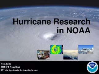
The following sequence of four slides makes a compelling case for -- high resolution modeling to critical capture essential features in the core -- coupling between atmosphere and ocean surface to properly represent exchanges of heat, moisture, and momentum (= surface drag) waves play a very important role in these exchanges
5. Novel Methods for Data Assimilation • (Medium-term) A 4D data assimilation system for hurricane forecasting should be developed as a priority. This development should explore the advantages and disadvantages of both 4DVar and Ensemble Kalman Filter approaches to assimilating the diverse range of data that are available. • (Short-term) Airborne and surface-based radars offer the best opportunity to observe mesoscale fields in the inner core region but full realization of their potential requires real time assimilation into models. A focused program aimed at assimilating radar data into HWRF is recommended, with the goal of operational testing in 2007. • Finding: • A state-of-the-science data-assimilation system is and will be a crucial element the recommended advanced numerical weather prediction system as it allows useful initial fields to be extracted from both traditional and nontraditional observations, such as radar of all type, aircraft, satellite, dropsonde, etc.
6. Improved Observations of the Hurricane and its Environment • Findings: • Combining a broad range of atmospheric and oceanic observing techniques provides the best overall observing capacity for hurricanes • There are promising technologies in-hand (Stepped Frequency Microwave Radiometer) and on the horizon (Unmanned Aerial Systems; Gulfsteam-IV radar) • The current mix of satellites, manned aircraft, buoys, radar, etc, should be maintained, upgraded, and extended to ensure comprehensive coverage • Radar, surface and airborne, offer opportunities for further development and better integration into operations, use in mesoscale model initializations • (Medium-term) The strengths and weaknesses of current and past satellite observations for hurricane forecasting should be fully evaluated using Observing System Experiments (OSEs), with direct involvement from that portion of the academic community focused on operational products, and with the aim of developing a comprehensive plan in support of current initiatives and to recommend future directions. • (Short-term) NOAA should develop a program for deploying Airborne Expendable Bathythermographs (AXBTs) to define the initial conditions for high-resolution, coupled ocean-hurricane prediction via an appropriate regional ocean data assimilation system that uses the previous model solutions as the background.
7. Focused Applied Research and Development • (Short- to medium-term) Priority should be given to enhanced support for research to advance understanding of phenomena related to predictability of rapid intensification and secondary eyewall phenomena. This should include investigations of core processes such as heat and momentum exchanges with the surface and across the eyewall and the impact of atmospheric and oceanic interactions. • Findings: • Fundamental aspects of rapid intensification and decay, re-intensification cycles, and rapid decay must be properly represented in a prediction model if forecast skill is to improve. • Many of these fundamental aspects are not well understood. These gaps in understanding drive the formulation of a research agenda.
8. Attaining Critical Mass • Findings: • NOAA presently has limited resources for in-house hurricane-related mesoscale-model development, and for interfacing with the wider research community • Excellent work is being done in the academic community and at the National Center for Atmospheric Research (NCAR) and the Naval Research Laboratory that complements the NCEP expertise, but the communication, coordination, cooperation, and collaboration between these research and operational activities could be substantially improved. • (Short- to medium-term) The hurricane modeling capability at HRD should be increased and improved, and coordinated interaction between NCEP, HRD, NCAR, and the broader community established, with the immediate goal of substantially enhanced exchanges of ideas, requirements, and support. This should be a two-way effort assigning priority to research satisfying operational needs.
9. Transfer of Research Results to Operations • (Short-term) The Development Testbed Center (DTC) needs to be fully implemented and adequately funded for the task of testing new research models that have demonstrated potential for skillful hurricane intensity forecasts. This must include the capacity to test and transfer multi-faceted model applications to operational hurricane forecasting. • Findings: • Research is required that identifies observationally accessible, reliable precursors of rapid intensification/weakening and eyewall-replacement cycling • The Joint Hurricane Testbed, though underfunded, is an excellent vehicle for interfacing between NOAA and university research • The Developmental Testbed Center at the National Center for Atmospheric Research has capabilities for model development, evaluation, and comparison suitable for the type of model recommended here; it also has good connections to the wider university community
-- Minority Report • “The majority report does contain many useful suggestions with which we substantially agree …” • “… we are trying to be objective outsiders offering a constructive critique of NOAA’s tropical-cyclone research” • “… we regard the position advocated in the majority report as supporting continuation and expansion of approaches and programs that have yielded little progress in operational intensity forecasts over a period spanning more than a decade” • “… this minority report does present NOAA with a wider range of options from which to choose in formulating a pathway to practical upgraded operational tropical-cyclone-intensity-forecasting aids” Minority report is out for public comment. Baum and Fendell will review comments received and respond as appropriate. Likely mid-August to finalize minority report and then final report
HIRWG Minority Report Howard Baum & Frank Fendell June 27, 2006
Motivation for, and Objectives of, a HIRWG Minority Report • By convening an HIRWG, NOAA acknowledges that the current focus on detailed numerical simulation has been unproductive • Reconciling such simulation to NOAA’s computing power results in inadequate spatial resolution of the crucial vortex core and boundary layer • Even more inclusive formulation would exacerbate the dilemma • Our calls for exploration of diverse alternatives were lost in the web-posted majority-report draft • From our perspective as nonmeteorologists, prediction of the basic parameters in a NOAA intensity forecast should be achievable via a simplified, less numerics-focused approach • We look to contributions from mathematical analysis, lab-scale experiments, and unmanned aeronautical vehicles (UAVs) • Advantages of ensemble forecasting and rapid research-to-operations transition should become accessible with this approach
Meeting NOAA’s Intensity-Forecasting Responsibilities: Recommendations • Modeling and Prediction: Targeted Research • NOAA should continue to focus resources allocated for hurricane research tightly on hurricane-like systems, especially high-speed vortices near landfall • High-resolution general-purpose numerical models should be replaced by simpler numerical and analytical models specialized for prediction of hurricane dynamics • NOAA should tentatively proceed with hurricane-intensity-forecast models not incorporating sea/air coupling, or use simple models to represent the coupling, especially since key sea/air-transfer formulae will remain largely empirical • NOAA ought to estimate in real time the “secondary effects” of a landfalling tropical cyclone, by adopting a model for each effect that is accurate and simplistic, and by using a compact representation of the low-level flow wind field and pressure field of the landfalling vortex.
Meeting NOAA’s Intensity-Forecasting Responsibilities: Recommendations (cont.) • Observational and Data Collection • UAVs transferred from the DoD have high promise for sustained remote sensing of hurricanes • NOAA should form an internal study group for the deployment of high-performance UASs, with a view to achieving operational status within 3-5 years • These novel operational platforms may be anticipated to yield insight into the highest-priority challenges for operational forecasting of intensity: (1) rapid large-magnitude intensification/weakening; and 2) eyewall-replacement cycling • Laboratory Experiments • NOAA should adopt a general policy of requiring the integration of laboratory-scale experimentation with every “field”-experiment initiative • NOAA should support extension of wind/wave-tank experiments to sea-to-air heat and moisture transfer at tropical-cyclone (TC) wind speeds • NOAA should convene a study group re a circular wind-driven wave tank of order 20-m diameter, to create a swirling-flow boundary layer over a warm-water pool (a laboratory simulation of the very-low-level flow in a hurricane)
Meeting NOAA’s Intensity-Forecasting Responsibilities: Recommendations (cont.) • Organizational Issues • A National Hurricane Research Laboratory (NHRL) should be established (more accurately, restored) at a single location in Miami, with responsibility for all hurricane-related research • Hurricane research encompasses analysis, numerical modeling, instrumentation, and large-scale experiments: NOAA organizational units currently located elsewhere that fit into NHRL should be relocated • The NHRL should be located as close to the operational hurricane forecast group (NHC) as possible • NHRL should be endowed with resources to hire a professional staff capable of supporting its activities, as well as host academic researchers and long-stay visitors from other NOAA laboratories on a regular basis • In recruiting the staff for NHRL, NOAA is advised to contact applied physicists, mechanical engineers, and others from the broader fluid-dynamics community in addition to traditional personnel sources
Closing Comments • Both majority and minority reports agree: recent research indicates that with carefully targeted investments in new R&D ventures involving whole hurricane research community and strengthening its internal R&D capabilities, NOAA can significantly improve the skill of hurricane intensity forecasts in 5 years • Comments on preliminary report should be considered carefully; insightful on views held by NOAA staff
Recommended SAB Actions • Receive the report: • Majority report accept as final • Majority report accept as final, subject to there being only non-substantive changes resulting from the public comments; should public comments result in substantive changes, then a revised minority report should be presented at the Fall SAB meeting • The Board can leave it to the discretion of the Chair of the SAB and the Chair of the HIRWG to decide if the changes are substantial or not • Transmit the report to NOAA ASAP to influence FY09 and subsequent budget year planning
Overarching Goal To reduce the error in 48-hour intensity forecasts for hurricane-strength storms by at least 10 kt (approximately one half of a Saffir-Simpson category) within the next five years, with an emphasis on improved forecasting of rapid intensification and decay, and decay and re-intensification cycles