Download
1 / 48
480 likes | 561 Vues
Explore the worldwide utility of GPS, its policies, constellation status, international cooperation, and modernization. Learn about sales, performance, and future developments.

E N D
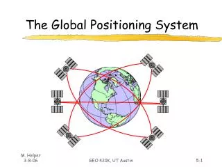
The Global Positioning SystemA Worldwide Information Utility NAVSAT 2002Nice, FranceNovember 12, 2002 Jason Y. KimExecutive SecretariatInteragency GPS Executive Board
Overview • United States Policy • Constellation Status & Performance • Modernization • Augmentations • International Cooperation
Interagency GPS Executive Board Defense Transportation State Commerce Agriculture Interior NASA Joint Chiefs of Staff Justice
United States GPS Policy • Consistent U.S. national policy statements from Executive and Legislative Branches • Congressional guidance, 1983 • Presidential Decision Directive, March 1996 • U.S. Public Law, December 1998 • Civil GPS signals to be provided free of direct user charges (since 1983) • U.S. to promote acceptance and use of GPS as a world standard • Selective Availability (SA) -- ended May 2000 • IGEB to manage GPS as a national asset
United States GPS Policy, cont’d. • Encourage private sector investment in/use of GPS technologies and services • Promote safety and efficiency in transportation and other fields • Promote international cooperation in using GPS for peaceful purposes • Advance scientific and technical capabilities • Strengthen and maintain national security
U.S. Policy Promotes Global Market Growth • Free signals from space (current and future) • Openly published documentation enabling anyone to build user equipment • No licensing fees/royalties • Available on an equal basis to users and industry worldwide • Promotion of common standards leads to economies of scale in receiver production -- lower costs for producers and consumers • SA termination fueled consumer demand by dramatically improving basic service • IGEB management increases user trust in GPS as a dual-use system
Worldwide GPS Hardware Sales Expected to Exceed $9B in 2002 (Projected) $Billions Source: DOC, 2001
Commercial Applications Dominate the GPS Market Global Sales, 2000 Source: DOC, 1998
New Commercial Applications Are Developed Every Day • Open pit mining • Child safety • Automatic snowplow guidance • Spacecraft control • Power grid management
GPS Sales by Geographic Region 1998 Japan U.S. 47% 32% 2003 U.S. Japan Europe 30% 44% Asia 18% Other 2% 1% Europe Other Asia 23% 1% 2% Source: DOC, 1998
Overview • United States Policy • Constellation Status & Performance • Modernization • Augmentations • International Cooperation
GPS Constellation Status 27 Operating Satellites (to ensure 24) • 21 Block II/IIA satellites operational • 6 Block IIR satellites operational • 14 of 21 Block IIR satellites available • Modernizing up to 8 Block IIR satellites • Last launch: 31 Jan 01 • Next Launch: On hold • Launch vehicle issues • Continuously assessing constellation health to determine launch need
Satellite Age & Health • Age Summary • 7 satellites past updated mean mission duration • Health Summary • 13 satellites one component away from navigation mission failure • 9 satellites one component away from bus failure Despite age and component issues, all satellites are providing a healthy nav signal
Constellation Performance All Errors Based on Dual Frequency, Signal in Space Only. Information Presented Reflects Data Collected During the Period from January 1, 2002 to September 11, 2002. Thresholds Provided Reflect Average Location Requirements from SPS Signal Specification Dated August 24, 2001. • PDOP Availability: • Requirement - PDOP of 6 or Less, 98% of the Time or Better • Actual - 99.99 • Horizontal Service Availability • Requirement - 95% Threshold of 36 meters, 99% of the Time or Better • Actual – 3.53 meters • Vertical Service Availability • Requirement - 95% Threshold of 77 meters, 99% of the Time or Better • Actual – 5.01 meters • User Range Error • Requirement - 6 meters or Less, Constellation Average • Actual - 1.43 meters Constellation exceeds all performance requirements
Overview • United States Policy • Constellation Status & Performance • Modernization • Augmentations • International Cooperation
GPS Modernization at a Glance Increasing System Capabilities Increasing Civil/Defense Benefit NAVWAR Capable Full Civil Rqmts Add’l Capabilities New Civil Signal – L5 L2C on L2 M-Code (Earth) SA Set to 0 Basic GPS GPS III • GPS-III: • Improved Anti-jam (+20dB) • Increased Accuracy • Assured Availability • Controlled Integrity • System Survivability • Other Transformational needs • Blue Force Tracking • Nav-related Messaging • Responsive Ops GPS IIA/IIR GPS IIR-M, IIF • Standard Service (~100 m) • Precise Service (~16 m) • Two Nav frequencies • L1: Civil (C/A) &Precise (P) Code • L2: P-Code • IIR-M: Improved on all IIA capabilities and added • 2nd Civil Signal on L2 • New L1 & L2 M-Code • IIF: IIR-M capability and: • Add 3rd Civil Signal on L5
Civil GPS Modernization • Ending SA considered first step • Civilians currently limited to GPS L1 signal • Coarse Acquisition (C/A) code at 1575.42 MHz • Low power signal, not intended for precision nav • Adding a second civil signal (L2C) • C/A-type code at 1227.60 MHz • Low power signal, not intended for precision nav • Adding a third civil signal (L5) • P-type codes at 1176.45 MHz • Higher power signal, intended for precision nav
Civil Benefits of GPS Modernization • More robust GPS service • Reduces vulnerability to unintentional interference • Unlikely to simultaneously affect L1, L2 and L5 • Worldwide dual frequency for en-route navigation and precision approach • Dual frequency (L1, L5) allows ionospheric corrections in avionics onboard the aircraft • Fewer reference stations may be needed for space-based augmentation systems (e.g. WAAS) • Centimeter-level accuracy for scientific & survey applications
C/A P(Y) P(Y) M M L2C C/A P(Y) P(Y) M M L2C C/A P(Y) P(Y) Modernized Signal Evolution Present Signal Block II/IIA/IIR 2nd Civil; M-Code Block IIR-M 3rd Civil Block IIF 1176 MHz (L5) 1227 MHz (L2) 1575 MHz (L1)
Second Civil Signal (L2C) • More robust civil service • Civil users currently only have codeless/semi-codeless access to P(Y) on L2 • Redundant signal for improved continuity when L1 is lost • Increased accuracy • Coded dual-frequency ionospheric corrections at the receiver • Wide-lane for extremely-precise local area differential GPS • Advanced signal structure • Working group defined signal characteristics • Better cross-correlation properties than C/A • Data-free component for robust tracking • Designated as primary L2 civil code versus C/A Begin Launch in 2004 (Block IIR-M) Full Capability Projected in 2012
Third Civil Signal (L5) • Further robustness and accuracy • Improved continuity when L1 or L2 signal is lost • Triple-frequency ionosphere correction • Tri-lane for ultra-precise local area differential GPS • Advanced signal structure • Higher power (~6 dB) for interference resistance • Broadcast over the full registered 24 MHz band • L5 specification developed by RTCA SC 159, WG #1 • GPS JPO originated/coordinated ICD-GPS-705 • Protected aeronautical radionavigation spectrum • Enables dual-frequency uses for safety-of-life navigation • DME compatibility achieved by frequency reallocation, if required Begin Launch in 2005 (Block IIF) Full Capability Projected in 2015
FIX FOM 1 N 42* 01” 46.12” W 091* 38’ 54.36” EL + 00862 ft 3 menu 1 ON 2 4 5 6 7 WPT 8 POS 9 NAV CLR MARK 0 OFF NUM LOCK ZEROIZE Rockwell GPS III Second Civil Signal Third Civil Signal • Relook at entire GPS architecture to: • Achieve long term GPS performance goals • Reduce long term total ownership costs • Ensure GPS is synergized with • Military and civil needs/systems • Possible augmentation opportunities • Build best GPS system for the next 30 years
GPS III Civil Goals • Significant increase in system accuracy • Assured and improved level of standalone integrity • Improved availability of accuracy with integrity • Backward compatibility with existing receivers • IOC for L5 (in combination with IIF satellites) • Smooth transition from GPS Block II to Block III • Flexibility to respond to evolving requirements with limited programmatic impacts
GPS III Proposed AccuracyDraft System Specification • Includes the effects of receivers • Threshold = low-cost/low-performance receiver • Objective = high-cost/high-performance receiver Accuracy (95%) Threshold Objective Horizontal 2.5 m 0.5 m Vertical 4.5 m 1.1 m 5.7 nsec 1.3 nsec Timing
A c t i v i t y I m p l e m e n t a t i o n D a t e S A s e t t o z e r o M a y 2 0 0 0 G P S I I R - M E n h a n c e m e n t s ( U p t o 8 2 0 0 4 – 2 0 0 6 s a t e l l i t e s ) á N e w L 2 C i v i l ( L 2 C ) S i g n a l á M - c o d e o n L 1 & L 2 G P S I I F E n h a n c e m e n t s ( U p t o 1 2 2 0 0 5 – 2 0 1 1 s a t e l l i t e s ) á N e w L 2 C i v i l ( L 2 C ) S i g n a l á M - c o d e o n L 1 & L 2 á L 5 G P S I I I E n h a n c e m e n t s 2 0 1 1 – T B D á N e w L 2 C i v i l ( L 2 C ) S i g n a l á M - c o d e o n L 1 & L 2 á L 5 á F u t u r e C a p a b i l i t i e s O C S E n h a n c e m e n t s 2 0 0 0 – 2 0 0 8 GPS Modernization Schedule
Overview • United States Policy • Constellation Status & Performance • Modernization • Augmentations • International Cooperation
Aviation Augmentations • Wide Area Augmentation System (WAAS) • Enroute thru near precision approach • Signal in space currently available • Use at your own risk until certified (2003) • Commissioning for aviation use by late 2003 • 60-day stability test successfully concluded Sept. 16, 2002 • FAA finalizing contract for third GEO • Allows reduction in ground-based nav aids • Local Area Augmentation System (LAAS) • Terminal through CAT III Precision Approach • Research and development program • CAT I contract award imminent
Nationwide Differential GPS Service • U.S. Coast Guard Differential GPS (DGPS) network provides <10 m accuracy plus integrity for mariners • 40 nations now implementing maritime DGPS based on same standards for seamless navigation • U.S. is expanding its network to cover terrestrial areas from coast to coast (NDGPS) • Positive Train Control for railroads • Intelligent Transportation Systems for highway use • 23 stations currently operating • Full operational capability by end of 2007 • High-Accuracy NDGPS project studying feasibility of creating nationwide RTK service
National Continuously Operating Reference System (CORS) • Nationwide network of GPS reference stations coordinated by U.S. National Geodetic Survey • Data enables surveyors, scientists to achieve up to sub-centimeter level GPS accuracies using post-processing techniques • Network gains efficiencies by utilizing many existing facilities at federal and local levels
Overview • United States Policy • Constellation Status & Performance • Modernization • Augmentations • International Cooperation
U.S. Principles for Cooperation • Compatibility and interoperability with GPS • No direct user fees for safety critical services • Open market access (non-discrimination) • Equal access to signal specifications • Equal access to user markets (free trade) • Market driven competition • Free choice for end users • Spectrum protection • Protection of national security interests • No M-code overlay
Compatibility and Interoperability • Compatibility (e.g.) -- the assurance that one GNSS will “do no harm” to another GNSS by degrading the standalone services that it provides • Includes forward, backward, and dual-service compatibility • Interoperability (e.g.) -- the ability to improve the level of service provided to users by any single system through the use of a combined system receiver • The U.S. Government considers the assurance of compatibility as the primary requirement for the GPS user community Existing and future GPS users must be protected from harmful service degradation
Dual-Service Compatibility • U.S. Policy and Public Law require: • Protection of Allied military use of GPS • Prevention of hostile use • Preservation of civil use outside an area of conflict • NAVWAR concept enables localized denial of service rather than global degradation of GPS • New military (M-code) signals are being developed to be spectrally separated from civil signals • Without spectral separation, security is weakened and greater degradation of civil service is likely Overlay of M-code signals is not dual-service compatible and is unacceptable to the U.S.
System Standards AreKey to Interoperability • Receiver complexity and cost depend on standards chosen • Geodesy • Timing • Signal structures • At L1, C/A code limits number of satellites, power, signal structure • At L2 & L5, there is greater potential for interoperability via use of same frequencies, signal structures, and common data structures
Interoperability Continuum of Compatibility and Interoperability in Timing, Geodesy, and Signal Structure Complete commonality of civil frequencies and signal structures Identical System Time Some frequency overlap with common signal structure(s) Same Geodetic Reference System -- merged ground segments Equivalent System Times Some frequency overlap with different signal structure(s) Same Geodetic Reference System -- unconnected ground segments Signal-based time offset Correction Complete separation of all signals Separate Geodetic Reference System - broadcast corrections to users Higher level of required technical & operational coordination to ensure compatibility Receiver-based Time Offset Correction Greater Burden on Receiver Design Separate Geodetic Reference Systems - no broadcast corrections Compatibility
U.S.-Japan Cooperation • September 1998: Joint Statement signed promoting GPS as a standard for satellite navigation and establishing a framework for cooperation • October 2002: Cooperation initiated between GPS and Quasi-Zenith Satellite System (QZSS) • QZSS is a regional constellation designed to complement and augment GPS, providing improved coverage and availability in urban canyons/mountainous areas • Highly interoperable -- same frequencies (L1, L2, L5) and same/similar codes • Working-level meeting scheduled for December 2002 to discuss technical details, including compatibility at L1
U.S.-Europe Cooperation • U.S. and E.C. have been working towards a mutually acceptable framework agreement on cooperation • Major issues under discussion • Security • Compatibility/interoperability • Trade & non-discrimination • June 2002: Last U.S.-E.C. meeting, Brussels • Led to a subsequent Technical Working Group (TWG) meeting on compatibility/interoperability of civil aspects of GPS and Galileo • No progress made on M-code overlay issue
GPS-Galileo: U.S. Objectives • Protect interests and investments of GPS user base • No degradation of GPS service • No user fees • Freedom of choice for end users • Lower costs through free market competition • Interoperability and backwards compatibility • Protect national security interests • DoD/NATO denial capabilities • No overlay of M-Code • Control technology transfer and proliferation • Move any discussion of military Galileo to NATO • Ensure level playing field for commerce • Maximize benefits of combined GPS-Galileo service
U.S. Opposes M-Code Overlay • Clearly stated in U.S. agreement text of October 2000 • Reiterated in December 2001 letter from Pentagon • September 2002 E.C. Communication: M-code overlay remains part of the Galileo PRS plan • Occupying M-code band will not accomplish the goals of PRS and could harm both civilian and military users • U.S. is willing to discuss the issue with military officials through NATO channels • However... The U.S. considers this matter to be non-negotiable
GPS-Galileo Compatibility and Interoperability • Two independent systems • Compatibility is essential and achievable with appropriate design and policy choices for Galileo • Interoperability is less certain • Different signal structures • Different system times • Different coordinate reference systems • Goal is to provide the greatest possible benefit to the largest number of users • Simple, inexpensive receivers • Increased service availability (greater number of satellites in view) • Greater reliability
GPS-Galileo Technical Working Group Meeting • Hosted by NASA Goddard Space Flight Center, October 21-23, 2002 • Technical compatibility/interoperability of civil GPS and Galileo services discussed • U.S. and E.C./ESA interference analyses and criteria for determining signal non-interference • Galileo L1 & L5/E5 signal structures and code selection • GPS third civil signal (L5) design and code selection • Timing and geodesy interoperability issues • Follow-up sub-teams were identified for specific issue areas such as L5/E5 code structures and signal interference analyses Dual-service compatibility was not discussed
Trade & Non-Discrimination • Free/equal access to Galileo signals, specifications • No discriminatory pricing for non-European users • No discriminatory licensing arrangements for non-European equipment manufacturers • Open access to European satellite navigation market • Market-driven competition to spur innovation, lower prices • No tariffs or other discriminatory barriers to trade • Need to go beyond WTO, which has only limited applicability • Freedom of choice • Users choose the technology solution that best meets their needs -- GPS, Galileo, GLONASS, some combination of these, or GNSS plus other technologies • Manufacturers produce what makes the most business sense • U.S. does not wish to see Europe impose new standards or regulations that effectively mandate the use of Galileo
For Additional Information www.igeb.gov Interagency GPS Executive Board4800B Herbert C. Hoover BuildingWashington, D.C. 20230ExecSec@igeb.gov+1 (202) 482-5809