8.4 Earth’s Layered Structure
790 likes | 1.05k Vues
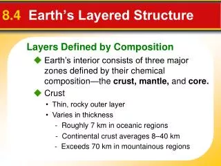
Layers Defined by Composition. 8.4 Earth’s Layered Structure. Earth’s interior consists of three major zones defined by their chemical composition—the crust, mantle, and core. Crust. • Thin, rocky outer layer. • Varies in thickness. - Roughly 7 km in oceanic regions.

8.4 Earth’s Layered Structure
E N D
Presentation Transcript
Layers Defined by Composition 8.4 Earth’s Layered Structure Earth’s interior consists of three major zones defined by their chemical composition—the crust, mantle, and core. Crust • Thin, rocky outer layer • Varies in thickness - Roughly 7 km in oceanic regions - Continental crust averages 8–40 km - Exceeds 70 km in mountainous regions
Layers Defined by Composition 8.4 Earth’s Layered Structure Crust • Continental crust - Upper crust composed of granitic rocks - Lower crust is more akin to basalt - Average density is about 2.7 g/cm3 - Up to 4 billion years old
Layers Defined by Composition 8.4 Earth’s Layered Structure Crust • Oceanic crust - Basaltic composition - Density about 3.0 g/cm3 - Younger (180 million years or less) than the continental crust
Layers Defined by Composition 8.4 Earth’s Layered Structure Mantle • Below crust to a depth of 2900 kilometers • Composition of the uppermost mantle is the igneous rock peridotite (changes at greater depths).
Layers Defined by Composition 8.4 Earth’s Layered Structure Core • Below mantle • Sphere with a radius of 3486 kilometers • Composed of an iron-nickel alloy • Average density of nearly 11 g/cm3
Layers Defined by Physical Properties 8.4 Earth’s Layered Structure Lithosphere • Crust and uppermost mantle (about 100 km thick) • Cool, rigid, solid Asthenosphere • Beneath the lithosphere • Upper mantle • To a depth of about 660 kilometers • Soft, weak layer that is easily deformed
Layers Defined by Physical Properties 8.4 Earth’s Layered Structure Lower Mantle • 660–2900 km • More rigid layer • Rocks are very hot and capable of gradual flow.
Layers Defined by Physical Properties 8.4 Earth’s Layered Structure Inner Core • Sphere with a radius of 1216 km • Behaves like a solid Outer Core • Liquid layer • 2270 km thick • Convective flow of metallic iron within generates Earth’s magnetic field
Discovering Earth’s Layers ´ ˇ Moho 8.4 Earth’s Layered Structure • Velocity of seismic waves increases abruptly below 50 km of depth • Separates crust from underlying mantle Shadow Zone • Absence of P waves from about 105 degrees to 140 degrees around the globe from an earthquake • Can be explained if Earth contains a core composed of materials unlike the overlying mantle
Discovering Earth’s Composition 8.4 Earth’s Layered Structure Crust • Early seismic data and drilling technology indicate that the continental crust is mostly made of lighter, granitic rocks. Mantle • Composition is more speculative. • Some of the lava that reaches Earth’s surface comes from asthenosphere within.
Discovering Earth’s Composition 8.4 Earth’s Layered Structure Core • Earth’s core is thought to be mainly dense iron and nickel, similar to metallic meteorites. The surrounding mantle is believed to be composed of rocks similar to stony meteorites.
An Idea Before Its Time 9.1 Continental Drift Wegener’s continental drift hypothesis stated that the continents had once been joined to form a single supercontinent. • Wegener proposed that the supercontinent, Pangaea, began to break apart 200 million years ago and form the present landmasses.
An Idea Before Its Time 9.1 Continental Drift Evidence • The Continental Puzzle • Matching Fossils - Fossil evidence for continental drift includes several fossil organisms found on different landmasses.
An Idea Before Its Time 9.1 Continental Drift Evidence • Rock Types and Structures - Rock evidence for continental exists in the form of several mountain belts that end at one coastline, only to reappear on a landmass across the ocean. • Ancient Climates
Rejecting the Hypothesis 9.1 Continental Drift A New Theory Emerges • Wegener could not provide an explanation of exactly what made the continents move. News technology lead to findings which then lead to a new theory called plate tectonics.
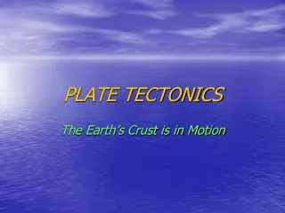
Earth’s Major Roles 9.2 Plate Tectonics According to the plate tectonics theory, the uppermost mantle, along with the overlying crust, behaves as a strong, rigid layer. This layer is known as the lithosphere. • A plate is one of numerous rigid sections of the lithosphere that move as a unit over the material of the asthenosphere.
Types of Plate Boundaries 9.2 Plate Tectonics Divergent boundaries (also called spreading centers) are the place where two plates move apart. Convergent boundaries form where two plates move together. Transform fault boundaries are margins where two plates grind past each other without the production or destruction of the lithosphere.
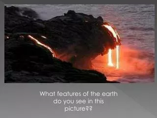
Divergent Boundaries 9.3 Actions at Plate Boundaries Oceanic Ridges and Seafloor Spreading • Oceanic ridges are continuous elevated zones on the floor of all major ocean basins. The rifts at the crest of ridges represent divergent plate boundaries. • Rift valleys are deep faulted structures found along the axes of divergent plate boundaries. They can develop on the seafloor or on land. • Seafloor spreading produces new oceanic lithosphere.
Divergent Boundaries 9.3 Actions at Plate Boundaries Continental Rifts • When spreading centers develop within a continent, the landmass may split into two or more smaller segments, forming a rift.
Convergent Boundaries 9.3 Actions at Plate Boundaries A subduction zone occurs when one oceanic plate is forced down into the mantle beneath a second plate. Oceanic-Continental • Denser oceanic slab sinks into the asthenosphere. • Pockets of magma develop and rise. • Continental volcanic arcs form in part by volcanic activity caused by the subduction of oceanic lithosphere beneath a continent. • Examples include the Andes, Cascades, and the Sierra Nevadas.
Convergent Boundaries 9.3 Actions at Plate Boundaries Oceanic-Oceanic • Two oceanic slabs converge and one descends beneath the other. • This kind of boundary often forms volcanoes on the ocean floor. • Volcanic island arcs form as volcanoes emerge from the sea. • Examples include the Aleutian, Mariana, and Tonga islands.
Convergent Boundaries 9.3 Actions at Plate Boundaries Continental-Continental • When subducting plates contain continental material, two continents collide. • This kind of boundary can produce new mountain ranges, such as the Himalayas.
Transform Fault Boundaries 9.3 Actions at Plate Boundaries At a transform fault boundary, plates grind past each other without destroying the lithosphere. Transform faults • Most join two segments of a mid-ocean ridge. • At the time of formation, they roughly parallel the direction of plate movement. • They aid the movement of oceanic crustal material.
Causes of Plate Motion 9.5 Mechanisms of Plate Motion Scientists generally agree that convection occurring in the mantle is the basic driving force for plate movement. • Convective flow is the motion of matter resulting from changes in temperature.
Causes of Plate Motion 9.5 Mechanisms of Plate Motion Slab-Pull and Ridge-Push • Slab-pull is a mechanism that contributes to plate motion in which cool, dense oceanic crust sinks into the mantle and “pulls” the trailing lithosphere along. It is thought to be the primary downward arm of convective flow in the mantle. • Ridge-push causes oceanic lithosphere to slide down the sides of the oceanic ridge under the pull of gravity. It may contribute to plate motion.
Causes of Plate Motion 9.5 Mechanisms of Plate Motion Mantle Convection • Mantle plumes are masses of hotter-than-normal mantle material that ascend toward the surface, where they may lead to igneous activity. • The unequal distribution of heat within Earth causes the thermal convection in the mantle that ultimately drives plate motion.
Earthquakes 8.1 What Is an Earthquake? An earthquake is the vibration of Earth produced by the rapid release of energy Focus and Epicenter • Focus is the point within Earth where the earthquake starts. • Epicenter is the location on the surface directly above the focus. Faults • Faults are fractures in Earth where movement has occurred.
Cause of Earthquakes 8.1 What Is an Earthquake? Elastic Rebound Hypothesis • Most earthquakes are produced by the rapid release of elastic energy stored in rock that has been subjected to great forces. • When the strength of the rock is exceeded, it suddenly breaks, causing the vibrations of an earthquake.
Cause of Earthquakes 8.1 What Is an Earthquake? Aftershocks and Foreshocks • An aftershock is a small earthquake that follows the main earthquake. • A foreshock is a small earthquake that often precedes a major earthquake.
Earthquake Waves 8.2 Measuring Earthquakes Seismographs are instruments that record earthquake waves. Seismograms aretraces of amplified, electronically recorded ground motion made by seismographs. Surface waves are seismic waves that travel along Earth’s outer layer.