Download
1 / 23
230 likes | 368 Vues
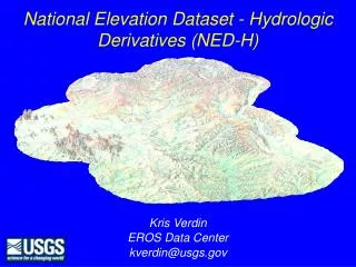
National Elevation Dataset - Hydrologic Derivatives (NED-H). Kris Verdin. EROS Data Center. kverdin@usgs.gov. NED-H Description. The N ational E levation D ataset- H ydrologic Derivatives Multi-layer dataset of topographically-derived data layers of hydrologic significance

E N D
National Elevation Dataset - Hydrologic Derivatives (NED-H) Kris Verdin EROS Data Center kverdin@usgs.gov
NED-H Description • The National Elevation Dataset-Hydrologic Derivatives • Multi-layer dataset of topographically-derived data layers of hydrologic significance • Derived from NED in U.S. Albers projection, 30 m cell size
Raster Layers Hydrologically Conditioned DEM Flow directions Flow accumulations Slope Aspect Compound Topographic Index Vector Layers Synthetic Streamlines Reach Catchments Metadata NED-H Core Data Layers
NED-H Rationale • Responsive to the need for better watershed boundaries for the country • Serves to integrate two of USGS’ key National Datasets - NED and NHD • Will provide nation-wide, reliable flow direction dataset
NED-H Cooperators • USGS Mapping & Water Divisions • EROS team providing core team • Cooperative development of the WBD • NAWQA funded development of Stage 2 tools • National Weather Service • Bulk processing of Stage 1 data • Using Stage 1 product in AMBER modeling effort • EPA Office of Research & Development • funding Stage 3 tool development
Development Stages • 3 Stage Plan for development • Stage 1: Blind Pass Processing • Cataloging Unit used as processing unit • National Weather Service’s National Severe Storms Lab in Norman, OK • California being done by WRD in Sacramento
Development Stages • Stage 1 Post-processing • Stage 1a: Clean-up of sink processing • Digital Dam-break algorithm • Stage 1b: Attribution of Pfafstetter ID to reach catchments • Will immediately be useful as input to AMBER modeling
Stage 1a:Digital Dam-break algorithm • Post-processing of large spurious sink features filled in Stage 1 • Typically, these features are “filled” to allow uninterrupted flow • Iterative algorithm identifies controlling pour point and breaks the digital dam • Results in preservation of detail of DEM and improved streamline generation
Stage 1b:Pfafstetter Attribution • Provides unique ID number for every reach catchment • ~1000 per C.U. • Pfafstetter number carries topological information • no linkage table required • Numbers developed on catchment basis and transferred onto streamlines
Development Stages • Stage 2: Vector Editing • In-depth QA/QC of Stage 1 products by local or regional stakeholders • ArcView based procedures for Stage 2 cooperators • Output is watershed and subwatershed delineations for WBD along with areas identified for correction in Stage 3
Stage 2 cooperators • USGS – Utah, New York, Cheaspeake Bay area • EPA • USFS - Alaska • State agencies • Stage 2 training – Thursday afternoon
Development Stages • Stage 3: Raster Editing • Feedback from Stage 2 is incorporated into NED-H DEM via raster edits where required • Revised DEM and derivatives reflect correct drainage pattern • Derived streamlines are conflated with NHD for final transfer of attributes • Reach Code is common attribute
Stage 3 Tools • Highway overpass/blockage tool • Improved flow direction algorithm through flat area • Sink clearing tool