Download
1 / 27
270 likes | 425 Vues
High Resolution Data Needs for Downscaling WRF-ARW for South Asia (in particular Bangladesh). WRF Lecture Series at the Bjerknes Centre (NCAR Visit to the Bjerknes Centre) September 20-24, 2010 Bjerknes Centre for Climate Research, Bergen, Norway. Md. Abu Syed Research Fellow

E N D
High Resolution Data Needs for Downscaling WRF-ARW for South Asia (in particular Bangladesh) WRF Lecture Series at the Bjerknes Centre (NCAR Visit to the Bjerknes Centre) September 20-24, 2010 Bjerknes Centre for Climate Research, Bergen, Norway Md. Abu Syed Research Fellow Bangladesh Centre for Advanced Studies (BCAS), Bangladesh
Contents: • Short note on BCAS • Regional Overview ofSouth Asia & Bangladesh • South Asian Climate • South AsianPhysiography and Climate • Modelling South Asian Monsoon • High resolution data required for downscaling ARW-WRF for South Asia & Bangladesh • Conclusions and way forward
An independent, research, implementation and policy institute for sustainable development Bangladesh Centre for Advanced Studies Established in 1986 with a vision to promote people-centred, environmentally sound and socially just development
Environment- Development Integration Thematic Areas of BCAS: Advancing Sustainable Development Poverty alleviation and Sustainable livelihoods Good governance and people’s participation Economic growth and public-private partnership
Science Approaches of BCAS:Science-Policy-People Integration Policy People
Scientific Knowledge Approaches of BCAS:Integration of Scientific and Peoples Knowledge Science and Peoples Knowledge Integration Peoples Knowledge
Approaches of BCAS:Integration of Knowledge and Decisions at Different Levels
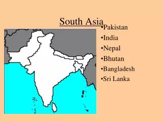
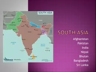
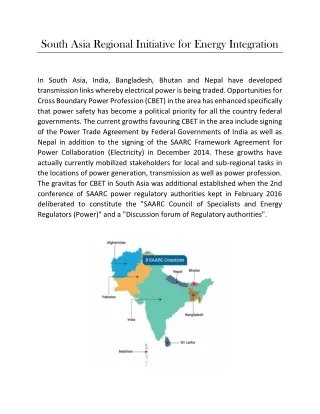
High Resolution Data Needs for Downscaling WRF-ARW for South Asia South Asia-Regional Overview • SA is bounded in the south by the Indian Ocean, in the south-east by the Bay of Bengal and in the southwest by the Arabian Sea. • The South Asian region spans to the countries of Bangladesh, Bhutan, India, Maldives, Nepal, Pakistan and Sri Lanka • covers an area of about 41,26,800 sq km with a population of about 1.3 billion. • The SA region generally slopes from the north to the east and the west.
Nepal Pakistan Bangladesh Myanmar India Relief Map of South Asia http://www.flickr.com/photos/ocean_of_stars/2785428699/sizes/o/in/photostream/
While the north-western part is home to the flat Indus plains and the Baluchistan plateau, partly covered by deserts, • The rugged Himalayas in northern India tower over the flat plains of Indus, Ganges, Brahmmaputra, Irrawardy, Yangze • Together, these range form an imposing east-west arc, some 2,500 km (about 1,550 miles) in length, containing numerous peaks which are more than 6,100 m in height, including the Mt. Everest. • The region has a long stretch of coastline extending to about 10,000 km from Pakistan to Bangladesh.
South Asian Climate • The South Asia regional climate is characterized by a prevailing monsoon climate, wet summers and dry winters. • The south-west monsoons (late May to October) bring the maximum rainfall to the region, followed by the northeast monsoons. • Due to the variations in land forms, precipitation and climate vary significantly from place to place in different countries. • E.g., rainfall ranges from 200 mm in the desert areas of the north-west to 4,000 mm in the Higher Himalayas of Bhutan. (record of 26000mm in 1985) • Cyclones, generated by the south-west monsoons, are a common phenomenon in coastal areas of India, Bangladesh and Sri Lanka.
South Asian physiography and climate • The differential heating by the Central Asian land masses and cooling by the Indian Ocean water mass cause moisture-laden air from the ocean to move towards the Indian subcontinent, from a region of high pressure to one of low pressure. This gives rise to the cyclones. • The climate varies from the semi-arid in Pakistan to the tropical monsoon and hot-dry, humid-dry in the rest of the region. • Localized climatic conditions prevail in hilly regions. • Marked variations in temperature as well-ranging from as low as -20°C in the cold deserts to a scorching 48°C in desert areas and some plains.
The Tibetan Plateau holds the third largest amount of stored fresh water on the planet. • The Himalayas, which dominate the Plateau, are the source of melt water for the most important rivers Asia’s. • Rapid melting from black-carbon (byproducts from incomplete combustion of fossil fuels) fuel "heat pump" occurring primarily in the western Tibetan Plateau, beginning each year in April and extending through early fall. • The brisk melting coincides with the time when concentrations of aerosols like soot and dust are most dense in the atmosphere.
The variability of onset, breaks and duration of the summer monsoon have enormous affects on water resources, agriculture, economics, ecosystems, and human mortality throughout South Asia.
The heating by the plateau enhance rainfall along its southern edge, [Kuang and William Boos Harvard University Center for the Environment (HUCE)]; • Daly [HUCE] used an atmospheric circulation model to show that the large-scale South Asian summer monsoon circulation remains unaffected when the plateau is removed. • The Himalayas and other nearby mountain ranges can, produce an equally strong monsoon by insulating warm, moist air over South Asia from the cold dry extra-tropics • From Ramnathan’s (2009) recent modeling output and in Lau’s (2010) word “The science suggests that we’ve got to better monitor the flue on our 'rooftop to the world, For Asia's sake. " said Lau.
Modelling South Asian Monsoon • Increased greenhouse forcing resulted in overall suppression of summer precipitation, a delay in monsoon onset, and • An increase in the occurrence of monsoon break periods (Ashfaq et. al., 2009) • To better simulate the response of fine-scale climate system processes: • to enhanced greenhouse forcing, • a suite of high resolution nested climate model simulations, offering an improved representation of the dynamics associated with: • physiographic complexity, • land cover/use heterogeneity, and • atmospheric convection need to be developed (Ashfaq et. al., 2009).
How the winds change: in the summer, the elevated Tibetan Plateau heats more rapidly than the ocean. • The upper tropospheric air is warmer (cooler) at 30N than that at 5N, representing the reversal of the meridional tropospheric temperature gradient (MTG) in the upper troposphere. • The positive reversal of the MTG is concurrent with the monsoon onset and produces zonal winds with easterly vertical shear
Latitude Distribution of the mean upper tropospheric temperature averaged between 200 and 500 hPa for the boreal summer (JJA) and winter (DJF). Note the two locations where the mean temperature is warmer than the equatorial temperature: over the Tibetan Plateau during the boreal summer
The variations in the sign and magnitude of precipitation change throughout SA highlight the importance of spatial complexity in the climate response. • Ashfaq et.al. 2009 applied nested RegCM3 with parameterizations of convective, boundary layer, and land surface processes following those of Pal et al. [2007] with 25km horizontal grid • Positive correlation between precipitation index & local Hadley circulation index at inter-annual timescale [Goswami et al., 1999]
High resolution data required for downscaling WRF-ARW for South Asia • Most interesting problems related to weather forecasting is the reproduction/forecasting of the airflow over complex terrain. • The complexity of terrain influences the weather in a variety of ways. Under stable atmospheric conditions, the terrain generates internal gravity waves that distribute momentum over wider areas. • High resolution terrain model incorporation is necessary for nested modeling in smaller grid probably <10km; • Horizontal/vertical grid size needs to be higher resolution (smaller grids) to better represent the atmospheric/physical conditions into the model. • Temperature gradient over South Asia and Bangladesh has to be calculated incorporating land surface terrain in higher resolution along with SST. This would improve predictability of onset and breaks in the summer monsoon.
Temperature gradient over South Asia and Bangladesh has to be calculated incorporating land surface terrain in higher resolution along with SST. This would improve predictability of onset and breaks in the summer monsoon. • A positive correlation between the precipitation index and the local Hadley circulation index (HCI) suggest defining: • local HCI for South Asia and Bangladesh • Local Meridional Tropospheric Temperature Gradient (MTG) (knowing high resolution topographic information) • Local Intertropical Convergence Zone (ITCZ). • The 3-D radar reflectivity data can be brought into the model via Diabetic Digital Filter Initialization • An advantage of the RUC radar-enhanced diabetic DFI is an enforcement of the balance between the wind (especially the divergent wind) and thermal response consistent with convection based latent heating.
Yearly Average Precipitation A1B scenario PRECIS Station Model output Observed data
Yearly Average Temperature A1B scenario PRECIS Station Observed data Model output
Conclusions and way forward • Spatial distribution of precipitation are simulated quite well in regional modeling, • Special attention needed for any overestimation of rainfall along windward slopes. • High resolution satellite RS can be utilized for land use • Overly-dry soil moisturesummer results in a several degree warm bias in CCSM3 and WRF. • Bias from coastal sea surface temperature need to be addressed • Realistic simulation of high-elevation topography has to be incorporated through nested model to better simulate precipitation.