Modeling Contributions of the Greenland Ice Sheet to Sea Level Rise under RCP8.5 Scenarios
This study explores the contributions of the Greenland Ice Sheet (GIS) to sea level rise (SLR) under the RCP8.5 climate scenario. Initializations for glacier models on the RASM grid provide insights into surface mass balance evaluation techniques. Key findings indicate that optimized GIS configurations may lead to a projected rise of 7.3 cm from 1850 to 2100. The results show a strong negative feedback between ice thickness and velocity, highlighting the importance of accurate modeling techniques in predicting SLR contributions and understanding future variability.

Modeling Contributions of the Greenland Ice Sheet to Sea Level Rise under RCP8.5 Scenarios
E N D
Presentation Transcript
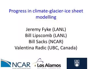
Progress in climate-glacier-ice sheet modellingJeremy Fyke (LANL)Bill Lipscomb (LANL)Bill Sacks (NCAR)ValentinaRadic (UBC, Canada)
Synopsis • RCP8.5 Greenland Ice Sheet (GIS) sea level rise contribution predictions • Glacier model initialization on RASM model grid • Preliminary techniques for non-GIS surface mass balance evaluation • Ongoing work
RCP8.5 GIS sea level rise contribution predictions (Lipscomb et al., submitted) • Optimized Greenland Ice Sheet preindustiral spin up simulations forced with CESM-derived RCP8.5 surface mass balance to year 2100.
RCP8.5 GIS sea level rise contribution predictions • Best initial GIS configurations generate 7.3 cm of eustatic sea level rise (SLR) 1850-2100
RCP8.5 GIS sea level rise contribution predictions • Negative feedback between ice thickness and ice velocity strongly damps total SLR signal
RCP8.5 GIS sea level rise contribution predictions • Variability in ablation dominates overall SMB variability (+ increase in future variability?)
RCP8.5 GIS sea level rise contribution predictions • ‘Poorly’ optimized models generate different SLR curves • Due to interplay between hypsometry (area-elevation relationship) of GIS realization ice surface and ablation/discharge • Improved spinup techniques and reduction of geometry (i.e. preindustrial SMB) biases = important
Surface mass balance model initialization on climate model grids • Distributed glacier model component requires an initial glacier population on climate model grid • Each glacier forced with output from climate model grid-cell SMB • Recall: each glacier evolved forward using volume-area scaling • Development of initial conditions for glacier models in RASM has been latest focus
Surface mass balance model initialization on climate model grids • Randolph Glacier Inventory (v.2) shapefiles + 30-m SRTM/ASTER DEMs processing extended to provide global-coverage high-resolution glacial hypsometries Normalized hypsometry Normalized elevation
Surface mass balance model initialization on climate model grids • Randolph Glacier Inventory (v.2) shapefiles + 30-m SRTM/ASTER DEMs processing extended to provide global-coverage high-resolution glacial hypsometries Iceland
Surface mass balance model initialization on climate model grids • Characteristic shape of normalized hypsometries is motivating some side-line glaciological work – interesting spin-off of model development Western Canada/US
Surface mass balance model initialization on climate model grids • Characteristic shape of normalized hypsometries is motivating some side-line glaciological work – interesting spin-off of model development Svalbard
Surface mass balance model initialization on climate model grids • Characteristic shape of normalized hypsometries is motivating some side-line glaciological work – interesting spin-off of model development Scandinavia
Surface mass balance model initialization on climate model grids • Characteristic shape of normalized hypsometries is motivating some side-line glaciological work – interesting spin-off of model development Greenland Periphery
Surface mass balance model initialization on climate model grids • Characteristic shape of normalized hypsometries is motivating some side-line glaciological work – interesting spin-off of model development Arctic Canada (South)
Surface mass balance model initialization on climate model grids • Characteristic shape of normalized hypsometries is motivating some side-line glaciological work – interesting spin-off of model development Arctic Canada (North)
Surface mass balance model initialization on climate model grids • Characteristic shape of normalized hypsometries is motivating some side-line glaciological work – interesting spin-off of model development Alaska
Surface mass balance model initialization on climate model grids • Characteristic shape of normalized hypsometries is motivating some side-line glaciological work – interesting spin-off of model development Russian Arctic
Surface mass balance model initialization on climate model grids Annual-mean PDD at mean glacier elevation Annual-mean total precipitation
Surface mass balance model initialization on climate model grids • RGI glaciers nearest-neighbour-binned to RASM grid cells
Surface mass balance model initialization on climate model grids • 6% of RASM land cells contain initial glacial ice • Land-terminating, ‘non-trivial’ glaciers/ice caps cover approximately 0.3% of the RASM land surface
Surface mass balance model initialization on climate model grids • Individual glaciers binned on grid-cell basis
Surface mass balance model initialization on climate model grids • Empirically, observed ELA occurs where accumulation area=0.57*total area Accumulation ELA Ablation
CESM non-GIS surface mass balance evaluation • Simulated SMB fields need to be compared against against RGI-derived hypsometry • ELA (line of net 0 ice gain/loss) useful as a composite indicator of T/P conditions: give a new glaciologically-relevant metric of model performance: vertical ELA bias • Evaluation completed around Greenland peripheral glaciers in CESM
CESM non-GIS surface mass balance evaluation Individual glacier ranges in CESM cell Integrated grid cell hypsometry CESM SMB profile
CESM non-GIS surface mass balance evaluation Individual glacier ranges in CESM cell Integrated grid cell hypsometry CESM SMB profile
CESM non-GIS surface mass balance evaluation Individual glacier ranges in CESM cell Integrated grid cell hypsometry CESM SMB profile
CESM non-GIS surface mass balance evaluation melting glaciers growing glaciers
CESM non-GIS surface mass balance evaluation • Conclusions • ELA bias a strict indicator of model performance • Bias integrates T and P signal: correlating ELA bias to (seasonal) T/P biases or land surface biases way forward for assessing REASON for bias • RASM grid reaches 30N: if all glaciers to be modelled well, sub-grid VIC SMB scheme should work from near-sea-level to above 5000 m, at <=100 m vertical resolution • RASM may improve on CESM significantly w/r/t ELA biases and glacier simulation due to higher resolution topography
Ongoing work • Topography dataset generation underway for set of CAM5.2-SE AMIP-style simulations (collab with Peter Lauritzen), using GIS topographies from Fyke (PhD thesis, 2011) • Results will guide dynamic coupling of ice sheet with atmosphere models
Ongoing work • Transient spin-up techniques: • CESM has been run to quasi-equilibrium under LGM/mid-Holocene/preindustrial conditions • Extensions of these simulations with SMB calculations turned on should provide end-members for a transient glacial spin-up for model using ice core isotope data as control on interpolation Holocene time LGM
Ongoing work • Further development of CESM SMB scheme: • Refinement of vertical SMB calculations to capture high-elevation glaciers (Fyke/Sacks) • Dynamic land units for ice sheet/glacier retreat (Sacks) • Wrapping glacier and ice sheet model into ‘glc’ land surface model component (Sacks) • Isolating climate-ELA biases (Fyke/Radic): forcing CLM model with CAM/re-analysis • Further refinement of statistical glacier scheme: • Simulation of size distribution vs. individual glaciers • Parameterization of ice retreat at terminus Thanks!