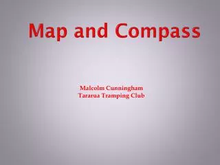
Map and Compass
Malcolm Cunningham Tararua Tramping Club. Map and Compass. Getting a sphere onto a plane (Mercator projection). Transverse Mercator Projection. Longitudinal lines (N-S) not necessarily vertical. There are three Norths. 1. True or Geographic North 2. Grid North 3. Magnetic North.

Map and Compass
E N D
Presentation Transcript
Malcolm Cunningham Tararua Tramping Club Map and Compass
Getting a sphere onto a plane (Mercator projection)
Longitudinal lines (N-S) not necessarily vertical
There are three Norths • 1. True or Geographic North • 2. Grid North • 3. Magnetic North
True North & Grid North
26 27 18 17
27 26 18 17
27 26 0 1 2 3 4 5 6 7 8 9 0 18 0 9 8 7 6 5 4 3 2 1 0 17
27 26 0 1 2 3 4 5 6 7 8 9 0 18 267178 0 9 8 7 6 5 4 3 2 1 0 17
MAP & COMPASS EXERCISE NO.1 ( Use map NZTopo50 BQ31) A) Grid References What feature is at Grid Reference 382218 ? • " " 412277? • " " 363293? B) Contour Lines • In Grid Square 3732, if you walked in a N.W. direction from Ohau Hill SpotHeight 243m, would you be ascending or descending? • Would you be crossing a steep slope or a gentle one? • If you walked in a N.E. direction to Ohau PLight, would you be ascending ordescending? • In Grid Square 3929, the lowest point is in which corner? NW, N, NE, E, SE, S,SW, or W • What height is it? • Which way is the Waiariki stream running in Grid Square 3823 ? C) Scale • How far is it between Outlook Hill trig in 3725 and Mt Misery trig in 3927? • How far is it between Mt Misery trig in 3927 and Terawhiti Hill trig in 3629?
MAP & COMPASS EXERCISE NO.1 ( Use map NZTopo50 BQ31) A) Grid References What feature is at Grid Reference 382218 ? Karori Rock light • " " 412277?Golf course • " " 363293?Terawhiti Hill B) Contour Lines • In Grid Square 3732, if you walked in a N.W. direction from Ohau Hill SpotHeight 243m, would you be ascending or descending? Descending • Would you be crossing a steep slope or a gentle one? Steep • If you walked in a N.E. direction to Ohau R Light, would you be ascending ordescending? Descending • In Grid Square 3929, the lowest point is in which corner? NW, N, NE, E, SE, S,SW, or W SW • What height is it? 100m • Which way is the Waiariki stream running in Grid Square 3823 ? 200o C) Scale • How far is it between Outlook Hill trig in 3725 and Mt Misery trig in 3927? 2100m • How far is it between Mt Misery trig in 3927 and Terawhiti Hill trig in 3629? 3.5km
Magnetic needle (north end is red)