Land Cover Mapping Background: Training Data and Classification Methods
260 likes | 413 Vues
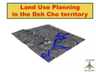
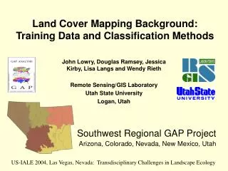
Land Cover Mapping Background: Training Data and Classification Methods. John Lowry, Douglas Ramsey, Jessica Kirby, Lisa Langs and Wendy Rieth Remote Sensing/GIS Laboratory Utah State University Logan, Utah. Southwest Regional GAP Project Arizona, Colorado, Nevada, New Mexico, Utah.

Land Cover Mapping Background: Training Data and Classification Methods
E N D
Presentation Transcript
Land Cover Mapping Background: Training Data and Classification Methods John Lowry, Douglas Ramsey, Jessica Kirby, Lisa Langs and Wendy Rieth Remote Sensing/GIS Laboratory Utah State University Logan, Utah Southwest Regional GAP Project Arizona, Colorado, Nevada, New Mexico, Utah US-IALE 2004, Las Vegas, Nevada: Transdisciplinary Challenges in Landscape Ecology
Presentation Overview I. Project Background & Objectives • Mapping Methodology III. Training Data Collection Approach IV. Summary
I. Project Background & Objectives • Earlier GAP efforts: • State-based vegetation classification systems • State-based mapping methods • State-based mapping area • Project Objectives: • Regionally consistent product • Improvements in Land Cover representation
Mapping Zone Identification Began by Refining Bailey’s Ecoregions over a Color Shaded Relief Map
40 Mapping zones • Spectrally consistent • Eco-regionally distinct • Labor divided among 5 state teams
Thematic Target LegendDeveloped with NatureServe NatureServe Ecological Systems ~ NVC Class/Subclass NVC Formation NVC Alliance NVC Association ~10 units ~300 units ~700 units ~1,800 units ~5,000 units MRLC 2000 Proposal Gap Analysis Program National Park Mapping (Natural/Semi-natural types) (Slide Courtesy Pat Comer, Nature Serve)
Ecological Systems Groups of plant communities and sparsely vegetated habitats unified by similar ecologicalprocesses, substrates, and/or environmental gradients...and spectral characteristics.
Predictor Datasets: DEM derived Landform Elevation
Predictor Datasets: Imagery Derived July-Aug Sept-Oct ETM Bands 5, 4, 3 ETM Bands 5, 4, 3
II. Mapping Methods: Classification Trees • Data-mining software for decision-making and exploratory data analysis • Identifies complex relationships between multiple independent variables to predict a single categorical class • Predictor variables may be categorical or continuous • Recursively “splits” the predictor data to create prediction rules or a decision tree. • Software packages available: See5,SPLUS, CART
SAMPLE SITES Fall Brightness Summer NDVI Elevation Landform Etc…. Output table Mining the Predictor Layers
Example: Rules Output See5 [Release 1.17] Wed Apr 23 13:42:02 2003 Options: Rule-based classifiers Class specified by attribute `dep' Read 7097 cases (10 attributes) from t3.data Rules: Rule 1: (17, lift 45.4) band01 = 1 band03 > 115 band03 <= 122 band05 <= 81 band06 <= 1419 -> class 1 [0.947] Rule 2: (9, lift 43.6) band01 = 1 band02 <= 102 band03 > 115 band03 <= 118 band04 <= 117 band06 <= 1419 -> class 1 [0.909] Rule 3: (6, lift 42.0) band01 = 13 band03 <= 110 band05 <= 73 band07 = 4 | Generated with cubistinput by EarthSat | Training samples : 10260 | Validation samples: 2565 | Minimum samples : 0 | Sample method : Random | Output format : See5 dep. |h:/mgzn_5/trainingdata/mrgpts1.img(:Layer_1) Xcoord: ignore. Ycoord: ignore. band01: 1,2,-30 |h:/mgzn_5/img_files/sum30cl.img(:Layer_1) band02: continuous. |h:/mgzn_5/img_files/subrt.img(:Layer_1) band03: continuous. |h:/mgzn_5/img_files/sundvi.img(:Layer_1) band04: continuous. |h:/mgzn_5/img_files/fandvi.img(:Layer_1) band05: continuous. |h:/mgzn_5/img_files/fabrt.img(:Layer_1) band06: continuous. |h:/mgzn_5/img_files/elev.img(:Layer_1) band07: 0,1,2,3,4,5,6,7,8,9,10. |h:/mgzn_5/img_files/landf.img(:Layer_1) dep: 1,2,3,4,5,6,7,8,9,10,11,12,13,14,15,16,17,18,19,20. |h:/mgzn_5/trainingdata/mrgpts1
Multiple Tree Approaches V O T E 2) Boosting (iterative tree’s try to account for previous tree’s errors)—C5 Different over-fitting issues associated with each tree tend to be averaged out.
Imagine CART Module (USGS Eros Data Center)—C5-Imagine Integration
III. Training Data Collection Opportunistic, ground-based sampling, stratified by digital landform model
Percent ground cover by dominant species is recorded through ocular estimation. Only the top 4 species of each of 4 life forms are recorded
X THE FIELD SITE POLYGON IS DRAWN ONLY AROUND THE GENERAL AREA OF THE PERSON RECORDING FIELD DATA. THE SITE SHOULD BE AT 90 METERS SQUARED (3X3 PIXEL AREA) OR LARGER
Sub-sampling to account for positional error for point samples, and minimize size bias for polygon samples
IV. Summary • Challenge to assure to regional consistency • Challenge of developing tools & methods to be used by multiple analysts/teams • Importance of training sample collection (quantity and quality) • Primarily product oriented • Many research questions…