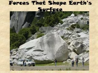
Forces That Shape the Earth
Forces That Shape the Earth. State Objectives 4.a.-4.b. Structure of the Earth. Share some different structures that are on Earth The Earth is made of four layers Inner Core Outer Core Mantle Crust. Core. Inner Core Made of iron and nickel Temperatures at 6000 °C (10,000°F)

Forces That Shape the Earth
E N D
Presentation Transcript
Forces That Shape the Earth State Objectives 4.a.-4.b.
Structure of the Earth • Share some different structures that are on Earth • The Earth is made of four layers • Inner Core • Outer Core • Mantle • Crust
Core • Inner Core • Made of iron and nickel • Temperatures at 6000°C (10,000°F) • Although temperatures are hot it is solid due to great pressure from the above layers • Outer Core • Molten (liquid) iron and nickel • Temperature between 4000°C (7,200°F) & 5000°C
Mantle • Thick layer of hot, solid rock between the crust and the liquid outer core. • Upper mantle melts rocks, forming a substance called magma which flows like a thick liquid
Asthenosphere • The mechanically weak deforming region of the upper mantle that is ductile & plastic due to extreme temperatures & pressure • Plastic means that the consistency of the rock is flowing but it is not a liquid • Convection currents occur here due to uneven heating
Convection Currents • Heat from the core and the mantle itself causes convection currents in the mantle. • Heating and cooling of the fluid, changes in the fluid’s density, and the force of gravity combine to set convection currents in motion.
Crust • A solid layer of rock that includes both dry land and the ocean floor.
Lithosphere • The outermost shell of the rocky planet that floats on top of the asthenosphere • Made up of the crust & the upper solid rocky part of the mantle • Brittle, rigid, & has fault lines • Divided into plates • Plates are large sections of the earth’s crust and upper mantle that ride on top of the asthenosphere.
Review Use your notes to create a venn diagram comparing and contrasting the lithosphere and asthenosphere.
Plate Tectonics • In 1912, German scientist Alfred Wegener proposed two ideas that are known as continental drift theory • Earth’s continents were once joined in a single large landmass called Pangaea that broke apart millions of years ago. • Continents have drifted to their current location.
Continental Drift • It has taken the continents about 225 million years since the breakup of Pangaea to move to their present locations.
What do you notice about the movement of the continent Pangaea to present day continents?
How Can Continents Move? Plate Tectonics Explains Continental Drift
Theory of Plate Tectonics • Claims that Earth’s plates are always in motion • Plates move • slowly • at different rates • in different directions • Explains the formation, movement, and subduction of Earth’s plates
Theory of Plate Tectonics • Crust rides on top of the plates • Plates ride on top of mantle which is in motion due to convection currents • Convection currents moving the plastic rocks of the asthenosphere sideways cause large portions of the crust to move called lithospheric plates • Convection currents can cause plates to move away from each other or toward each other.
Two Types of Lithospheric Plates • Continental crust: made of rocks that are less dense and ride higher on the mantle than oceanic crust; made of Granite • Oceanic crust: rocks that are more dense and ride lower on the mantle than continental crust; made of basalt
Plate Boundaries • Movement of Earth’s plates are responsible for most major geological events and landforms. • Volcanoes, earthquakes, mountain formation • Plate boundaries are where edges of plates interact.
Divergent Plate Boundaries • Forms when two plates move away from each other • Most occur on the ocean floor & form undersea mountain ranges called mid-ocean ridges. • Magma wells up where plates pull apart creating new ocean crust in a process called seafloor spreading. • Ex. Mid-Atlantic Ridge • Create under water volcanoes
Growing an Ocean • Because of sea-floor spreading, the distance between Europe and North America is increasing by a few centimeters per year.
Evidence for Sea-Floor Spreading • Eruptions of molten material • Magnetic strips in the rock of the ocean floor • Older rocks are found farther away from a ridge.
Divergent Boundaries • When two continental plates pull apart, a rift valley forms • Ex. East African Rift • Faulting occurs where there are breaks in the rock of the crust because rocks slip past each other due to plate movements (transform boundary) • Tension forces
Convergent Plate Boundaries • Boundaries that form when two plates collide or come together • Compression forces (squeezing) • Called Folding • Three Types • Oceanic & Continental • Two continental • Two oceanic
Oceanic & Continental • The more dense oceanic plate is forced below the less dense continental plate. • Oceanic plate melts as it pushes into the mantle forcing hot magma & gas up to the surface of the continent. • Forms a deep-ocean trench & a long chain of continental volcanic mountains. • The movement of one plate under another is called subduction.
Volcanoes and Plate Boundaries • Volcanic belts form along the boundaries of Earth’s plates.
Hot Spot Volcanoes • Hot spots called intra-plate regions • These volcanoes are believed to have sources deeper down in the Earth's mantle that remain in a relatively fixed location. • Plates move over the hot spot • Ex. The Hawaiian Islands
Two Continental Plates • First, the seafloor between the continents is forced below one of the continents • Then, when the plates collide the continent crusts buckle, thicken, & rise up forming mountain ranges. • Ex. Himalaya & Appalachian Mountains • Folding occurs when compression forces bend rocks without breaking them.
Two Oceanic Plates • One plate is forced down into the mantle forming a deep ocean trench that sinks & melts. • Magma & gas push through the ocean floor forming a chain of volcanoes. • If a volcano becomes large enough, it rises above sea level & makes a volcanic island arc. • Ex. Japanese Islands, Philippines, Aleutian Islands
Transform Plate Boundaries • Two plates slide past each other without creating or destroying the lithosphere. • Form Strike-slip faults • Shearing forces • Earthquakes occur most often at transform boundaries. • San Andreas Fault is an example. • North America & Pacific plates slide past each other in a N – S direction creating earthquakes.
Review: Graphic Organizer : copy this if you don’t have it Type of Plate Boundary Type of Motion Effect on Crust Feature(s) Formed Transform boundary Plates slide past each other. Crust is sheared. Strike-slip fault Convergent boundary Plates move together. Subduction or mountain building Mountains, volcanoes Divergent boundary Plates move apart. Crust pulled apart by tension forces. Mid-ocean ridge, ocean floor
Earthquakes • Faults are large cracks in the Earth’s crust where movement occurs. • At strike-slip faults, rocks on either side of the fault are under pressure & can get locked together. • When too much pressure builds up, the rocks suddenly slide past each other releasing the pressure. • The violent shaking of the Earth’s crust at the fault line is known as an earthquake.
Seismic Waves • The focus is the place (underground) in Earth’s crust where the pressure was released. • Seismic (earthquake) waves spread out in all directions from the focus. • The epicenter is the spot on Earth’s surface directly above the focus. • 3 kinds of seismic waves • Primary, secondary, land/surface
Types of Seismic Waves • Primary (P)-waves: originate at the focus • Travel by stretching & compressing land as they pass (like a slinky) • Travel faster through solids than liquid • Secondary (S)-waves: move land side to side • Only travel through solids • Cause the most damage • Land/Surface waves: move up and down on earth’s surface (like waves on a pond)
Measuring Earthquakes • The measure of the strength of an earthquake’s waves is called magnitude. • Magnitude is measured using a seismograph and a Richter Scale.
The Modern Seismograph • Seismic waves cause the seismograph’s drum to vibrate. However, the suspended weight with the pen attached moves very little. Therefore, the pen stays in place and records the drum’s vibrations. http://content.usatoday.com/communities/ondeadline/post/2011/01/stomping-by-elated-seahawk-fans-on-pivotal-play-caused-local-quake/1
Locating the Epicenter • Geologists use seismic waves to locate an earthquake’s epicenter.