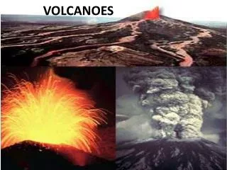
ESS 125 – Volcanoes LAB
190 likes | 385 Vues
ESS 125 – Volcanoes LAB. Volcano Scenario 6. 2. 3. 1000. 5. 1. 4. 1000. Rivers & streams. Locations of pictures. 2. Contour line. N. Logging forest. 2000. Suburbs (growing). Natural Features. Major metropolitan area (city). 10 km. Contour interval = 1000 feet. 2. 3. 1000. 5.

ESS 125 – Volcanoes LAB
E N D
Presentation Transcript
ESS 125 – Volcanoes LAB Volcano Scenario 6
2 3 1000 5 1 4 1000 Rivers & streams Locations of pictures 2 Contour line N Logging forest 2000 Suburbs (growing) Natural Features Major metropolitan area (city) 10 km Contour interval = 1000 feet
2 3 1000 5 1 4 1000 N 2000 Major roads Smaller roads Small town or village Man Made Constructions Numbers indicate locations of volcanic deposits (see following slides). 10 km Contour interval = 1000 feet
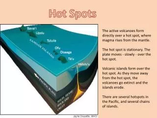
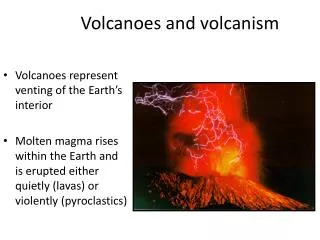
Overview of Eruption Histories • Large eruptions involving multiple hazards occurred about 13,000 years ago and about 6,000 years ago. For the past 2,900 years, only small eruptions have happened. The small eruptions involved the growth and collapse of lava domes with small lahars and pyroclastic flows at about 2900 and 2000 years ago, and again between 850-1200 years ago (multiple events). • In the most recent events, lahars and pyroclastic flows have traveled up to 15 km from the vent, but most are smaller. Ash from an eruption about 6,000 years ago can be found 100’s of kilometers away, and had a total volume beween 10-100 km3. Most ash deposits are more localized, closer to the volcano.
Keynotes for Analysis Natural conditions • Eruption sequences 13000, 6000, 2900, 1000, recent? • Volcanic deposit locations and deposit types (Look at pics) • River and stream systems Man made constructions • Residental area and populations • Road systems and bridges • Sky resort construction and its location
Key for pictures • Location 1: Lava flow (central layer) between 2 pyroclastic flows or debris flows (lower and upper layers). • Location 2: Pyroclastic flows. • Location 4: Ash fall (tephra), possible pyroclastic flows, as well. More recent deposits. • Location 3: Debris flows or lahars (cold). • Location 5: Pyroclastic flow. • Young deposits near summit: Rock avalanche.
Video clips – Volcanic Hazards • Eruption • Story of 1980 Mount St. Helens eruption (Ash @ 7:00 min, debris flow @ 8:10) • http://www.youtube.com/watch?v=FnDT_6V4qVw&feature=related • Mount St. Helens eruption minute. • http://www.youtube.com/watch?v=bgRnVhbfIKQ&feature=related • Eruption in Iceland (+ lava @1:10) • http://www.youtube.com/watch?v=NV0mniJrnzc • Etna Mt. • http://www.youtube.com/watch?v=IiEw1p5BaSU
Location 1: Lava flow (central layer) between 2 pyroclastic flows or debris flows (lower and upper layers).
Lava flow • Big island HW • http://www.youtube.com/watch?v=488BkTUsMa4&feature=related • Mount Etna Volcano December 2006 (+ pyroclastic n ash @2:50) • http://www.youtube.com/watch?v=ePra9ycif7M
Location 4: Ash fall (tephra), possible pyroclastic flows, as well. More recent deposits.It is found along road at Location 4 on map. hammer handle in center is about 40 cm long (about 16 inches)
Ash eruption • Etna Volcano December 2006 • http://www.youtube.com/watch?v=BbTFkPxwhTM&feature=related Ash clouds • 2010 Iceland taken from aircraft Video • http://www.youtube.com/watch?v=dS9FgSVKeN4&feature=related • 2010 Iceland taken from satellite Video • http://www.youtube.com/watch?v=GTLYwM9kgPM&feature=related
Location 5: Pyroclastic flow.along road. Close-up of this rock (below right).
Pyroclastic flows • Mixed with interview • http://www.youtube.com/watch?v=XLmbnnh5OLs • Mt Merapi Java Indonesia http://www.youtube.com/watch?v=Bz7WCttwXQk&feature=related • Etna eruption 2006 • http://www.youtube.com/watch?v=ciEUtv9HiIM&feature=related
Location 3: Debris flows or lahars (cold).. Largest block is about 1 foot across.
Volcanic deposit – location 3. Note cracks radiating from the center of this block. This indicates a significant difference in temperature between the block (hot) and surrounding matrix (cold).
:.Young volcano deposit of rock avalanche near summit. Note small glaciers at summit. Photo source: U.S. Geological Survey
Rock avalanche + Ice + Heat? = ??? Mud and Debris flow • Fall 2005 debris flow at Mount Rainier National Park • http://www.youtube.com/watch?v=SrYqJlCuppA&p=15F96194F1329590&playnext=1&index=6