Download
1 / 42
420 likes | 444 Vues
Join us for the MGIO Celebration and Stakeholder Meeting on June 24, 2009, as we discuss the progress and recommendations of the Minnesota Geospatial Information Office. Learn about the legislative mandate, project overview, and the challenge ahead. Don't miss this opportunity to engage in a community dialog and help shape the future of geospatial information in Minnesota.

E N D
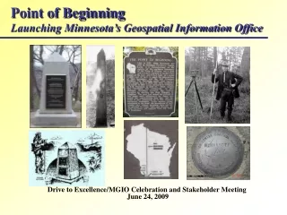
Point of BeginningLaunching Minnesota’s Geospatial Information Office Drive to Excellence/MGIO Celebration and Stakeholder Meeting June 24, 2009
Point of BeginningAgenda • Welcome (David Arbeit) • The Executive View (Sheila Reger) (Gene Hugoson) (Gopal Khanna) • Contributors and Stakeholders • The Road We’ve Traveled (David Arbeit) • Project Overview/ Recommendations (Michael Terner) • The Legislative Mandate (David Arbeit) • Break (GIS/LIS Consortium) • Introducing the MGIO (David Arbeit) • The Challenge Ahead (David Arbeit) • A Community Dialog (All) • Adjourn
Point of BeginningExecutive Leadership Sheila RegerChair, Drive to Excellence Subcabinet CommissionerDepartment of Administration Gene HugosonProject SponsorCommissionerMN Department of Agriculture Gopal KhannaCommissioner and State CIOOffice of Enterprise Technology
Point of BeginningAdvisors, Contributors and Stakeholders Drive to Excellence Steering CommitteeProject Sponsors: Commissioners Brad Moore and Gene Hugoson Governors Council on Geographic Information GCGI Strategic Planning CommitteeCo-Chairs: Victoria Reinhardt, Mike Dolbow (Co-Chairs) Legislative SponsorsAuthors of Legislation: Representative Phyllis Kahn and Senator Don Betzold Community of PartnersMore than 250 stakeholders who have participated in forums, meetings, panels, interviews, and discussions.
DTE GIS Coordination InitiativeSteering Committee Sponsors Gene Hugoson -- Commissioner, Agriculture Brad Moore -- Commissioner, MPCA Team Members David Arbeit -- Administration Michael Barnes --Transportation Janet Cain --Public Safety Paul Egers -- MPCA Margaret Kelly --Health John Lally -- OET Fred Logman -- Administration Robert Maki -- DNR Wendy Nelson -- Health Larry Palmer --Agriculture Leo Raudys -- MPCA Dan Storkamp -- Corrections
David Arbeit, LMIC/Administration David Brandt, Washington County Curtis Carlson, MLS of Minnesota Will Craig, University of Minnesota Mike Dolbow, Department of Agriculture Kris Eide, Department of Public Safety Rebecca Foster, MN GIS/LIS Consortium Rick Gelbmann, Metropolitan Council Jeffrey Grussing, Great River Energy Joshua Gumm, Scott County Tim Loesch, DNR Tom Mathisen, City of Crystal Lee Meilleur, Legislative GIS Office Richard Morey, MnDOT Tim Ogg, BWSR Victoria Reinhardt, Ramsey County Eileen Quam, OET Tad Schindler, MPCA Gerry Sjerven, NRRI, U of M Mark Sloan, Clay County Sally Wakefield, 1000 Friends of Minnesota Ron Wencl, USGS Brenda Zachman, USDA Point of BeginningAdvisors, Contributors and Stakeholders • Governors Council on Geographic Information
Point of BeginningAdvisors, Contributors and Stakeholders Community of Partners
Point of BeginningOur Journey to Here 1978: LMIC established – 1st state GIS program in nation 1990: First Strategic Plan for State GIS (PlanGraphics) 1991: Executive Order creates Governor’s Council on GI 2004: Second Strategic Plan for State GIS (GCGI) 2006: NSGIC State coordination guidelines/grant 2007: Compass Points retreat recommends strategic priorities 2008: Enterprise GIS adopted as DTE Subcabinet initiative 2009: MGIO authorized by legislation
Point of BeginningOur Journey to Here 1990: Strategic GIS Plan (PlanGraphics) • Reorganize to coordinate GIS activities and investments among all state agencies. • Policy responsibilities • Data Clearinghouse • Coordinate data development • GIS Service Bureau • Link GIS coordination to authorizations for IT. • Create advisory bodies for State and statewide issues. • LMIC serves as foundation for new office. • Provide appropriate and stable funding structure.
Point of BeginningOur Journey to Here 2004: Mn Governor’s Council on GI A Foundation for Coordinated GIS: Minnesota’s Spatial Data Infrastructure Recommended assigning explicit authority and responsibility for GIS coordination to a cabinet level agency.
A Foundation for Coordinated GISMinnesota’s Spatial Data Infrastructure Roles & Responsibilities: Coordinating Organization • Oversee statewide GIS infrastructure, including data plans. • Monitor effectiveness of adopted policies and recommend actions. • Work with stakeholders to identify GIS needs and priorities. • Identify new and emerging opportunities that improve the effectiveness of state programs through use of GIS. • Identify and coordinate opportunities for joint GIS projects and leveraged resources.
A Foundation for Coordinated GISMinnesota’s Spatial Data Infrastructure Roles & Responsibilities: Coordinating Organization • Coordinate agency GIS within state’s IT architecture framework. • Advocate for Minnesota’s GIS stakeholders to executive branch and legislature, federal agencies and other organizations. • Serve as the state’s liaison and representative to federal mapping agencies and national GIS organizations. • Develop/ maintain MN Geographic Data Clearinghouse services.
Point of BeginningOur Journey to Here 2006: NSGIC 50 States Initiative NSGIC’s criteria for successful state coordination reinforced the recommendations in A Foundation for Coordinated GIS.
Point of BeginningOur Journey to Here NSGIC Criteria for Success • An office with clearly defined authority for statewide coordination of GIS technologies and data. • A full time, paid coordinator with the authority to implement the state’s business and strategic plan. • A formal relationship with the state’s Chief Information Officer. • A champion (political or executive decision maker) committed to coordinated GIS.
Point of BeginningOur Journey to Here Compass PointsSetting a Direction for Minnesota’s GIS Future 2007
Compass PointsSetting a Direction for Minnesota’s GIS Future Strategic Planning retreat held to confirm a vision for coordinated GIS and set a direction for achieving it. • Full day retreat held on June 25, 2007 • Attended by 54 invited participants • Legislators and legislative staff • Agency CIOs and GIS Coordinators • GI Council members • Local, regional, and federal representatives • Educators/researchers/non-profit representatives • Business • Professionally facilitated
Compass PointsSetting a Direction for Minnesota’s GIS Future Executive Sponsors Dana BadgerowCommissionerDepartment of Administration Gopal KhannaCommissioner and State CIOOffice of Enterprise Technology
State Agencies Governor’s Council Met Council MetroGIS Counties Regional Agencies Municipalities Legislature Federal Agencies Academic institutions Utilities Professional Associations Non-profits School Districts Vendors Businesses Compass PointsSetting a Direction for Minnesota’s GIS Future Stakeholders
Compass Points Planning RetreatSetting a Direction for Minnesota’s GIS Future Facilitated Discussions – Large and Small Groups • Achievements • Setbacks • Strengths • Weaknesses • Opportunities • Threats • Issues
Compass PointsSetting a Direction for Minnesota’s GIS Future Coordination Service or Function • Policy • Priorities and Strategies • Investments • Standards and Architecture • Communications • Coordination • Data Library • Technology • Tools • Assistance • Consulting
Compass PointsRecommendations Vision Statement Should Focus on MinnesotaCreate a vision statement to reflect concerns raised at the retreat. GIS Coordination within State Government is Critical Develop a strategy for State agency GIS coordination. Coordinated StrategiesThe community needs to coordinate funding priorities for discussion with the legislature well in advance of the next budget cycle.
Coordinated Affordable Reliable Effective GIS Compass PointsVision Minnesota improves services statewide through the coordinated, affordable, reliable, and effective use of GIS.
Compass PointsNext Steps Focus on GIS Coordination for State Government • Establish a Steering Committee • Hire consultant to lead effort • Analyze business functions to determine GIS needs • Identify GIS functions that could be coordinated or centralized • Develop organizational and operational recommendations • Identify governance structure with active community involvement • Present to Executive Sponsor(s) by fall of 2008
DTE GIS Coordination Initiative Project Overview ObjectiveDevelop, recommend and implement a framework to coordinate GIS as an “enterprise” activity of state government. Elements • Organizational TransformationOrganizational changes and governance framework to institutionalize capacity for coordination. • Functional TransformationTechnical aspects of providing GIS services needed to support the State functions and programs.
DTE GIS Coordination Initiative Project Overview ObjectiveDevelop, recommend and implement a framework to coordinate GIS as an “enterprise” activity of state government. Scope and Timing • ScopeFocuses on State Government • Time FrameFast tracked to impact next budget/legislative cycle.
Point of BeginningOur Journey to Here 2008: DTE GIS Coordination Study Applied Geographics Analysis and Strategic Design • Extensive analysis of State agency needs, capabilities, resources, and plans. • Detailed profiles of State agency GIS programs. • Analysis of GIS programs in other states. • Recommended program elements and design. • Implementation options, including staffing and costs.
Point of BeginningFunctional Transformation Study Project Consultant Applied GeographicsBoston, MA Michael Terner
Point of Beginning MGIO Established 2009: MGIO Legislation • Creates MN Geospatial Information Office in Department of Administration and headed by a Chief Geospatial Information Officer. • Authority to coordinate, guide, and plan implementation of GIS. • Duties assigned reflect 2004 GCGI recommendations, refined during DTE process based on stakeholder input. • Requires CGIO to work closely with State CIO. • Provides for governance with advice from state agency and statewide advisory councils. • Transfers resources of LMIC to MGIO.
Point of BeginningLaunching Minnesota’s Geospatial Information Office Celebratory Break! Refreshments courtesy of MN GIS/LIS Consortium
Point of BeginningIntroducing MnGeo Improving services statewide through the coordinated, affordable, reliable, and effective use of GIS.
Point of BeginningIntroducing MnGeo MnGeo Staff David Arbeit – Director (CGIO) Norm Anderson –Project Consultant Anna Brenes – Project Specialist Chris Cialek –Coordination (Data and Licenses) Jim Dickerson –Geospatial Web Services Specialist John Hoshal – Coordination (Public Safety)/Project Services Supervisor Andrew Koebrick –Web Coordinator(PT) Jim Krumrie –Project Specialist Sandi Kuitunen – Project Specialist Fred Logman –Coordination Consultant (PT) Brent Lund –Applications Programmer Susanne Maeder –Coordination (Data - Hydrography) Pete Olson –System Administrator/Programmer Augusta Paye – Administrative Support Nancy Rader –Coordination (Data and Council Support)
Point of BeginningIntroducing MnGeo MnGeo Organization
Point of BeginningOur Advisors • Two related stakeholder councils will advise MnGeo. • MnGeo Agency Advisory CouncilAdvises MnGeo on improving state government services through the coordinated, affordable, reliable, and effective use of GIS. • MnGeo Statewide Advisory CouncilAdvises MnGeo and the geospatial community on improving servicesstatewidethrough the coordinated, affordable, reliable, and effective use of GIS.
Universities - UMN - MnSCU K-12 Education Businesses (2) Non Profit Organization GIS/LIS Consortium MetroGIS MnGeo (non-voting) Local Government (4) - Counties (2) - Cities (2) Regional Agencies (2) - Metropolitan Council - Non-Metro Organization Tribal (1) State Agencies (4) Federal Agencies (2) Point of BeginningOur Advisors The MnGeo Statewide Advisory Council will represent a cross-section of stakeholders and be chosen based on guidelines recommended by the Governor’s Council on GI. 23 Voting Members
Point of BeginningOur Advisors The MnGeo Agency Advisory Council will represent a cross-section of state government organizations and focus on issues that directly involve state agencies and offices. Chief Geospatial Information Officer (Chair) State Agencies & Constitutional Offices (8) Legislature Judiciary MnGeo Statewide Advisory Council (Non voting) 11 Voting Members
Point of BeginningOur Advisors Advisory Councils are required to be appointed using the Open Appointments process. What About Now? • Strategic Planning Committee of GCGI will be asked to serve as MnGeo Transition Advisory Team. • Outreach Committee of GCGI will be asked to serve as MnGeo Communications Advisory Team. • All other GCGI committees will be designated as MnGeo Technical Advisory teams. • Open Appointments process will be used to identify and recommend members
Point of BeginningOur Stakeholders MnGeo stakeholders include all organizations and users of geospatial technology to deliver, support or consume services in Minnesota. That means everybody! The Lines are Open
Point of BeginningThe Challenges Ahead MnGeo’s mandate is comprehensive and ambitious. It will take time to fulfill its promise and there are many challenges ahead that we need to face together. • PrioritiesMatch priorities to legislative mandate. • OperationalEvaluate existing services and make needed adjustments. • OrganizationalEvaluate organizational capacities and make needed adjustments. • ResourcesFocus limited resources on high priorities and pursue options to fill the “resource gaps.” • PartnershipsIdentify strategic partnerships and work to create them.
Point of BeginningWhat’s On Your Mind Launching MnGeo brings with it lots of questions. Here are some that we’ve heard. • Why do we need an MGIO? Doesn't LMIC already do this stuff? • Why does the office need a new name? • What will happen to LMIC? • Why will the MGIO be housed in Administration and not OET? • What happens to the GCGI and its committees? • I don't work in state government. Why should I care about the MGIO? • Funding for the MGIO seems too little to support the legislatively mandated duties. How will this problem be addressed?
Point of BeginningWhat’s On Your Mind Launching MnGeo brings with it lots of questions What concerns you?