Download
1 / 36
360 likes | 473 Vues
Learn how GIS, GPS, and Quantm software are transforming Karst analysis in the I-69 Mega-Project, enhancing fieldwork efficiency and environmental outcomes. Discover the significance of software in mapping, locating, and evaluating Karst features like caves, springs, and groundwater flow. Explore the integration of software in cave environments, species protection, and engineering considerations, essential for problem-solving throughout the I-69 project.

E N D
KARST FEATURES:Why Software is the CINDERELLAinI-69’sBIG DANCE Compiled / Created by: Bernardin-Lochmueller & Associates, Evansville, IN Quantm, Henderson, NV
First and foremost there needs to be clarification for a title like this, so… Why is software a Cinderella? • GIS software is used for pre & post field work • Quantm software is a decision making tool • GPS software speeds up field work • Cuts down on cost – no more hunting for the ‘Needle in the Haystack’ In the I-69 Mega-Project, software has made a Stunning impact on Karst analysis.
BIG DANCE REFERS TO THIS
HOW DOES SOFTWARE HELP? GLOBAL POSITIONING SYSTEM – GPS GEOGRAPHIC INFORMATION SYSTEM – GIS ROUTE ANALYSIS SOFTWARE - QUANTM
GPS SOFTWARE • Allows for field crews to accurately pinpoint the location of cave locations • Locations of caves can be loaded into the GPS unit prior to conducting field work , this allows for field personnel to go directly (in many cases) to cave opening instead of wandering around ‘hunting’ for the cave and thus saving valuable time & money.
GIS SOFTWARE Aids in identifying critical issues before conducting field work Create maps to aid in field work Create differing scenarios
Quantm Software • With necessary data inputs Quantm can help by. • Cutting Construction cost • Manage Complex Environmental Issues • Critical decision making process’s • Improved environmental outcomes
A BRIEF HISTORY OFI - 69 • INDOT wanted a GIS for the southwestern 26 counties of Indiana. • Tier I began January 5th 2000. • Tier I ended March 24th 2004. • Indiana GIS completed in 2002. • Tier II began March 2004.
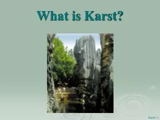
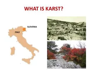
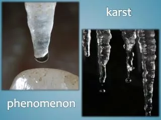
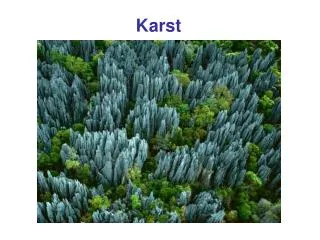
WHAT IS KARST? • Karst occurs in carbonic rock such as limestone & dolomite. • Karst forms by the rock dissolving groundwater in subterrainean settings
INDIANA KARST FEATURES
GIS, GPS, AND QUANTM SOFTWARE HELPS US MAP IT! LOCATE IT! EVALUATE IT!
CONSIDERATIONS IN KARST CAVE ENVIRONMENTS SPECIES GROUND WATER & SPRINGS ENGINEERING
Threatened & Endangered SPECIES Indiana Bat
Threatened & Endangered SPECIES Blind CrayFish
Threatened & Endangered SPECIES Spotted Cave Salamander
Threatened & Endangered SPECIES Cave Cricket
SOFTWARE IS ESSIENTIAL IN PROBLEM SOLVING IN THE I-69 PROJECT