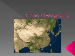
China’s Geography
210 likes | 417 Vues
China’s Geography. Location and Landforms. Landforms Home to 1.3 billion people 3.7 million square miles Eastern 1/3 of country: live in arable (farmable) land Western China: nomadic herders People make terraces on hills for farmland. China vs. the U. S. in Size. China. United States.

China’s Geography
E N D
Presentation Transcript
Location and Landforms Landforms • Home to 1.3 billion people • 3.7 million square miles • Eastern 1/3 of country: live in arable(farmable) land • Western China: nomadic herders • People make terraces on hills for farmland
China vs. the U. S. in Size China United States
Regions of China • There are Six Main Regions of China 1. North China 2. South China 3. The Northeast 4. Mongolia 5. Xinjiang (sheen jee ahng) 6. Xizang (shee dzahng)
B. North China: Major city: Beijing Manufacturing center and China’s capital Warm or hot summers and cold winters. Rainfall varies greatly and farmers never know how much to expect. C. South China: much richer farming and industrial region. Grow rice, cotton, tea, vegetables and many other crops D. Manchuria: home to the Manchu who conquered China during the 1600s (Cold Climate)
E. Gobi Desert: summers are extremely hot and winters are bitterly cold F. Xinjiang: important oil-producing region G. Tibet- sits among several mountain ranges, including the Himalayas - Since taking over Tibet in 1950, China has tried to develop its rivers for hydroelectric power. Tibet has wanted freedom for years from China.
Major Rivers Huang He: Yellow River • 1000s of miles long • “River of Sorrow” because of floods: but silt is a positive outcome Chang (Yangtze) River • Carries much of China’s trade • Shanghai • Hydroelectric power along the river: Three Gorges Dam Xi River (West River) • South China
Bodies of Water Amur River Sea of Japan Yellow Sea Huang-He River Yangtze River Xi River Pacific Ocean SouthChinaSea
People • 92% of the people who make up China’s population are Han, or ethnic Chinese • Minority groups: Mongols, Tibetans • Many different dialects but Mandarin, which is spoken in North China, is the country’s official language
Fact Check… • How many people are found in China? • Where do most of these people live? • How many regions are found in China? • Where is most of the manufacturing and industry found? • Name one important River in China. • What has helped keep China so isolated from the rest of the world? • What is the official language of China? • Most Chinese are of this ethnic background
Resources • Susan M. PojerHorace Greeley HS Chappaqua, NY • World Cultures: A Global Mosaic