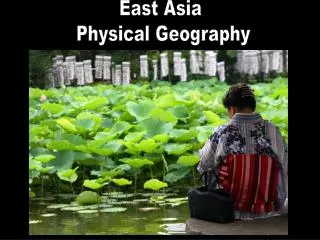
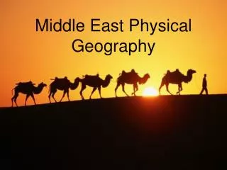
East Asia Physical Geography
470 likes | 2.41k Vues
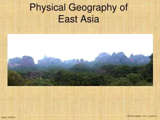
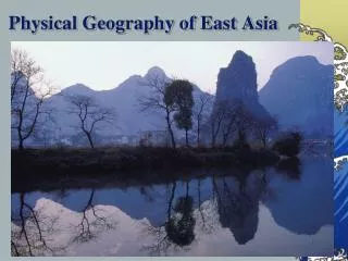
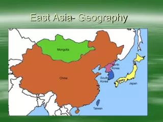
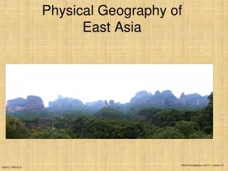
East Asia Physical Geography . Land and Water . Variety of Landforms in East Asia Plateaus – Plateau of Tibet Mountains – Himalayas (Mount Everest) Plains – North China Plain (loess- very fertile soil) Islands - Created from tectonic plates and lava from volcanoes

East Asia Physical Geography
E N D
Presentation Transcript
Land and Water • Variety of Landforms in East Asia • Plateaus – Plateau of Tibet • Mountains – Himalayas (Mount Everest) • Plains – North China Plain (loess- very fertile soil) • Islands - Created from tectonic plates and lava from volcanoes • 1.5 billion people live in East Asia
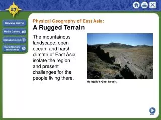
Mount Everest The Himalayas
China • Oldest civilizations found in China • More than one billion people today • Majority of land is desert and mountains • Gobi Desert • Important Rivers: Chang and Huang(yellow) • People live mainly around the rivers
China • 4,160 miles long • Built in 7th Century to divide small states
Japan • Archipelago – group of islands • 4 major islands: Hokkaido, Honshu, Shikoku, Kyushu • More than 3,000 smaller islands • Honshu is the most populated island • Tokyo (capital) located on Honshu
North and South Korea • Located on a peninsula • Been divided since 1957 • Today, North Korea is a communist country
Jan 11-15 • Tuesday – Finish Guided reading and Review Worksheet pgs. 230-233 • Wednesday – Study East Asia Vocabulary Ch. 8 • Thursday – Finish Study Guide for Ch. 8 • Friday – Relax/ No School MONDAY MLK Jr. Day
East Asia Climate and Vegetation • Variety of climates from tropical wet areas to subarctic tundra • Monsoons – winds that change direction with the change of seasons • Monsoons bring huge rainfalls from late spring to fall/autumn • In winter monsoon blows, east making interior Asia dry and icy
Climate and Vegetation • Typhoons – (hurricanes) • Trees • Deciduous – leave-shedding every year • Evergreen – stays green all year • Vegetation – depends on climate • Example: desert = no vegetation tropical wet = rain forest
Climate and Vegetation • People farm on the plains near the rivers where flooding occurs • Bamboo- major crop, needs plenty of water
Climate and Vegetation • Rice – grows in warm, wet areas (Main food eaten by Asians) • Wheat and grains grown in drier, cooler areas
Climates of East Asia • 7 Types of Climates in East Asia • Semiarid (Mongolia) • Arid (China/Gobi Desert) • Humid Subtropical (parts of Japan and Koreas) • Humid Continental (China and part of Japan) • Highlands (China/Plateau of Tibet) • Tropical Wet (small portion of China) • Subarctic (Siberia/Russia)
Vegetations of East Asia • 8 Vegetation Regions in East Asia • Tropical Rain Forest (South China) • Deciduous Forest (Japan, Koreas, and China) • Mixed Forest (China) • Coniferous Forest (Siberia/Russia) • Tropical Savanna (South China) • Temperate Grassland (Mongolia) • Desert Scrub (China/Gobi Desert) • Highlands (China/Plateau of Tibet)
East Asia Natural Resources and Land Uses • East Asia is abundant in natural resources • Coal, Natural Gas, Oil (Japan) • Coal and Iron (North Korea) • Graphite (South Korea) • Coal, Copper, Tin, Iron (China)
Hydroelectricity • Only 20% of China’s energy comes from hydroelectricity • China is in the process of building more dams and power plants but they are very costly • Example: The Three Gorges Dam located on the Chang River
Aquaculture • East Asia’s oceans and water sources provide the area with food • Overfishing and pollution has caused a decreased supply for people • Aquaculture – farm raised fish has become popular food source for East Asians
Land Use for Food • Small percent of the land in East Asia can be used for farming because of mountains, plateaus, etc. • Terrace farming used • Double –Cropping – growing two crops at once • One crop is planted in rows between other crop
Review Questionspages 236 – 240 • Why is China building the Three Gorges dam? • How does the Koreas make up for a lack of natural resources? • Why was aquaculture needed in East Asia? • Explain two farming techniques used in East Asia.