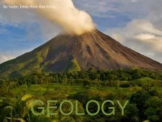
Geology
Geology. APES. Geologic origin of rocks. Dynamic process…always changing. Geologic origin of rocks in Reference to SC Geologic Time sloooow process. Geologic Processes. Internal Processes Originating from Earth’s interior

Geology
E N D
Presentation Transcript
Geology APES
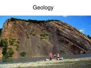
Geologic origin of rocks Dynamic process…always changing
Geologic origin of rocks in Reference to SCGeologic Timesloooow process
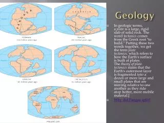
Geologic Processes • Internal Processes • Originating from Earth’s interior • Internal Processes drive plate tectonics, earthquakes, volcanoes
Geologic processes (cont.) • External Processes • Based on the energy from the sun and/or gravity • Erosion and Weathering • Erosion: material removed from one location and deposited somewhere else. • Weathering: produces the material to be eroded
Chemical Weathering Limestone Cavern, KY Limestone Statute, Bath, England Lichens, Big Bend NP, TX
Physical Weathering Columnar joints in the Tertiary intrusive Devils Tower at Devils Tower National Monument, WY. Note the talus derived from mechanical weathering of the columnar joints.
Multiple rock types Igneous, metamorphic or sedimentary Low economic value Uniform Igneous, metamorphic, or sedimentary Have significant value Rocks vs. Minerals
Gold Mining in South Carolina Haile Gold Mine, Kershaw Co. 2.7 million ounces still there
Rock Types • Sedimentary: formed from sediments from pre-existing rocks • Igneous: pre-existing rocks melt below surface and are cooled • Metamorphic: pre-existing rocks are subjected to extreme pressure/temperature
Identifying Metamorphic Rocks • Type of parent material • Color and thickness of layers • Angle of layers • Evidence of folds and faults • Embedded material • Type and impact of weathering
Soil Mapping and Land Suitability • Potential future uses and therefore value • Building constraints (foundation stability, drainage) • Potential for erosion • Types of crops • Silviculture • Regulatory constraints (wetlands, steep slopes, groundwater recharge)
What is Soil? • Parent material is slate based metamorphic rock strongly influenced by millions of years of erosion • Typical soil is • 45% geologic materials • 25% water • 25% air • 5% organic matter • Soils at DFHS have high clay content, are blocky, and are friable (easily crumbled)
Soils Differ • Content: combination of sizes • Clay – very fine particulate (sticky) • Silt – fine particulate (smooth) • Sand – medium sized particulate (gritty) • Gravel – course particulate • This determines the soil texture • Soils with equal mixtures are called loams (best for plant)
Growth Suitability • Soil Permeability: determined by the spaces between the sediments. Measures the rate at which air/water can move through soil layers. • Porosity – average distances. More porous can hold more air/water • Want to hold plenty of water, but not be too hard where water cannot move through layers • Soil Alkilnity: pH. Influences ability of plants to get nutrients from the soil. • Too alkaline or too acidic will not support plant growth.
Why Map Soils? • Determine uses of land and therefore its $$$ • Locate building sites, sewers, and septic tanks • Determine type of crops, grasses, and trees that can be planted • Comply with regulations protecting wetlands, steep slopes, and groundwater recharge areas
DFHS/DFMS Soil Types Symbol Name Description NaCNason Deep, well drained, moderate to steep NaE Silt slopes, good for cotton, some limits NaB Loam on foundations due to clay and slopes GeBGeorgeville Moderately permeable, formed by GeC residual slate deposits, B horizon more red than Nason soils, good for corn, soybeans, building foundations
USDA Soil Map of DFMS and DFHS Area DFHS DFMS Old Tamah Road
Degradation of Soils • How are soils degraded? • Over use: • Farming • Logging • Grazing • Impacts? • Loss of arable land • Erosion • Desertification • What can be done?