Download
1 / 21
210 likes | 346 Vues
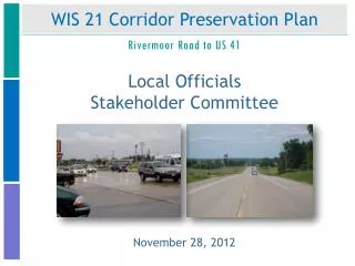
WIS 21 Corridor Preservation Plan. Rivermoor Road to US 41. Local Officials Stakeholder Committee. November 28, 2012. Today’s Agenda. Introductions Project History Project Re-Start Project Outcomes Table Exercise What’s Next. Project History. Project History. Project History.

E N D
WIS 21 Corridor Preservation Plan Rivermoor Road to US 41 Local Officials Stakeholder Committee November 28, 2012
Today’s Agenda • Introductions • Project History • Project Re-Start • Project Outcomes • Table Exercise • What’s Next
Current Status Winter 2012 • New Project Manager: Bryan Lipke • Re-evaluated project outcomes in light of findings, data and results of stakeholder involvement • Map for eventual expressway • Limited access controls over the long-term • Identify phased improvements to meet state, regional and local transportation objectives
Purpose and Need WIS 21 Corridor Goal Meet long-term transportation needs by providing safe, dependable and efficient movement of traffic while enhancing economic viability. WIS 21 Corridor Objectives Improve mobility and operating capacity by reducing congestion and travel time. Improve safety by reducing intersection-related crashes and conflict points. Improve aesthetics by minimizing billboards and utilizing community sensitive design techniques. Enhance economic viability by reducing congestion and improving accessibility. Find an acceptable balance between mobility and accessibility. Develop transportation improvements that are compatible with sound comprehensive plans. Provide transportation improvements using cost-effective strategies. Provide a transportation system that minimizes negative impacts on aesthetics, environment, and community. Develop a plan that provides for alternate modes of transportation, such as bicycles and pedestrians. Purpose Designate and Officially Map WIS 21 as an Expressway under §84.295 Need Preserve regional mobility Maintain or improve existing safety conditions Preserve public investment along WIS 21 ahead of future development through local collaboration
Intersection Improvements J-Turn Intersection 16 Conflict Points RIRO with Left In Intersection 12 Conflict Points Right-In-Right-Out Intersection 4 Conflict Points Roundabout Intersection 16 Conflict Points Full Service Intersection 40 Conflict Points
Introduction to J-Turns J-Turn Intersection 16 Conflict Points
Workgroups • Identify • Land use changes • Intersection treatments • West End Limits • Access • Emergent Issues
Study Process with Schedule • STUDY • Data Collection • Public Involvement • Preliminary Concepts • EA & DESIGN • Environmental • Assessment • Purpose and Need • Range of Alternatives • Evaluation of Effects • Preferred Alternative EXPRESSWAYDECLARATION and Official Map
Contact Information Bryan Lipke WisDOT Planning Project Manager (920) 492-5703 bryan.lipke@dot.wi.gov
Project History Existing Land Use Planned Land Use
Project Outcomes: Official Map • WisDOT will map and preserve land required to convert WIS 21 to an expressway under Wis. Statutes §84.295(10) including: • Necessary right of way to construct divided highway • Grade separations: overpass or underpass at the interchange with the West Side Arterial • Alterations, removals, or additions to the local road system • Alterations to private access along local road system as part of new connections
Project Outcomes: Official Map Purpose and Need Range of Alternatives Alternatives Analysis and Evaluation of Impacts Selection of a Preferred Alternative