Download
1 / 77
770 likes | 913 Vues
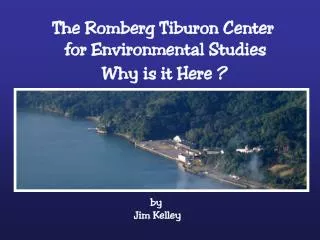
The Romberg Tiburon Center for Environmental Studies. Why is it Here ?. by Jim Kelley. Why Do We Live in the Bay Area?. San Francisco Bay Makes Life in the Bay Area What It Is. What Do You Think Of When You Hear “San Francisco Bay?” . A Famous Bridge?. A Beautiful Landscape? .

E N D
The Romberg Tiburon Center for Environmental Studies Why is it Here ? by Jim Kelley
Why Do We Live in the Bay Area? jim kelley
What Do You Think Of When You Hear “San Francisco Bay?” jim kelley
A Famous Bridge? jim kelley
A Beautiful Landscape? jim kelley
Alcatraz? jim kelley
Fisherman’s Wharf? jim kelley
Silicon Valley? jim kelley
Big Boat Races? jim kelley
An Urbanized Estuary? jim kelley
Estuaries Are Places Where a River Meets the Sea This May Occur in a Bay, for example… • San Francisco Bay • Chesapeake Bay • Bo Hai Gulf of the Yellow River • Thames River Estuary jim kelley
Bo Hai Gulf Yellow River Thames Estuary jim kelley
Estuaries Are Places Where a River Meets the Sea Or It May Occur in a Fjord, for example… • Oslofjord • Puget Sound • Cook Inlet jim kelley
Cook Inlet Anchorage Oslo Oslofjord Puget Sound jim kelley
Estuaries Of Course Deltas Are Also Places Where A River Meets the Sea, But In Deltas the Fresh and Salt Water Mix Turbulently at the Delta Margin, so they Behave Differently from Estuaries. Examples are: • Mississippi River (Historically) • Mekong Delta • The Netherlands (Rhine River Delta) jim kelley
1973 1989 2003 Erosion of the Mississippi Delta Mekong River Rhine Netherlands jim kelley
Estuaries • Are Important Nursery Grounds for the Ocean • Are as Biologically Productive as Irrigated Agriculture on a per square meter basis • Are Home to Most of the World’s Human Population • The Sites of Most of the World’s Great Cities • Are the Most Heavily Affected Parts of the Ocean jim kelley
Cities on Estuaries • Buenos Aires • Montevideo • Rio de Janeiro • Washington D.C. • Ho Chi Min City • Tokyo • St. Petersburg • Bangkok • San Francisco • New York • London • Rangoon • Shanghai • Dhaka • Bombay • Vladivostok jim kelley
Sylvia Mc Laughlin, Founder Save the Bay, 1961 jim kelley
Often Estuaries are “Tidal” ~~~~~~~~~~~~~~~~~~~~~~ The Salt Water Wedge moves Landward on the Flood Tide And Seaward on the Ebb Tide ~~~~~~~~~~~~~~ At the Golden Gate this Daily Flow is 6 Times the Volume Of the Mississippi River jim kelley
Before Oceanographers Looked At the Bay, Engineers Assumed That Since the Tidal Prism is 1/3 of the Volume of the Bay, The Bay Flushes Every Three Days jim kelley
The Original Misconception Tidal Mixing Flushes the Bay Every Three Days Bay Water Day 3 Day 1 Day 2 Ocean Water Salt Water jim kelley
If the Bay Flushes Every Three Days by Tidal Action, You Can Divert as Much Water as You Like jim kelley
Estuaries are threatened by: 1. Water Diversion 2. Wetland Loss 3. Invasive Species 4. Pollution jim kelley
Estuaries are threatened by: 1. Water Diversion jim kelley
In Estuaries • Fresh Water Flows Seaward, Floating on the Salt Water • Salt Water is Entrained at the Bottom of the Fresh Water Lens • The Fresh Water Lens Becomes Saltier as it Moves Seaward • The Salt Water “Wedge” Flows Landward, Against the Salinity Gradient jim kelley
Estuarine Circulation Fresh Water Salt Water jim kelley
Estuarine Circulation Fresh Water Salt Water jim kelley
Estuarine Circulation Fresh Water Salt Water jim kelley
Estuarine Circulation Fresh Water Salt Water jim kelley
Most of the Estuarine Circulation Is in the North Bay (San Pablo Bay) And the Central Bay jim kelley
The Salt Water Wedge is not Flowing “Uphill” It is Flowing Across a Salinity Gradient And thus is Flowing “Downhill” From Higher Salinity to Lower Salinity jim kelley
San Francisco Bay Is Fed by the Sacramento and San Joaquin Rivers ~~~~~~~~~~~ Together the Drain 43% of The Land Area of California Sacramento Valley San Joaquin Valley jim kelley
Most of the Water First Falls as Snow in the Sierra Nevada And the Siskiyou Mountains Siskiyous Sierra Nevada jim kelley
Most of the Water First Falls as Snow in the Sierra Nevada And the Siskiyou Mountains Siskiyou Mountains Sierra Nevada jim kelley
Annual Mean Total Precipitation jim kelley
So, in California, The Water is in the North (Green), but The People are in the South (Brown) ~~~~~ This Makes California Politics even more Interesting the They would be Otherwise jim kelley
So, in California, The Water is in the North (Green), but The People are in the South (Brown) ~~~~~ This Makes California Politics even more Interesting the They would be Otherwise jim kelley
Actually, Only 15 % Of the Water Diverted FromSan Francisco Bay Goes to Los Angeles ~~~~~~~~ 85 % Is Used By Central Valley Agriculture jim kelley
80 60 40 20 0 Inflow and Outflow (km3/year) Inflow Outflow 1960 1970 1980 1990 2000 Water Year jim kelley
60 40 % 20 0 8 6 4 2 0 Export Flow (km3/year) Percent Flow Diverted 1960 1970 1980 1990 2000 Water Year jim kelley
Estuaries are threatened by: 1. Water Diversion 2. Wetland Loss jim kelley
Wetlands in 1848 Wetlands Today San Francisco Bay Has Lost 95% Of Its Natural Wetlands In the Past 160 Years jim kelley
Wetlands Today Wetlands in 1848 jim kelley
Hydraulic Mining in the Sierra Raised the Seabed Of San Francisco Bay 1 Meter Before it was Stopped in 1884 jim kelley
Grove Karl Gilbert Studied the Effects Of Hydraulic Mining On The Bay and Delta jim kelley
The California Academy of Sciences Was Founded in 1853 by 7 Men Concerned About the Effects of Hydraulic Mining Andrew Randall jim kelley
Estuaries are threatened by: 1. Water Diversion 2. Wetland Loss 3. Invasive Species jim kelley