Download

1 / 22
220 likes | 330 Vues
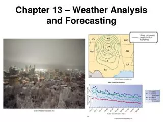
Flash Flood Monitoring and Prediction (FFMP) Flash Flood Monitoring and Prediction-Advanced (FFMPA). Reggina Cabrera NOAA/National Weather Service Eastern Region. Johnson City - Picture from Pressconne cts.com. Tools. FFPI FFMPA . FFMP.

E N D
Flash Flood Monitoring and Prediction (FFMP)Flash Flood Monitoring and Prediction-Advanced (FFMPA) Reggina Cabrera NOAA/NationalWeather Service Eastern Region Johnson City - Picture from Pressconnects.com
FFMP • Flash Flood Monitoring and Prediction (FFMP) is a Decision Assistance tool specifically designed to help forecasters monitor and evaluate the flash flood threat and decide whether or not to issue flash flood warnings • It does this by using radar data to calculate precipitation accumulation in hydrologic water basins over various time periods and compare to the suggested Flash Flood Guidance (FFG), provided by River Forecast Centers (RFCs).
Flash Flood Monitoring and Prediction tool used by National Weather Service forecasters to track the precipitation rates and accumulations in small basins (typically 5 to 25 square kilometers) as compared to flash flood guidance. Information is updated every 4.5 to 6 minutes. The stream name and county can also be displayed so more specific information can be included in flash flood warning messages.
Data Requirements • Radar: DHR product for each applicable radar • Basin shapefile for each applicable radar • Radar Bin shapefile for each applicable radar • Flash Flood Guidance (FFG) issued by the RFCs.
Basins 2-20 mi2
Basic Components • Processor • Creates input data • Display • Displays data as an image (map) • Displays data in a table • Displays data in a time trend • Flash Flood Threat Indicator (FFTI) • The Monitor
Processor Ingests • Localization • Radar data • Flash Flood Guidance (FFG) Writes output for each radar volume scan: • /data/fxa/radar/@@@@/ffmp/yyyymmdd_hhmm* • /data/fxa/radar/@@@@/ffmp/accumulation*
Display • Image: displays Counties or Basins • Basin Table: GUI presenting data in tabular form • Basin Trend: launched form Basin Table or D2D Image (if made active)
Set of Displays D2D Image Basin Trend Graph Basin Table
County Precipitation Accumulation Display Left Click on County Name To zoom in Images from a WFO-created Presentation
Basin Precipitation Accumulation Display • Only displays those basins within the county area selected. FFMP 1.0 Hour Basin Avg Precip Right Click to display the Basin Trend. Left Click to Zoom out. Left Click to Zoom in more.
Basin Trend Graph Where the accumulation is above the FFG there is a threat of flash flooding Accumulation Instantaneous Rate Flash Flood Guidance
Flash Flood Threat Indicator (FFTI). Provides GUI to define settings. Note: FFG Expiration definition is here.
Highlights/Strengths: Split Window • Combine QPE with QPF, then compare to guidance • Brings much more of a predictive quality to FFMP
Questions? Reggina.Cabrera@noaa.gov Binghamton, NY - Picture from Pressconnects.com