Evaluating the Need for Comprehensive Vegetation Inventory Across All Lands by FIA
110 likes | 242 Vues
The Forest Inventory and Analysis (FIA) program currently lacks a cohesive effort to inventory, monitor, and assess vegetation across all lands nationally. Various regions, including Montana and parts of California, Oregon, and Washington, have developed specific protocols but operate independently. This paper explores how FIA is aligning its activities with sustainable rangeland management through partnerships like the Sustainable Rangeland Roundtable. It emphasizes the importance of developing desired conditions and monitoring plans to support effective land management and adaptive strategies.

Evaluating the Need for Comprehensive Vegetation Inventory Across All Lands by FIA
E N D
Presentation Transcript
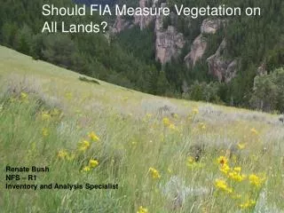
Should FIA Measure Vegetation on All Lands? All Condition Inventories Renate Bush NFS – R1 Inventory and Analysis Specialist
All Condition Inventory • Current Status: • There is no coordinated effort specifically designed to inventory, monitor, or assess all conditions at the national level
National Forest Systems current condition • Region 1: All R1 lands in Montana, N. Idaho, North Dakota, South Dakota • Region 4: 2 National Forests • Region 5: All R5 lands in California • Region 6: All R6 lands in Oregon and Washington • R8, R9, and R10 are considering
National Forest Systems current condition • No national core optional protocols available • Each NFS Region has worked with their FIA Region to develop protocols (R1 and R4 with IW-FIA, R5 and R6 with PNW-FIA)
How is NFS using information on all lands? • Develop a set of desired conditions for land management planning (LMP) • Develop associated monitoring plans • Use broad-level current and desired conditions to set the context for management actions • Assess the current condition of an ecosystem and trends over time • Support adaptive management strategies
What is FIA doing? Sustainable Rangeland Roundtable (SRR) • Collaborative partnership established to assess rangeland sustainability • Comprised of over 50 organizations including conservation associations; land trusts; tribal, federal and state agencies; universities; and corporate and private landowners • Developed a set of social, economic and ecological indicators for assessing rangeland sustainability
What is FIA doing? • In May 2005, SRR asked the federal agencies participating in the Roundtable • to develop a proposal for incorporating the SRR indicators into their ongoing assessment activities and • to develop a strategic level inventory of the nations rangelands
Multi-agency Rangeland Pilot • Federal agencies BLM,NRCS, USFS • Utilize existing inventory programs The Forest Inventory and Analysis (FIA) USFS The National Resources Inventory (NRI) NRCS • 5 indicators Bare ground Species composition Invasive plants Amount of “Rangeland”; Changes in Use (over time) Fragmentation
Expected Outcomesfor Pilot • Proof of concept that the FIA and NRI inventories can be combined for range indicators. • Estimates of four indicators • for entire pilot area, across all ownerships • for BLM lands within the pilot area
Oregon Multi-agency Rangeland Pilot • Planning: October 2006 - April 2007 • Data collection: May – October 2007 • Analyze data and report results – May 2008 • Internal review of report – May 2008 • External review of report – December 2008 • Showed that given proper planning and extensive coordination FIA and NRI inventories can be combined. • Next steps are currently under consideration
In closing • There is a need to have information on all lands • In some areas, may be efficient to extend FIA collection