Download
1 / 14
140 likes | 158 Vues
Explore the changing costs of extreme weather events and the role of insurance in managing flood risks in land use planning policies. Learn about strategies to reduce vulnerabilities and enhance resilience to climate change.

E N D
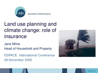
Land use planning and climate change: role of insurance Jane Milne Head of Household and Property ESPACE International Conference 29 November 2005
Changing costs of extreme weather • Costs doubling each decade • Since 1990, $16 bn each year on average • 2004 was costliest year on record: Central European Flood - $40 bn • Hurricane Katrina 2005 - $40 – 60 bn • UK Floods: Autumn 2000, Boscastle, Carlisle, North Yorkshire
UK Flood Cover • UK is unusual in offering flood cover as a standard feature of household insurance • Typical premium is £320 per year • Average flood cost £15 – 30k • Only sustainable where flood risk is managed.
ABI Statement of Principles • Provide flood cover as standard feature under normal competitive market for those at 1.3% annual probability of flooding (1-in-75 yr) or less • Continue cover in areas where defences will be in place in next five years that reduce risk to 1.3% annual probability or less • Use best efforts, on a case-by-case basis, with existing policyholders where no defences are planned and risks are unacceptably high
ABI Project “Making Communities Sustainable” • Potential financial costs of flooding arising from additional development in the growth areas • Most effective approaches to manage the risk in coming decades
Land Use Planning Policy (PPG25) Key features of PPG25: • Sequential approach potentially powerful, but: • EA only consulted on half applications • 1-in-5 applications where EA sustains its objection are approved • Only half final decisions reported back to EA
Mapping Development Sites onto Flood Map Source: Environment Agency, NERC/CEH, UK Hydrographic Office, Ordnance Survey
Adaptation 1a. Floodplain Avoidance • Ashford, M11 and South Midlands - Between 86 - 97% losses removed due to effective planning (PPG25) -100% savings in some locations (Aylesbury, Bedford, Kettering) • Thames Gateway - Limited scope for floodplain avoidance - very low savings
Adaptation 1b. Sequential test behind defences • Ashford, M11 and South Midlands - Higher development density results in 90 - 100% savings in most locations • Thames Gateway - Increased savings for most areas (40 - 52%)
Adaptation 2. Reduce Vulnerability • Increasing development density = Decreased damages (up to 58%) • Greatest impact in ‘significant’ flood risk areas • Increased construction costs per home (30 - 50%) • Additional benefits at groundlevel (car parking etc.)
ABI Guidance - Strategic Planning for Flood Risk • Planners and developers should consider key flooding and development issues when carrying out an appropriate flood risk assessment for their development plan • Key considerations: • LOCATION OF NEW DEVELOPMENTS: sequential planning approach • DESIGN OF NEW FLOOD DEFENCES: standard of defence and tackling aggregation • TYPES OF HOMES: fully-certified resilient construction methods • SITE CONSIDERATIONS: sustainable drainage
Conclusions • Stronger planning system to avoid flood risk where possible, including clearer role for Environment Agency and allowance for climate change • Code for Sustainable Buildings should include resilience to climate change (but still better to avoid floodplain) http://www.abi.org.uk/housing