Download
1 / 25
250 likes | 355 Vues
The workshop on decision-support tools and models in Lebanon focused on improving rural livelihoods in water-scarce areas. Key outputs included integrated water and land-use policies, enhanced stakeholder skills, and sustainable practices for farmers. The workshop also highlighted Lebanon's national water strategy, emphasizing infrastructure, wastewater management, and poverty reduction through agricultural practices.

E N D
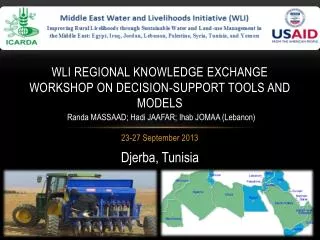
WLI Regional Knowledge Exchange Workshop on Decision-support Tools and Models Randa MASSAAD; Hadi JAAFAR; Ihab JOMAA (Lebanon) 23-27 September 2013 Djerba, Tunisia
Watershed location 1384 km2 El Qaa Village Mediterranean Sea
El Qaa village FTF Indicator: Number of hectares under improved technologies or management practices as a result of USG assistance: (300 ha) • Target population • 60 villages/Orontes Watershed Pilot area(s) for data collection(17,000 ha) Upscaling area (138,000 ha) Benchmark site (17,000 ha) 36˚ 28’ 48” 34 ˚ 20’ 31” • Benchmark = El Qaa villagepopulation • 900 households • 12000 total inhabitants • 45 % adult male • 55% adult female Cadastral Limit of El Qaa village
WLI Goal and Intended Outputs Overall Goal: to improve the livelihoods of rural households and communities in areas where water scarcity, land degradation, and associated problems are prevalent. Intended Outputs: 1. Integrated water and land-use strategies for policy-making, tools for sustainable benchmark management and organizational mechanisms for community inclusion at the benchmark site. 2. Enhanced knowledge, skills and qualifications for key stakeholders in the benchmark sites. 3. Improved rural livelihoods of farmers in the benchmark sites through the adoption of sustainable land and water management practices and livelihood strategies. Please insert a picture that represents your work • National water strategy in Lebanon: • Strategic objectives for the Lebanese water Sector • The vision is: "Water: A right for every citizen, a resource for the whole country"
The MEW has two main objectives, the infrastructure and the management of the water sector in Lebanon. Infrastructure 1- Production • Water quantity and quality 2- Transmission and Distribution • Insure proper water supply • Irrigation: Provide adequate quantities and quality of irrigation water and water-saving irrigation techniques 3- Wastewater • Wastewater collection and treatment MoA strategy to reduce poverty • - Good Agricultural Practices - Insure and distribute certified rootstocks • Subsidies some field crops • Irrigation water saving techniques Management of water sector in Lebanon 1- Institutional and Organizational 2- Financial 3- Legal and Regulatory 4- Environmental Concerns 5- Awareness and Conservation
Component1. Integrated water and land-use strategies Activity 1. Investigation of water availability at the benchmark area, water distribution schemes analysis study Source to Qaa Village Source Difference Village
Component1. Integrated water and land-use strategies Activity2: Irrigation/rainfed (micro level harvesting water) at small scale rainwater harvesting at farm level Slope 3% Najarims micro catchments
Semi-circular bunds Slope 3%
Qaa: NDVI and FOV temporal and spatial changes during the 21st century A GIS and Remote Sensing approach Hadi Jaafar, PhD FAFS AUB Beirut, Lebanon 9/12/2013
Brief • Area: 17383 ha • Cadastral: Qaa • Subject: Vegetation Changes • Period: 2000- 2013 ( May to August) • Index: Net difference vegetation and Fraction of Vegetation • Method: GIS, remote Sensing • Data: Landsat 5, 7 and 8 • Sensors: TM, ETM, and LOI
Method • ArcGIS data Model + Remote Sensing Difference between IR and Visible (Red) Band Reflectances (Gillies, et,al1997)
FOV, July • Highest in 2013
MODIS ET Results • MOD13A2 NASA Product
Discussion & Conclusion • Increase in NDVI in year 2013 • 18% above average in general • Difference due to increase in agricultural lands • Increase in fraction of vegetation cover • Difference implies increase in evapotranspiration • Less downstream flow to lower parts of Orontes
Activity 4: Conservation agriculture or no-tillageOn-farm pilot-testing of conservation agriculture (CA) continued at a 2 dunum testing site and a 2 dunum control site Planted :December with 18kg/dn of Durum wheat " Lahn". Fertilizers and herbicides were added in February The aim of the experiment is to compare CA to the conventional agriculture CV in the same land and same conditions. The experiment is expected to prove to farmers that CA can reduce the risk of crop failure in dry years, due its positive effects on the soil moisture levels. A farmer who is willing for water harvesting techniques to be pilot tested on his land was identified.
Printed a booklet on wheat in Arabicfor farmers (Plant Breeding Department and seed production) -varieties -Irrigation -Agricultural management…(fertilizer, harvesting..). Delivered in October Founded by WLI project
Component1. Integrated water and land-use strategies Activities suggested for 2014 Activity 1: Investigation of water availability at the benchmark area, water distribution schemes analysis study Activity2: Irrigation/rainfed (micro level harvesting water) at small scale rainwater harvesting at farm level Activity 4: Conservation agriculture or no-tillage Activity 5:On farm demonstration trial (Wheat, Barley and Chickpea) Activity 6: Effect of compost as a mulch on water productivity of sprinkle-irrigated potatoes in till and no-till systems (AUB)