Download
1 / 48
480 likes | 511 Vues
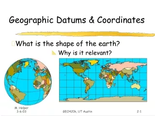
Understanding Coordinates Ellipsoids, Geoids, Datums and Projections. Important concepts for today. What is a Geographic Coordinate System (GCS)? What is a Datum? What is a Projected Coordinate System (PCS)? How do these apply to ArcGIS?. A Geographic Coordinate System.

E N D
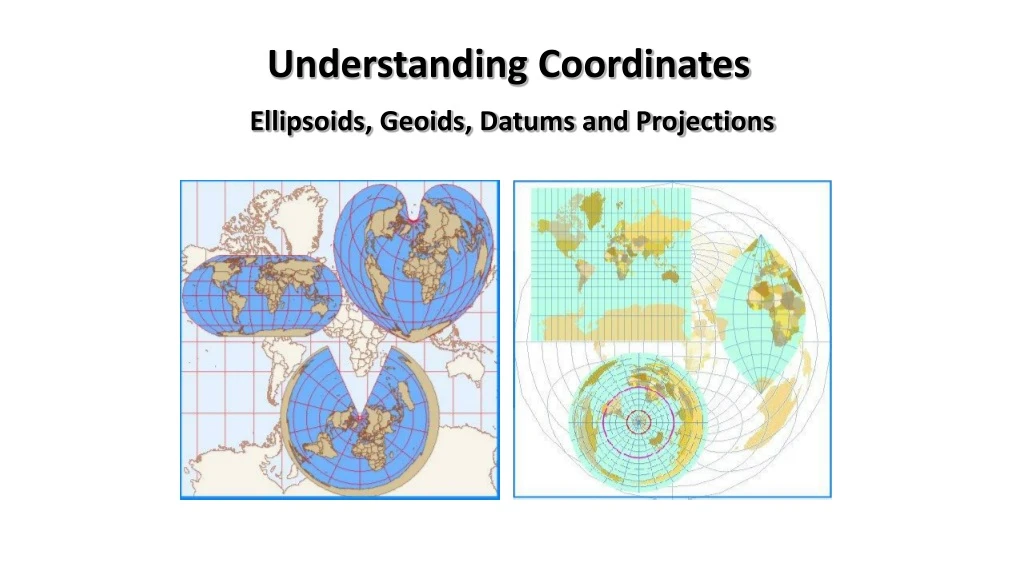
Understanding Coordinates Ellipsoids, Geoids, Datums and Projections
Important concepts for today • What is a Geographic Coordinate System (GCS)? • What is a Datum? • What is a Projected Coordinate System (PCS)? • How do these apply to ArcGIS?
A Geographic Coordinate System Means of measuring spherical coordinates that consists of: • Angular unit of measure • A prime meridian • A Datum
Geodetic Datum: • Reference frame for locations on the surface. • Based on: • Ellipsoid • Surface measurements
Shape of the Earth Sphere Ellipsoid
Axes of the Ellipsoid: Minor Major Axis Semi - Major Semi - Minor
Earth Geoid: http://earthobservatory.nasa.gov/Library/GRACE_Revised/page3.html
There are different ellipsoids that work best at different areas on earth:
Geodetic Datum: • Reference frame for locations on the surface. • Based on: • Ellipsoid • Surface measurements
Importance of Using the Correct Datum Using coordinates from wrong datum can result in position errors of up to 1 kilometer!
If Latitude = Y-axis, and Longitude = X-axisand x-scale = y-scale;ArcGIS calls this “geographic” Y X
U.S. Projected… with unprojected layer added! Y 250 km! X
What happens when plotted like XY? Geographic Coordinate System
Distortion Caused by Map Projections Shape Area Distance Direction
Types of Projections Classified by the spatial attribute that they maintain Projection Type Maintains Example Conformal Shape Lambert Conformal Conic Equal Area Albers Equal Area Conic Area Equidistant Distance Equidistant Conic Azimuthal Direction Lambert Equal Area Azimuthal
Projections • How does ArcGIS handle map projections for data? • Projecting data creates a new data set on the file system • ArcGIS’s projection engine can go in and out of a large number of different projections, coordinate systems, and datums.
In ArcGIS: Exercise 5 • 3 Situations: • Data has no projection > Define • Changing the Coordinate System > Project • Do not change the data itself > Change the data frame projection
Projecting spatial data sets • ArcToolbox is used for converting data sets from one system to another • Used for going between projections
Examples of different projections • Albers (Conic) Shape Shape along the standard parallels is accurate and minimally distorted in the region between the standard parallels and those regions just beyond. The 90-degree angles between meridians and parallels are preserved, but because the scale along the lines of longitude does not match the scale along lines of latitude, the final projection is not conformal. Area All areas are proportional to the same areas on the Earth. Direction Locally true along the standard parallels. Distance Distances are best in the middle latitudes. Along parallels, scale is reduced between the standard parallels and increased beyond them. Along meridians, scale follows an opposite pattern.
Examples of different projections • Lambert Azimuthal Equal Area (Planar) Shape Shape is true along the standard parallels of the normal aspect (Type 1), or the standard lines of the transverse and oblique aspects (Types 2 and 3). Distortion is severe near the poles of the normal aspect or 90° from the central line in the transverse and oblique aspects. Area There is no area distortion on any of the projections. Direction Local angles are correct along standard parallels or standard lines. Direction is distorted elsewhere. Distance Scale is true along the Equator (Type 1), or the standard lines of the transverse and oblique aspects (Types 2 and 3). Scale distortion is severe near the poles of the normal aspect or 90° from the central line in the transverse and oblique aspects.
Examples of different projections • Mercator(Cylindrical) Shape Conformal. Small shapes are well represented because this projection maintains the local angular relationships. Area Increasingly distorted toward the polar regions. For example, in the Mercator projection, although Greenland is only one-eighth the size of South America, Greenland appears to be larger. Direction Any straight line drawn on this projection represents an actual compass bearing. These true direction lines are rhumb lines, and generally do not describe the shortest distance between points. Distance Scale is true along the Equator, or along the secant latitudes.
Examples of different projections • Miller(Cylindrical) Shape Minimally distorted between 45th parallels, increasingly toward the poles. Land masses are stretched more east to west than they are north to south. Area Distortion increases from the Equator toward the poles. Direction Local angles are correct only along the Equator. Distance Correct distance is measured along the Equator.
Examples of different projections • Mollweide(Pseudo-cylindrical) Shape Shape is not distorted at the intersection of the central meridian and latitudes 40° 44' N and S. Distortion increases outward from these points and becomes severe at the edges of the projection. Area Equal-area. Direction Local angles are true only at the intersection of the central meridian and latitudes 40° 44' N and S. Direction is distorted elsewhere. Distance Scale is true along latitudes 40°44' N and S. Distortion increases with distance from these lines and becomes severe at the edges of the projection.
Examples of different projections • Orthographic Shape Minimal distortion near the center; maximal distortion near the edge. Area The areal scale decreases with distance from the center. Areal scale is zero at the edge of the hemisphere. Direction True direction from the central point. Distance The radial scale decreases with distance from the center and becomes zero on the edges. The scale perpendicular to the radii, along the parallels of the polar aspect, is accurate.
Examples of different projections • Robinson(Pseudo-cylindrical) Shape Shape distortion is very low within 45° of the origin and along the Equator. Area Distortion is very low within 45° of the origin and along the Equator. Direction Generally distorted. Distance Generally, scale is made true along latitudes 38° N and S. Scale is constant along any given latitude, and for the latitude of opposite sign.