High Altitude Flight Planning
220 likes | 544 Vues
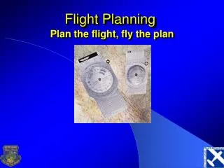
High Altitude Flight Planning. Audio required make sure your volume is tuned up!. October 4, 2006. Introduction. While high altitude flight planning can present different challenges than low altitude flight planning, the process is still the same.

High Altitude Flight Planning
E N D
Presentation Transcript
High AltitudeFlight Planning Audio required make sure your volume is tuned up! October 4, 2006
Introduction • While high altitude flight planning can present different challenges than low altitude flight planning, the process is still the same. • This section is designed to provide you with a basic review of flight planning, and is advisory in nature only. Be sure to consider all aspects when planning a flight in the high altitude environment.
Some things to think about • Pilot and Aircraft Limitations and Capabilities • Choosing Your Route • Weather Considerations • In Flight Considerations
Pilot & Aircraft Capabilities • Understand your capabilities and limitations • Understand your aircraft’s capabilities and limitations.
Planning Your Route • Direct • Victor Airways • Jet Routes • Preferred Routing • http://www.fly.faa.gov • Flight Planning Software • Flight Star • AOPA • fltplan.com • DUATS
Low En-route charts Provides navigational information below FL180 Depicts the following: Victor airways VHF Radio aids Military training routes Reporting points Special use airspace High En-route Provides navigational information above FL180 Depicts the following: Jet routes VHF Radio aids Selected airports Reporting points Special use airspace IFR Charts
Planning Your Altitude • When choosing an altitude take in account: • Am I IFR rated, current and proficient? • If not flight must be below 18,000ft MSL • Distance of flight • Winds • Cloud bases and tops • Freezing levels and icing potential • Terrain • Oxygen availability
91.159 VFR Cruising Altitude or Flight Level Sec. 91.159 When operating at or below 18,000 feet MSL but above 3,000 AGL • On a magnetic course of zero degrees through 179 degrees, any odd altitude (such as 3,500, 5,500, or 7,500); or • On a magnetic course of 180 degrees through 359 degrees, any even altitude (such as 4,500, 6,500, or 8,500).
§ 91.179 IFR cruising flight level. • When operating at or above 18,000 feet MSL but below flight level 250, and— • On a magnetic course of zero degrees through 179 degrees, any odd flight level (such as 190, 210, or 230); or • On a magnetic course of 180 degrees through 359 degrees, any even flight level (such as 180, 200, or 220).
§91.135 Class A Operations • Each person operating an aircraft in Class A airspace must conduct that operation under instrument flight rules (IFR) and in compliance with the following: • (a) Clearance • (b) Communications • (c) Transponder • requirement • ATC authorizations • Remember to set your • altimeter to 29.92 at 18,000 ft MSL. • Remember to re-set your altimeter when descending below 18,000 ft MSL
Weather Considerations Sources of weather information • Flight Service Station • 800-WX-BRIEF • DUATS • http://www.duats.com • DUAT • http://www.duat.com • AOPA • http://www.aopa.org/flight_planner/intro.html • Aviation Weather Center • http://adds.aviationweather.noaa.gov
High Altitude Weather • Pressure Systems • Knowing why position is important when flight planning • Convective Activity • Includes discussion on interpreting weather radar • Icing • What’s different about high altitude ice • Jetstreams • Refer to winds aloft charts for planning purposes • CAT • Can be found in areas of strong converging winds
Pressure Systems H • In the Northern Hemisphere • Eastbound • Fly North of a High, South of a Low • Westbound • Fly North of a Low, south of a high
Convective Activity • Avoid Cells by 20NM when the tops are above FL200 • 20/20 Rule • 20+20 = 40 (40NM is the distance you should maintain between cells.) • Gradients • Avoid radar returns. • General Radar Interpretation Guidelines • If radar depicts the cell as red with yellow and green edges the whole cell should be considered red • Thunderstorms present dangers which are not readily detectable by the radar such as turbulence, tornadoes, ice, and dry hail • Weather can change faster than the update times of XM weather.
Icing • Consider all factors of weather before making a go/no go decision when dealing with icing potential! • Icing at High altitudes usually forms in the tops of tall cumulus clouds and in cirrus clouds • Clouds over the mountains usually have more ice because of the added lifting motion • Freezing levels • PIC Concerns • Where am I going to encounter ice? • How can I get out of ice? • Where are my MEAs in relation to the freezing level? • Exit icing ASAP and inform ATC
Jet Streams • Can be a factor in your Turbo Cirrus • Result of large pressure gradients created by significant temperature changes over a short distance • CAT is associated with the Jet Stream • CAT risk increases if two jet streams converge • General Jet Stream Rules • Avoid during westbound flights, use on eastbound • Jet streams can be depicted on winds aloft charts as areas of converging strong winds in excess of 60 kt
CAT (Clear Air Turbulence) • Turbulence without clouds • CAT generally forms when contrasting air masses converge • Mountain Waves and strong low pressures aloft can create CAT • CAT can be encountered in places where there seems to be no reason • Strong winds can carry turbulent air away from its source (This is why you always should wear seatbelts even in what you presume to be smooth air) • CAT is difficult to forecast because it gives no visual warning and winds can carry it away from its source • PIREP’s and ATC are good current sources for CAT reports MSP UUA /OV MSP045020/TM 1636/FLUNKN/TP B757/SK TOPS 110/TB MOD-SEV UP TO 190/RM DURC RAP UUA /OV RCA/TM 1630/FL200/TP SR22/TB SVR FOR 1 MIN/RM WESTBND
Observation Considerations • Terminal Aerodrome Forecast (TAF) • METAR • Most cover conditions below 12,000 AGL • Special weather observation • PIREP
In Flight Considerations • Some things to think about in flight • Changes in weather • Changes in routing • Do we have enough fuel to meet reserves and personal minimums? • What is our oxygen status?
Time and Distance to Descend • Descent planning in Garmin GNS-430 • Vertical navigation page • Alternate Method • Example • Cruise at FL200 • Cross GEP VOR at 12,000 • Need to lose 8,000 • Descend at 1000 fpm (consider passenger comfort) • consider any crossing restrictions from ATC • Start descent 8 minutes out from GEP VOR • Refer to POH supplement for fuel consumption.
Planning Summary • Know the route(s) and get the big weather picture using local media sources, the internet and FSS • Get a thorough preflight briefing with an emphasis on the position of weather systems, winds aloft, and convective activity • Anticipate routing changes due to weather or ATC delays • Planning is the same, just additional factors and considerations. • If in doubt you should be on the ground and not in the air.