Download
1 / 34
350 likes | 566 Vues
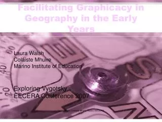
Facilitating Graphicacy in Geography in the Early Years. Laura Walsh Coláiste Mhuire Marino Institute of Education Exploring Vygotsky EECERA Conference 2007. What is graphicacy?.

E N D
Facilitating Graphicacy in Geography in the Early Years Laura Walsh Coláiste Mhuire Marino Institute of Education Exploring Vygotsky EECERA Conference 2007 Laura Walsh Coláiste Mhuire Marino EECERA 2007
What is graphicacy? “Graphicacy refers to the communication of spatial information which cannot be conveyed adequately by verbal or numerical means alone, for example, a plan of a town, a picture of a distant place…”( Wiegand, 1993, p. 16). Laura Walsh Coláiste Mhuire Marino EECERA 2007
Vygotsky and the ZPD • Vygotsky argues that when presented with any task the children can operate at two levels. • Intramental plane • Intermental plane • ‘Zone of proximal development’ Laura Walsh Coláiste Mhuire Marino EECERA 2007
Academic Relevance • 30 years ago it was assumed that graphicacy was beyond the ability of early years children • In recent years, Wiegand (1993), Blades and Spencer (1987), Foley and Janikoun (1996) have found evidence to say that graphicacy is within the remit of early years children • Lacuna in research conducted around early years graphicacy in Ireland. • Low expectations for children aged 4-5 years (Geography Primary School Curriculum, 1999) Laura Walsh Coláiste Mhuire Marino EECERA 2007
Practical Relevance • Geography introduced to junior infant classes in current Primary School Curriculum (1999) • Support teachers and early years educators in their teaching of graphicacy to infants • Balchin and Coleman (1965) describe communication as occurring in four modes,(1) literacy, (2) oracy, (3) numeracy……with graphicacy being described as the “fourth ace in the pack”. • It may not be necessary to defer grid referencing until the age of 9 or 10 years as recommended in the Irish Primary School Curriculum (1999) Laura Walsh Coláiste Mhuire Marino EECERA 2007
Research Question • Can early years children engage successfully in graphicacy processes when scaffolded as envisaged by Lev Vygotsky? • In particular can they engage successfully with grid referencing earlier than the Irish Primary Curriculum (1999) expects? Laura Walsh Coláiste Mhuire Marino EECERA 2007
Aim of Study • Establish children’s existing competency in the area of graphicacy • Track children’s progress following five intervention sessions on sub competencies of graphicacy • Ascertain children’s competency to engage with graphicacy processes in the junior infant classroom. Laura Walsh Coláiste Mhuire Marino EECERA 2007
Structure of the Research • Sample: 28 Junior Infants, aged 4 to 5 years • 1 hour a week, for 7 weeks • A sequential and cumulative structure for the research • Session 1: Establish current level (transcribed)**before intervention • Session 2: Locational language • Session 3: Symbols • Session 4: Aerial Perspective • Session 5: Grid referencing • Session 6: Drawing maps • Session 7: Assessment Laura Walsh Coláiste Mhuire Marino EECERA 2007
Session 1: Initial Session • Aim of session One: establishing the children’s current level of graphicacy before instruction. • The children answer a variety of questions. For example, ‘What is a map? Have you ever seen one? Where?’ etc. • The children then complete a variety of activities relating to locational language, symbols, aerial perspective and the drawing of maps. Laura Walsh Coláiste Mhuire Marino EECERA 2007
Session 2 : Location and Direction • Aim of session two: ability and competence in referring to and using locational and directional language. • Oral language and active learning; story, nursery rhymes, games, P.E. • Signpost mapping Laura Walsh Coláiste Mhuire Marino EECERA 2007
Initial Locational Language Assessment Locational Language 1 1 1 1 All right 2 wrong all right 3 wrong 4 wrong 4 wrong 23 25 Language Laura Walsh Coláiste Mhuire Marino EECERA 2007
Session 3 : Symbols • Aim of session three: identify and create symbols • Picture map and symbols map • Milner (1994) promotes the use of story to teach symbols • Initial assessment task was through group work • Assessment session, the children complete an activity based on identifying symbols and an activity based on designing symbols Laura Walsh Coláiste Mhuire Marino EECERA 2007
Symbols Laura Walsh Coláiste Mhuire Marino EECERA 2007
Symbols Laura Walsh Coláiste Mhuire Marino EECERA 2007
Grid Activity Laura Walsh Coláiste Mhuire Marino EECERA 2007
Symbols Laura Walsh Coláiste Mhuire Marino EECERA 2007
Session 4 : Aerial Perspective • Aim of session four: understanding of aerial perspective and identifying maps as 2-D representations of 3-D places. • Gura and Bruce (1992), Foley and Janikoun (1996) argue for the use of block play • Matching photos of objects as seen from the side and from an aerial perspective • Assessment by activity sheet Laura Walsh Coláiste Mhuire Marino EECERA 2007
Aerial Perspective Laura Walsh Coláiste Mhuire Marino EECERA 2007
Aerial Perspective Laura Walsh Coláiste Mhuire Marino EECERA 2007
Initial Aerial Perspective Assessment of aerial perspective 2 1 1 All right 2 wrong 8 3 wrong 15 All wrong All right 1 wrong 27 Aerial Perspective Laura Walsh Coláiste Mhuire Marino EECERA 2007
Session 5 : Grid Referencing • Aim of session five: enabling the children to read and use simple grid reference maps • Initially using colours • Game Blue Monkey • Later advancing to the use of simple co-ordinates. • Currently positioned in the 3rd/4th class curriculum, at age of 9 or 10 Laura Walsh Coláiste Mhuire Marino EECERA 2007
Use colours Laura Walsh Coláiste Mhuire Marino EECERA 2007
Blue Monkey Laura Walsh Coláiste Mhuire Marino EECERA 2007
Simple co-ordinates Laura Walsh Coláiste Mhuire Marino EECERA 2007
Grid Reference Activity Sheet Laura Walsh Coláiste Mhuire Marino EECERA 2007
letter number grid assessment 20 18 16 14 12 10 Series1 8 6 4 2 0 all 1 2 wrong 3 wrong all wrong correct wrong Grid Referencing Laura Walsh Coláiste Mhuire Marino EECERA 2007
Session 6 : Drawing of Maps • Aim of session six centres: drawings of ‘maps’ and enabling children to understand that maps can be used to trace journeys. • Activities included tracing routes on maps and drawing a map from their house to school • Assessment: the maps from session 1 and session 7 are compared Laura Walsh Coláiste Mhuire Marino EECERA 2007
Using their own Environment Laura Walsh Coláiste Mhuire Marino EECERA 2007
Initial understanding of maps • Seventeen of the maps drawn by the children contained an ‘x’. • Thefunction of the ‘x’ was to show “eh where the treasure is”. • “finds you where to go and finds where you can get treasure” • “It’s a thing to help you know where to go and if you’re in a country like Spain and you don’t know where the shop is you can follow the map” • “a countries one up in my brother’s bedroom” Laura Walsh Coláiste Mhuire Marino EECERA 2007
Drawing of Maps Laura Walsh Coláiste Mhuire Marino EECERA 2007
Drawing of Maps Laura Walsh Coláiste Mhuire Marino EECERA 2007
Significant Findings • Early years children have the ability to develop all of their graphicacy processes from junior infants (age 4-5) • Most significant finding is that of their ability to engage with grid referencing that is currently situated in the 3rd/4th class curriculum. • The study confirms the importance of scaffolding by adults in helping children to achieve the upper potential of their ‘zone of proximal development’ as described by Vygotsky. • The use of play, story and the local environment are effective approaches for teaching graphicacy Laura Walsh Coláiste Mhuire Marino EECERA 2007
Implications • Early years educators should facilitate children in developing graphicacy processes • Books, games and resources that would allow for the development of these processes through story and play be recommended and made available • The NCCA in their review of the Geography Primary School Curriculum (Gov. of Ireland, 1999) consider the introduction of all graphicacy processes including grid referencing from junior infants onwards. Laura Walsh Coláiste Mhuire Marino EECERA 2007
Implications • Early years settings and schools participate in drawing up of maps of their local and wider environments, such as those of the classrooms, outdoor grounds, local park and wider area to promote the use of maps with early years children. Laura Walsh Coláiste Mhuire Marino EECERA 2007