Mapping With Mobile Devices
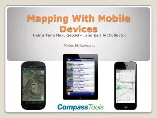
Mapping With Mobile Devices. Using TerraFlex , GeoJot +, and Esri ArcCollector Myles McReynolds. Cloud-based sync for fast data transfer No expensive equipment needed Replaces paper forms and maps Cross platform: mobile, GPS, desktop Android, iOS, Windows Mobile

Mapping With Mobile Devices
E N D
Presentation Transcript
Mapping With Mobile Devices Using TerraFlex, GeoJot+, and Esri ArcCollector Myles McReynolds
Cloud-based sync for fast data transfer • No expensive equipment needed • Replaces paper forms and maps • Cross platform: mobile, GPS, desktop • Android, iOS, Windows Mobile • Work anywhere: offline editing • Assign users to different projects • Customizable to fit your workflow • Affordable • Scalable licensing: pay for what you use Benefits
Reduced accuracy • Functionality • Ruggedness • No post-processing Drawbacks
Trimble InSphere is the online geospatial information management tool that provides cloud based data sharing • Entry level GIS field data collection • Centrally managed • Online office platform – no need to download desktop software • Import/Export Esri XML schema and data • Export to Google Earth • Replaces pen and paper workflows Trimble TerraFlex
Start by creating a project Trimble TerraFlex
Select Users (you can go back later) Trimble TerraFlex
Edit Form Templates: What to Collect? Trimble TerraFlex
Attribute Fields: What do you want to know? Trimble TerraFlex
Publish forms for field use Trimble TerraFlex
Collecting data in the field Trimble TerraFlex
Collecting data in the field Trimble TerraFlex
Forms sync automatically when in service area • If you don’t have service, forms will be saved and will sync when you come back into service Trimble TerraFlex
Meanwhile, back in the office… Trimble TerraFlex
Export forms to multiple formats Trimble TerraFlex
Export forms to multiple formats ArcGIS Google Earth Trimble TerraFlex
Includes desktop application used to create forms • Collected forms uploaded to Dropbox cloud automatically • Easily transfer data into back-end GIS • Create customizable .docx and .pdf reports, photo maps (Esri shapefiles or GeoDatabases, and Google Earth files), watermarked photos, and other database imports GeoSpatial Experts’ GeoJot+
Photo-centric GPS data for site assessment, proof of performance, asset audits, or to document compliance - quickly and accurately. • Available in 3 levels • Essentials • Team • Enterprise GeoJot+
GeoJot+ Mobile Field App focuses on simplicity and speed. Create and distribute unlimited field data collection forms to your team. Easily collect data that is both accurate and consistent. Train your field team in minutes. GeoJot+
GeoJot+ Core Desktop Software lets you review field data and enforce quality standards before inputting data into a GIS database. Create customizable reports as well as ArcGIS and Google photo maps. GeoJot+
For more on GeoJot+, be sure to attend John Clark’s presentation this afternoon in the Asia room located on the first floor. GeoJot+
Use your iOS or Android device to collect and update information in the field, whether connected or disconnected. From damage reports and service requests to places of historical interest—create the data that matters most to your organization. • Use the Collector app offline to collect and edit maps and data regardless of your network availability. Note: Because Collector for ArcGIS is a feature of ArcGIS Online, you will need an ArcGIS Online organizational account Esri Collector for ArcGIS http://doc.arcgis.com/en/collector/
Easy to use, map driven, custom forms • Attach photos and videos • Collected data is synced to ArcGIS Online server • Get directions to features • Calculate distance and areas • Download maps to your device and work offline. • Use GPS to create and update map data. • Collect points, lines, and area features. • Track and report areas you visited. Esri Collector for ArcGIS
Cloud-based technology makes for sleek workflow • No expensive equipment • Replaces paper forms and maps • Android, iOS, Windows Mobile • Optimized for offline editing • User friendly • Customizable to fit your workflow • Affordable • Easily export to back-end GIS Take Aways
www.compasstoolsinc.com • Product information and pricing • Contact information • Links to helpful support documents • FAQ’s – mapping and survey • Rental program information • Training information • Newsletters Visit Our Website!