Download
1 / 13
150 likes | 484 Vues
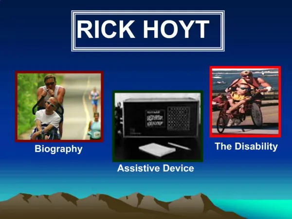
Models Of Burgess And Hoyt. IB SL. Burgess. Explanation. Having made in depth studies of the morphology of Chicago in the 1920's, Burgess concluded that city land-use could be identified as a series of concentric rings around the CBD.

E N D
Explanation • Having made in depth studies of the morphology of Chicago in the 1920's, Burgess concluded that city land-use could be identified as a series of concentric rings around the CBD. • The CBD will contain all the major shops and offices and be a centre of entertainment. • Surrounding this CBD will be the oldest housing, which is in a state of deterioration. Industry will also feature in this area. This is the area often referred to as the inner city or 'zone of transition'.
Explanation • Then, we get three rings of housing. The first will be high density, poor quality that traditionally houses the workers for the factories. • Next, is slightly lower density, middle class housing. These will be semi-detached with gardens. • Finally, there is a ring of high class housing for those who can afford to commute.
Evaluation: For • If taken as a very broad pattern, then a large number of towns and cities follow the pattern identified by Burgess. • It is good model because it is simple and easy to understand. Hopefully! • Burgess could not have foreseen the changes in transport routes or society yet his model is still relevant when identifying the reasons behind the urban morphology of a city. • It helps us to understand the process involved in the growth of a city.
Evaluation: Against (1) • It does not take any physical features into account. Burgess' own case study - Chicago - does not follow the pattern because it is on the coast! The growth of any city will be influenced by the physical geography of the area. • Transport is much more readily available allowing more people to commute. This has meant that commuter villages have developed some distance from the edge of the urban area. Burgess could not have foreseen this.
Evaluation: Against (2) • Urban regeneration and gentrification has meant that some of the most expensive property can now be found in traditional 'low class' areas. Whilst council estates have built up on the edges of many large cities - these are now some of the most depressed areas in British cities. • The decentralisation of shops, manufacturing industry and entertainment does not follow his model.
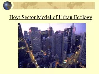
Explanation • Hoyt's model came nearly twenty years after Burgess'. • He suggested that the city grew in a series of sectors or 'wedges'. • These would grow along traditional communication routes. • The land-use within a sector would remain the same as like attracts like. • For example, a 'high class' sector would remain high class as it would be the most desirable area to live, so only the wealthiest could afford it. • An industrial sector would remain industrial as the zone would have a common advantage - perhaps a railway line or river. • Note how the low quality housing is next to the industrial zone, middle class next to low class and high class as far as possible from industry and low class.
Evaluation: For • Some cities seem to follow Hoyt's sectors. Bristol, for example, has a very clear industrial sector following a main rail line and the River Avon. • It provides us with an alternative set of explanations to Burgess. • Communication routes (Rivers, roads, railways) do often provide a very definite boundary to a sector/land-use.
Evaluation: Against • Like Burgess' there is little reference to the physical environment. • The growth of sector can be stopped as land-use leapfrogs out of the old inner city. • For example, out of town council estates have prevented large high-class sector developing in other areas of Bristol. • Again, like Burgess, there is no reference to out of town developments.
Comparison • In addition, the division between land-uses in both models is far to clear-cut. • Firstly, you would not suddenly walk from lower to middle to higher class housing. • Also, all zones will have a mixture of land-uses. • Residential zones will have shops and industry in amongst them. • They do, however, give us a bench mark for comparison and allow us to have a basic understanding of the complex set of processes that determine the distribution of land-use within a city.
Activity Create a factfile on the 5 main Land Use Models for MEDC’s.