Sector Model, by Hoyt
801 likes | 3.8k Vues
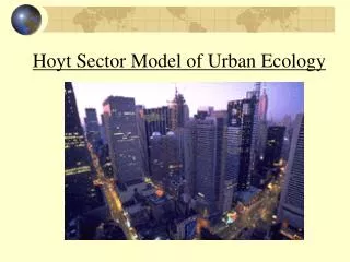
Sector Model, by Hoyt. Sector model. Homer Hoyt, an economist, presented his sector model in 1939. Introduction. Hoyt, being an land-economist, based on Chicago to theorize the urban structure & growth of 142 American cities in 1939. main emphasis:

Sector Model, by Hoyt
E N D
Presentation Transcript
Sector model • Homer Hoyt, an economist, presented his sector model in 1939
Introduction • Hoyt, being an land-economist, based on Chicago to theorize • the urban structure & growth of 142 American cities in 1939. • main emphasis: • access to major transport routes, to a great extent, • explains the basic structure of a city.
What is the pattern? Refer back to your textbook. How does it differ from Burgess’s?
General Ideas • The sector model complements the Burgess model because it considers an additional factor – • direction as well as distance; • accessibility to the town or city centre influences the location of functional zones;
General Ideas • zones are shown in the model as sectorswith wedges of residential areas developing outwards from the centre; • High-class residential areas are located in the most convenient locations and have a strong influence on the pattern of urban growth because • other zones have to fit around them.
OLD Assumptions • Assumptions suggested by Burgess: • No districts are more attractive because of differences in terrain. • There is no concentration of heavy industry. • Cultural & social heterogeneity of the population are assumed; • Commercial and industrial activities are the major economic activities in the city;
OLD Assumptions There are private ownership of property and economic competition for space; The city centre is the main centre of employment and the space is limited in supply; Competition for space is high and therefore the land rent here is the most valuable; The area and population of the city are expanding;
NEW Assumptions Transportation is only easy, rapid and cheap in certain directions within the city; The city is served by several radial routes (arteries), and that there is a difference in accessibility between arteries; Wealthy people, owners of private cars, choose the best sites & live further from industry and nearer to main roads;
NEW Assumptions “Attract and repel” process in action -- land uses concentrating a function in a particular area and repelling others; high-class housing area -- expensive new houses to be established; new working-class -- likely to be built next to the existing working-class housing; new industries adjacent to old industries; Once an area had developed a distinctive land use, it tended to retain that land use as the city extended outwards;
Homer Hoyt’s Theory • “Different land use zones will develop along radial transport routes from city core in sectoral forms,not concentric circles!” • By the choice of the higher-income class, the internal structure is constructed.
High-class residential land use tends to locate • along communication lines • towards high ground (free from flooding) • in open country with no physical barriers • towards the homes of community leaders • towards office blocks and stores • in established outlying business centres • along waterfront sites
High-class residential area • The case in Hong Kong? http://www.centamap.com
Comment • “It is a refinement of Burgess Model” • Why? • it is based on city growth around one single centre; • inside a residential sector, old houses may be found in the inner portion and new houses in the outer portion; Why?
Comment “Hoyt’s model is better than Burgess’s.” Why? both the distance & direction from the city centre are considered; the directional element of outward-oriented city growth is more realistic;
Comment It places more emphasis on the role of transport and the development of industry; it recognizes the effect of social leap-frogging which did not guarantee a whole sector to be geographically similar at any one moment of time;
Comment • The existence of a particular land use was better explained by the law of natural selection which acted randomly rather than strictly directionally. • It also recognizes the spatial association of mutually attractive land use activities (?) and mutually opposing land use activities (?)
Criticism • paying not enough attention to the exist-ence of residential & industrial suburbs; • areas of low cost housing do occur beside main roads near to the boundaries of most cities; • little focus on the segregation of residence according to racial difference and religious creeds Vs economic status.
Criticism • Like Burgess, Hoyt studied only the cities in the USA; • There was little attention paid to the height of buildings and the variation of use with height; • Existence of mixed land use was neglected. (Examples in Hong Kong?)
Conclusion • Sector model complements rather than contradicts the concentric zone model; • adding a directional element while not discounting the distance variable; • more attention paid to the importance of transport in the functioning of a city; • has proved to be a more useful tool in incorporating industrial districts.
Conclusion Sector model: rents & house values was essentially concerned with the distribution of the socio-economic variable, social status and class, within the city and was found to be sectoral; Concentric model: main focus on the density of settlement and the distribution of different house types.