Download
1 / 58
650 likes | 980 Vues
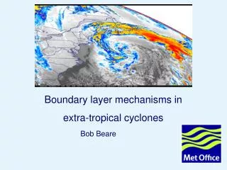
Extra-Tropical Cyclones and Anticyclones, Chapter 10. ATMO 1300 Fall 2009. Polar Front Theory. We begin by looking at the polar front Our virtually continuous boundary that separates cold polar air masses from the warm tropical air masses to the south

E N D
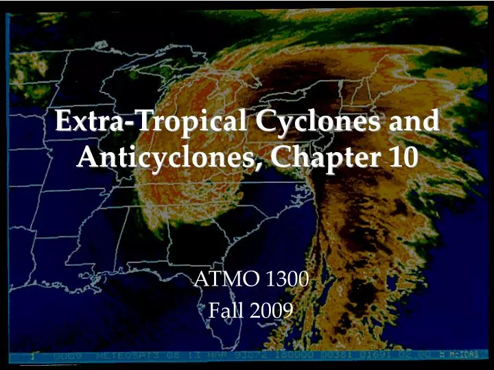
Extra-Tropical Cyclones and Anticyclones, Chapter 10 ATMO 1300 Fall 2009
Polar Front Theory • We begin by looking at the polar front • Our virtually continuous boundary that separates cold polar air masses from the warm tropical air masses to the south • We’ll start by assuming the polar front is a stationary front along a trough of low pressure with higher pressures on either side of it
Polar Front Theory • Cold air is located the north, warm air to the south • The wind flow is parallel to the front, but opposite directions • This creates an axis of wind shear, or winds that change direction quickly over a relatively small horizontal distance • In our case, the shear is cyclonic (counter-clockwise flow)
Polar Front Theory • This shear gives rise to a wave-like kink along the front • This is known as a frontal wave • The formation of frontal waves is similar to a wave breaking in the ocean • Wave gets larger and larger before breaking and dissipating
Polar Front Theory • The region of lowest pressure is now located at the intersection of the warm and cold fronts • Precipitation forms along the warm front – overrunning • Cold air displaces the warm, less stable air upwards along the cold front
Polar Front Theory • The wave now moves with the predominant upper-level winds (typically toward the east or northeast in the mid-latitudes) • Central pressure of the system continues to fall as air is converging along the frontal boundaries • As the pressure falls more air spirals inward toward the center of low pressure • Isobars tighten, which means wind increases and so does the convergence, which leads to even more rising motion and pressure falls
Polar Front Theory • The region of air between the warm front and cold front is known as the warm sector • Air is most unstable in the region • Energy for the storm system is derived from several sources • Each air mass wants to attain equilibrium, so we have convection occurring (warm air rising, cold air sinking)
Polar Front Theory • Energy is transformed from potential to kinetic • Condensation supplies energy to the system in the form of LATENT HEAT • The additional heat released allows air parcels to become more unstable • Increasing rising motion leads to a decrease in pressure at the surface
Polar Front Theory • Cold front moves quickly and the warm sector shrinks as the system moves eastward • Eventually the cold front overtakes the warm front and we now have the development of an occluded front • The point at which the three boundaries come together is called a triple point
Polar Front Theory • When the occluded front develops, the storm system is typically at its peak intensity or lowest surface pressure during its lifetime • Now cooler air resides on both sides of the occluded front • The surface low pressure center has lost its supply of warm moist air • The rising motion begins to decrease and surface pressures start to rise, and the system eventually dissipates • Occasionally a secondary low will form at the triple point and intensify into another cyclone
Polar Front Theory • The polar front theory is a conceptual model • Few system follow the model exactly but most exhibit many characteristics of the polar front • It serves as a good foundation for the understanding of mid-latitude storms
Mid-Latitude Cyclones • Any development or strengthening of a cyclone is called cyclogenesis • There are several regions across the US that are favorable for cyclogenesis to occur • Eastern Slope of the Rockies, • Great Basin • Gulf of Mexico • Just off the coast of the Carolinas
Mid-Latitude Cyclones Example: • Warm moist air located over the Gulf Stream may supply moisture and warmth to an area south of a stationary front • This increases the temperature gradients along the front • This promotes convective development (rising motion) • With rising motion comes falling pressures
Mid-Latitude Cyclones • We refer to the strengthening of cyclones as deepening • Frontal waves that develop into huge storms are called unstable waves • These storms can last nearly a week • Other frontal waves that do not intensify are said to be stable waves • Why do some waves develop and other don’t???
Mid-Latitude Cyclones • The key to understanding which wave will develop and which will not lies in the upper-level wind pattern • We know we have a wavelike pattern in the upper-atmosphere (Remember Rossby waves and shortwaves) • Caused by our unequal heating of the Earth and that it is a rotating system
Upper Level • Suppose the Upper-low (or trough) • Is located right above the surface low • (frontal wave) • Air at the surface converges and basically piles up, the mass increases and so does the pressure • There is no divergence aloft to spread out the air moving upward • The system will dissipated • Same applies for anticyclones as well L L Surface
Mid-Latitude Cyclones • We know that troughs in the upper-troposphere are generally associated with cold air • We have cold air at the surface behind a cold front and cold aloft • The upper-low is typically located behind the surface low (or to the west) • Directly above the surface low the air flow spreads out or diverges
The diverging air aloft allows more air to flow upward from the surface • The divergence aloft acts as an exhaust system for the surface low • This is a mechanism for storm intensification
Mid-Latitude Cyclones • When divergence aloftexceedsconvergence at the surface more air is removed at the top of the troposphere than can be moved upward • Surface pressure drop in response as mass is removed from the column of air • The surface low will intensify or deepen • When divergence aloft is less than the convergence at the surface, air cannot be removed quickly enough • Surface pressures rise and the system weakens
Mid-Latitude Cyclones • Same applies to anticyclones as well, just in reverse • If divergence at the surface exceeds convergence aloft, the surface high will weaken • If convergence aloft exceeds surface divergence, the high pressure area at the surface will strengthen
Faster winds L divergence convergence H Slower winds
Mid-Latitude Cyclones • Winds aloft help steer surface pressure systems • In general, surface storms tend to move about 16 kts (18 mph) in the summer and about 27 kts (31 mph) in the winter • We have several typical storm tracks across the US
Mid-Latitude Cyclones What we know: • We can have deep pressure systems at the surface and aloft • When the surface pressure system does not lie beneath the upper level system, the atmosphere can redistribute mass and help intensify the pressure system • Intensifying pressure systems tilt toward the west with increasing height • Surface cyclones are steered by winds aloft and move away from their development region
Upper-Level Waves and Surface Storms • Due to the unequal heating of the Earth and its rotation we see a cycle of waves in the troposphere • Waves appear as troughs and ridges • We know we have long wave troughs and shortwave troughs
Upper-Level Waves and Surface Storms • Typically between 4 and 6 longwaves circling the globe at one time • Wavelength typically of 4000 – 8000 km (2400 – 5000 miles) • The fewer the number of waves the longer the wavelength • Mountain ranges can disrupt the air flow through longwaves
Upper-Level Waves and Surface Storms • Imbedded in the longwaves are shortwaves • Small ripples in the large-scale flow • The smaller the wavelength the faster they move • Shortwaves typically move at a speed proportional to the flow at the 700 mb level • Longwaves can move very slowly or remain stationary • Sometimes if the wavelength of a longwave is large enough, it can retrograde or move back westward
Upper-Level Waves and Surface Storms • Shortwaves typically deepen or intensify when they approach a longwave trough and weaken when they approach a longwave ridge • Shortwaves can also help deepen existing longwave troughs
Role of the Jet Stream • Jet streams play an additional role in developing a wave cyclone • Remember the polar jet lies very near the polar front • The region of strongest winds within the jet stream is called a jet streak • Jet streaks often form in the curved part of the flow through an upper trough where pressure gradients are tight
Role of the Jet Stream • The curving of the jet stream coupled with the changing wind speeds near a jet streak produces regions of strong convergence and divergence • The region of divergence draws surface air upward • This helps decrease surface pressures • Regions of convergence push air downward
Role of the Jet Stream • Remember that the polar jet is strongest during winter • This is why we see more developed storms in the winter time • Polar jet helps remove air from the surface cyclone and supply it to the surface anticyclone
Summary • For a storm to intensify we need: • Upper trough to lie to the west of the surface low • Shortwave helps intensify the upper longwave trough • Polar jet exhibits waves and swings just south of the developing storm system Zones of vertical motion provide energy conversions for the system’s growth
Summary • In regions where there is no upper trough or shortwave or strong jet streak, the motions at the surface are not sufficient enough for a frontal wave to intensify
Super Storm 1993 • Produced nearly a foot of snow from Alabama all the way to Maine • 11 Tornadoes in Florida • Hurricane Force winds were reported from Florida to New Hampshire
Super Storm 1993 • Surface low developed as a frontal wave along a stalled front in the northern Gulf of Mexico • Strong trough approached from the west • Arctic air mass dove south over the Great Plains in association with the trough
Super Storm 1993 • This single mid-latitude storm system killed 270 people • Insured losses exceeded $3 Billion • 26 States were impacted • Nearly half of the country’s population felt the effects of this storm